Portal:Tropical cyclones
The Tropical Cyclones Portal
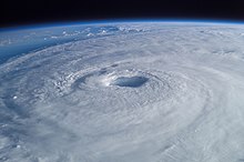
A tropical cyclone is a storm system characterized by a large low-pressure center, a closed low-level circulation and a spiral arrangement of numerous thunderstorms that produce strong winds and heavy rainfall. Tropical cyclones feed on the heat released when moist air rises, resulting in condensation of water vapor contained in the moist air. They are fueled by a different heat mechanism than other cyclonic windstorms such as Nor'easters, European windstorms and polar lows, leading to their classification as "warm core" storm systems. Most tropical cyclones originate in the doldrums, approximately ten degrees from the Equator.
The term "tropical" refers to both the geographic origin of these systems, which form almost exclusively in tropical regions of the globe, as well as to their formation in maritime tropical air masses. The term "cyclone" refers to such storms' cyclonic nature, with anticlockwise rotation in the Northern Hemisphere and clockwise rotation in the Southern Hemisphere. Depending on its location and intensity, a tropical cyclone may be referred to by names such as "hurricane", "typhoon", "tropical storm", "cyclonic storm", "tropical depression" or simply "cyclone".
Types of cyclone: 1. A "Typhoon" is a tropical cyclone located in the North-west Pacific Ocean which has the most cyclonic activity and storms occur year-round. 2. A "Hurricane" is also a tropical cyclone located at the North Atlantic Ocean or North-east Pacific Ocean which have an average storm activity and storms typically form between May 15 and November 30. 3. A "Cyclone" is a tropical cyclone that occurs in the South Pacific and Indian Oceans.
Selected named cyclone -
Severe Tropical Cyclone Marcia was a powerful tropical cyclone that made landfall at its peak strength over central Queensland, near Shoalwater Bay on 20 February 2015. The cyclone went on to affect various areas including Yeppoon and Rockhampton. It passed just to the west of Yeppoon as a Category 4 system, then traversed over the regional city of Rockhampton as a Category 2 system on the same day. Eventually, the cyclone weakened, moved southeast out to sea, before dissipating. Marcia caused at least A$750 million (US$587 million) worth of damage. (Full article...)
Selected article -
In September 2004, Hurricane Ivan caused significant effects in the Lesser Antilles and South America, including 44 deaths and over $1 billion in damage (2004 USD), primarily in Grenada where it was considered the worst hurricane in nearly 50 years. Hurricane Ivan developed from a tropical wave on September 2 and rapidly intensified to become a major hurricane, passing through the southern Lesser Antilles on September 7 with winds of 125 mph (201 km/h). At the time, its typical storm force winds extended outward up to 160 miles (260 km) with hurricane-force winds outward to 70 miles (110 km), and the northern portion of the eye passed over Grenada.
In the region, the worst damage occurred on Grenada, where the damage total of $1.1 billion (2004 USD, ($1.77 billion 2024 USD)) represented 200% of its GDP. The hurricane damaged more than 14,000 homes and destroyed 30% of the houses, leaving about 18,000 people homeless. A total of 39 people were killed by the hurricane on the island. Elsewhere, Hurricane Ivan caused at least three fatalities and moderate damage in northern Venezuela. One person died each in Trinidad and Barbados. The name Ivan was later retired. (Full article...)
Selected image -

Selected season -

The 1999–2000 South-West Indian Ocean tropical cyclone season was the first on record in which two storms – Leon–Eline and Hudah – struck Mozambique at tropical cyclone intensity, or with maximum sustained winds of at least 120 km/h (75 mph). The most notable storm of the season was Eline, which was the third longest-lasting storm on record in the basin. It lasted for 29 days while traversing the southern Indian Ocean, making the strongest landfall in decades along eastern Madagascar in late February. The storm was the first in a series of three storms that struck the country in early 2000, along with Gloria in March and Hudah in April. Collectively, the three storms killed at least 316 people. The season started on November 1, 1999, and ended for most of the basin on April 30, 2000; for Mauritius and the Seychelles, the season continued until May 15. These dates conventionally delimit the period of each year when most tropical cyclones form in the basin.
Despite the destructive nature of the season, it began later than usual. Cyclone Astride originated toward the end of December, bringing rainfall and gusty winds to northern Madagascar while in the region. In January, Cyclones Babiola and Connie both formed east of Madagascar and took southerly tracks. Connie passed near Réunion island, producing 1,752 mm (69.0 in) of rainfall in the mountainous peaks and killing two people. Eline, the longest lasting storm of the season, struck Mozambique while the country was experiencing its worst flooding in 50 years, collectively causing around 700 deaths and about $500 million in damage. The storm also killed 12 people in Zimbabwe and 21 in South Africa. Just two weeks after Eline struck Madagascar, Tropical Storm Gloria affected the same general region, bringing additional deaths and damage. Cyclone Hudah in April was the strongest storm of the season, reaching peak 10‑minute winds of 220 km/h (140 mph). It caused three deaths in Mozambique, although its effects were worse in Madagascar, where there were 111 deaths. The final storm of the season was Tropical Storm Innocente, which dissipated on April 24. In addition to the named storms, there were four unnamed tropical disturbances or storms, as well as one subtropical cyclone that formed in the southern Mozambique Channel.
(Full article...)Related portals
Currently active tropical cyclones

Italicized basins are unofficial.
- North Atlantic (2024)
- No active systems
- East and Central Pacific (2024)
- No active systems
- North Indian Ocean (2024)
- No active systems
- Mediterranean (2024–25)
- No active systems
- Australian region (2024–25)
- No active systems
- South Pacific (2024–25)
- No active systems
- South Atlantic (2024–25)
- No active systems
Last updated: 09:03, 18 November 2024 (UTC)
Tropical cyclone anniversaries

November 18
- 1964 - Typhoon Louise moved through the Philippines, killing 576 people.
- 1991 - Cyclone Tia reaches its peak strength near Vanuatu, the first of six cyclones to affect the island during that cyclone season.
- 1994 - Hurricane Gordon (pictured) reached its peak intensity as a Category 1 hurricane to the east of North Carolina. Gordon had previously killed over 1,000 people in Haiti.

November 19
- 1970 - Typhoon Patsy makes landfall over the Philippine archipelago of Luzon as a strong typhoon. Patsy killed more than 260 people with damages losses of $80 million.
- 1979 - The 1977 Andhra Pradesh cyclone (pictured) made landfall on the coastline of the Indian state of Andhra Pradesh with winds of about 210 km/h (130 mph), killing over 10,000 people and destroying 40% of India's food grain.

November 20
- 1985 - Hurricane Kate (pictured) reached Category 3 strength in the eastern Gulf of Mexico. It made landfall in Florida the next day.
- 1992 - Cyclone Forrest reaches its maximum intensity as a Category 4 over in the Bay of Bengal, before re-curving and making landfall in Myanmar.
- 1994 - Cyclone 02A makes landfall over in Somalia, killing 30 people in total.
Did you know…
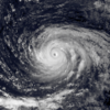


- …that the Joint Typhoon Warning Center considers that Typhoon Vera (pictured) of 1986 is actually two distinct systems, formed from two separated low-level circulations?
- …that Cyclone Freddy (track pictured) in 2023 was the longest-lasting tropical cyclone worldwide?
- …that Cyclone Raquel (track pictured) travelled between the Australian and South Pacific basins between the 2014–15 and 2015–16 seasons, spanning both seasons in both basins?
- …that Hurricane Otis (pictured) in 2023 was the first Pacific hurricane to make landfall at Category 5 intensity and surpassed Hurricane Patricia as the strongest landfalling Pacific hurricane on record?
General images -

85 Atlantic tropical or subtropical cyclones have affected the U.S. state of Florida from 1950 to 1964. Collectively, tropical cyclones in Florida during the time period resulted in about $7.04 billion (2017 USD) in damage, primarily from Hurricanes Donna and Dora. Additionally, tropical cyclones in Florida were directly responsible for 93 fatalities during the period, as well as responsible for 23 indirect deaths. Several tropical cyclones produced over 20 inches (500 mm) of rainfall in the state, including Hurricane Easy which is the highest total during the time period. The 1969 season was the year with the most tropical cyclones affecting the state, with a total of 8 systems. The 1954 and 1967 seasons were the only years during the time period in which a storm did not affect the state.
The strongest hurricane to hit the state during the time period was Donna in 1960, which was the 8th strongest hurricane on record to strike the United States. Additionally, Hurricanes Easy, King, Isbell, and Betsy hit the state as major hurricanes.
(Full article...)Topics
Subcategories
Related WikiProjects
WikiProject Tropical cyclones is the central point of coordination for Wikipedia's coverage of tropical cyclones. Feel free to help!
WikiProject Weather is the main center point of coordination for Wikipedia's coverage of meteorology in general, and the parent project of WikiProject Tropical cyclones. Three other branches of WikiProject Weather in particular share significant overlaps with WikiProject Tropical cyclones:
- The Non-tropical storms task force coordinates most of Wikipedia's coverage on extratropical cyclones, which tropical cyclones often transition into near the end of their lifespan.
- The Floods task force takes on the scope of flooding events all over the world, with rainfall from tropical cyclones a significant factor in many of them.
- WikiProject Severe weather documents the effects of extreme weather such as tornadoes, which landfalling tropical cyclones can produce.
Things you can do
 |
Here are some tasks awaiting attention:
|
Wikimedia
The following Wikimedia Foundation sister projects provide more on this subject:
-
Commons
Free media repository -
Wikibooks
Free textbooks and manuals -
Wikidata
Free knowledge base -
Wikinews
Free-content news -
Wikiquote
Collection of quotations -
Wikisource
Free-content library -
Wikiversity
Free learning tools -
Wikivoyage
Free travel guide -
Wiktionary
Dictionary and thesaurus


