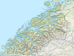
Gråsjøen
Tools
Actions
General
Print/export
In other projects
Appearance
From Wikipedia, the free encyclopedia
(Redirected from Grasjoen)
Reservoir in Møre og Romsdal and Trøndelag
| Gråsjøen | |
|---|---|
| Location | Møre og Romsdal and Trøndelag |
| Coordinates | 62°54′42″N 9°09′32″E / 62.9116°N 9.1590°E / 62.9116; 9.1590 |
| Type | Reservoir |
| Primary inflows | Folda River |
| Primary outflows | Foldsjøen |
| Basin countries | Norway |
| Max. length | 10.4 kilometres (6.5 mi) |
| Max. width | 1.7 kilometres (1.1 mi) |
| Surface area | 10.45 km2 (4.03 sq mi) |
| Shore length1 | 24.37 kilometres (15.14 mi) |
| Surface elevation | 483 metres (1,585 ft) |
| References | NVE |
| 1 Shore length is not a well-defined measure. | |
Gråsjøen is a lake/reservoir in the municipality of Surnadal in Møre og Romsdal county, Norway (and a very small part in the northeastern corner of the lake is in Rindal Municipality in Trøndelag county). The lake is located in the northern part of the Trollheimen mountain range. The lake is dammed and the water is used in the Gråsjø power station. The water flows out of the lake and into the lake Foldsjøen. Mount Snota lies just south of the lake.[1]
See also
[edit]References
[edit]- ^ "Gråsjøen" (in Norwegian). yr.no. Retrieved 2010-12-07.
This article related to a lake in Trøndelag in Norway is a stub. You can help Wikipedia by expanding it. |
This Møre og Romsdal location article is a stub. You can help Wikipedia by expanding it. |
Retrieved from "https://en.wikipedia.org/w/index.php?title=Gråsjøen&oldid=1202004317"
Hidden categories:
- Pages using gadget WikiMiniAtlas
- CS1 Norwegian-language sources (no)
- Articles with short description
- Short description is different from Wikidata
- Pages using infobox body of water with auto short description
- Coordinates on Wikidata
- Articles using infobox body of water without image
- Articles using infobox body of water without pushpin map alt
- Articles using infobox body of water without image bathymetry
- All stub articles


