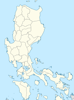
Antipolo station
 | |||||||||||
| General information | |||||||||||
| Location | Marilaque Highway, Mayamot Antipolo, Rizal Philippines | ||||||||||
| Coordinates | 14°37′29″N 121°7′16″E / 14.62472°N 121.12111°E | ||||||||||
| Owned by | Department of Transportation Light Rail Transit Authority | ||||||||||
| Line(s) | LRT Line 2 | ||||||||||
| Platforms | 2 (2 side) | ||||||||||
| Tracks | 2 | ||||||||||
| Connections | |||||||||||
| Construction | |||||||||||
| Structure type | Overpass | ||||||||||
| Parking | Yes (SM City Masinag) | ||||||||||
| Accessible | Concourse: Both entrances Platforms: All platforms | ||||||||||
| Other information | |||||||||||
| Status | Operational | ||||||||||
| History | |||||||||||
| Opened | July 5, 2021[1] | ||||||||||
| Previous names | Masinag (2015–2021) | ||||||||||
| Services | |||||||||||
| |||||||||||
| |||||||||||
Antipolo station, formerly known as Masinag station, is the current eastern terminus of the Light Rail Transit Line 2 (LRT-2) system.[1] It opened on July 5, 2021 and is the line's easternmost station, situated on the stretch of Marikina–Infanta Highway near the intersection of Sumulong Highway in Antipolo, Rizal. It is the first LRT station outside Metro Manila to be operational.
History
[edit]
Antipolo station was constructed as part of the Line 2 East Extension, which called for a 4-kilometer (2.5 mi) extension eastward from Santolan station and the construction of two stations.[2]
Construction of the Line 2 east extension began in September 2015 while the construction of Antipolo and Marikina stations began in May 2017. The expected opening was supposed to be in the fourth quarter of 2020, but was postponed repeatedly due to the COVID-19 pandemic[3] and various circumstances in integrating the east extension to the line's existing systems.[4] Earlier, the station was called Masinag Station, however, it was renamed in early 2021 for its location in Antipolo.
The east extension was inaugurated on July 1, 2021 by President Rodrigo Duterte, and Antipolo station opened on July 5, 2021. Rides for the East Extension were free of charge until July 18, 2021.[5][1][6] Due to the location's elevation for a possible future extension to Cogeo, the height between the ground and concourse levels is equivalent to three levels. As such, the end of the line after the switching tracks has provisions for a continuation.[7]
Nearby landmarks
[edit]The station is situated nearby SM City Masinag, and East Gate Business Center and Terminal Center via walkway which is a transport terminal for buses, e-jeeps and tricycles bound for Padilla-Paenaan and city proper of Antipolo. Other adjacent landmarks include the Diocesan Shrine and Parish of St. Therese of the Child Jesus, Cornel Medical Center, and Metro Antipolo Hospital and Medical Center. Residential subdivisions such as Kingsville Executive Village, Vermont Park Executive Village, Golden Meadows Executive Village, and Filinvest East Homes are found in the vicinity of the station.
References
[edit]- ^ a b c Garcia, Leandre (2021-07-05). "The new stations in Marikina-Pasig and Antipolo are now operational". Top Gear Philippines. Retrieved 2021-07-05.
- ^ "Project Update: The Line 2 Extension (East/West) Project". Light Rail Transit Authority. Archived from the original on 2012-03-10. Retrieved 2021-05-11.
- ^ Rey, Aika (16 April 2021). "COVID-19 curbs delay East Extension opening to June 23". Rappler. Retrieved 16 April 2021.
- ^ "East Extension Project inauguration moved; weekend closures announced". CNN Philippines. June 21, 2021. Archived from the original on June 21, 2021. Retrieved June 22, 2021.
- ^ "Duterte: Free rides from Antipolo to Santolan stations, vice versa for 2 weeks". GMA News. July 1, 2021. Retrieved July 1, 2021.
- ^ "Duterte inaugurates east extension". Public-Private Partnership Center. Retrieved 2021-10-26.
- ^ "ROADMAP FOR TRANSPORT INFRASTRUCTURE DEVELOPMENT FOR METRO MANILA AND ITS SURROUNDING AREAS (REGION III®ION IV-A)" (PDF). March 2014. Archived (PDF) from the original on 2020-06-27. Retrieved July 19, 2021.


