2009 Shizuoka earthquake
Appearance
 | |
 | |
| UTC time | 2009-08-10 20:07:09 |
|---|---|
| ISC event | 15742574 |
| USGS-ANSS | ComCat |
| Local date | 11 August 2009 |
| Local time | 05:07 |
| Magnitude | 6.4 Mw |
| Depth | 26 km |
| Epicenter | 34°46′41″N 138°16′34″E / 34.778°N 138.276°E |
| Areas affected | Japan |
| Max. intensity | MMI VI (Strong) JMA 6− |
| Casualties | 1 fatality 134 injuries |
Wikimedia Commons has media related to 2009 Shizuoka earthquake.
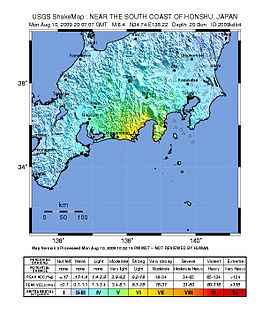
The 2009 Shizuoka earthquake occurred with a magnitude of 6.4,[1][2] hitting Shizuoka Prefecture in the south of Honshū, Japan, on August 11 at 05:07 local time (August 10, 20:07 UTC).
Overview
[edit]The seismic intensity was observed as shindo 6- in Izu, Yaizu, Makinohara, Omaezaki, Shizuoka.[3]
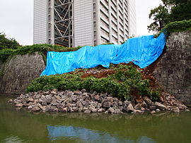
One woman was killed in Shizuoka, 134 people were injured, and 6,000 buildings were damaged. In addition, the shoulder of Tōmei Expressway was damaged.[4][5][6]
In this area, it is presumed that an M8 class Tokai earthquake will occur in the near future.[7]
See also
[edit]- Earthquake Early Warning (Japan)
- Fault (geology)
- List of earthquakes in 2009
- List of earthquakes in Japan
- Yoshinobu Ishikawa
References
[edit]- ^ "Magnitude 6.4 – NEAR THE SOUTH COAST OF HONSHU, JAPAN". Archived from the original on 2010-01-14. Retrieved 2017-08-28.
- ^ Magnitude 6.5 by Japan Meteorological Agency (JMA) 平成21年8月11日の駿河湾の地震(Japanese) – JMA. Accessed 2009-08-16. Archived 2009-08-22.
- ^ 2009年8月11日05時07分ころの駿河湾の地震について(Japanese) – JMA. Accessed 2009-08-16. Archived 2009-08-22.
- ^ Strong quakes hit Japan and India
- ^ Quake-prone Japan still waiting for 'the big one'
- ^ 駿河湾を震源とする地震(第15報):訂正(Japanese) – Fire and Disaster Management Agency (FDMA). Accessed 2009-08-16. Archived 2009-08-22.
- ^ 相模トラフ沿いの地震活動の長期評価について(Japanese) – The Headquarters for Earthquake Research Promotion. Accessed 2009-08-16. Archived 2009-08-22.


