Rural Municipality of Willow Bunch No. 42
Willow Bunch No. 42 | |
|---|---|
| Rural Municipality of Willow Bunch No. 42 | |
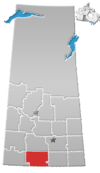
 Location of the RM of Willow Bunch No. 42 in Saskatchewan | |
| Coordinates: 49°21′29″N 105°45′47″W / 49.358°N 105.763°W[1] | |
| Country | Canada |
| Province | Saskatchewan |
| Census division | 3 |
| SARM division | 2 |
| Federal riding | Cypress Hills—Grasslands |
| Provincial riding | Wood River |
| Formed[2] | November 21, 1912 |
| Government | |
| • Reeve | Denis Bellefleur |
| • Governing body | RM of Willow Bunch No. 42 Council |
| • Administrator | Sharleine Eger |
| • Office location | Willow Bunch |
| Area (2016)[4] | |
| • Land | 1,047.77 km2 (404.55 sq mi) |
| Population (2016)[4] | |
• Total | 306 |
| • Density | 0.3/km2 (0.8/sq mi) |
| Time zone | CST |
| • Summer (DST) | CST |
| Postal code | S0H 4K0 |
| Area code(s) | 306 and 639 |
| Website | Official website |
The Rural Municipality of Willow Bunch No. 42 (2016 population: 306) is a rural municipality (RM) in the Canadian province of Saskatchewan within Census Division No. 3 and SARM Division No. 2. It is located in the south central portion of the province.
History
[edit]The RM of Willow Bunch No. 42 incorporated as a rural municipality on November 21, 1912.[2]
- Heritage properties
There is one historical building located within the RM.
- Grand Valley Lutheran Church - Constructed in 1916, in Grand Valley[5]
Geography
[edit]Communities and localities
[edit]The following urban municipalities are surrounded by the RM.
The following unincorporated communities are within the RM.
- Localities
- Grand Valley
- Gye
- Lisieux
- Little Woody
- St. Victor, dissolved as a village February 26, 2003
- Twin Valley
Jean Louis Legare Regional Park
[edit]Jean Louis Legare Regional Park (49°22′27″N 105°39′26″W / 49.3741°N 105.6573°W)[7] is a regional park in the RM of Willow Bunch, 1.6 km (0.99 mi) south-west of Willow Bunch in the Big Muddy Valley. Established in 1961, the park was named after Jean-Louis Légaré, who was one of the original settlers of Willow Bunch. The park has a campground, golf course, a picnic area, and hiking trails. The trails go through the coulees and valleys of the Big Muddy Valley. Access to the park is from Highway 36.[8]
The campground has 45 campsites (41 of which have electric hookups), washrooms, showers, and a sani-dump.[9] The Willow Bunch Golf Course is a par 36, 9-hole, grass greens course with 3,176 total yards. There is a licensed clubhouse with cart and club rentals.[10]
Demographics
[edit]In the 2021 Census of Population conducted by Statistics Canada, the RM of Willow Bunch No. 42 had a population of 285 living in 139 of its 163 total private dwellings, a change of -6.9% from its 2016 population of 306. With a land area of 1,037.04 km2 (400.40 sq mi), it had a population density of 0.3/km2 (0.7/sq mi) in 2021.[13]
In the 2016 Census of Population, the RM of Willow Bunch No. 42 recorded a population of 306 living in 154 of its 175 total private dwellings, a -15.2% change from its 2011 population of 361. With a land area of 1,047.77 km2 (404.55 sq mi), it had a population density of 0.3/km2 (0.8/sq mi) in 2016.[4]
Government
[edit]The RM of Willow Bunch No. 42 is governed by an elected municipal council and an appointed administrator that meets on the second Monday of every month.[3] The reeve of the RM is Denis Bellefleur while its administrator is Sharleine Eger.[3] The RM's office is located in Willow Bunch.[3]
Transportation
[edit]The RM is a part owner of the Fife Lake Railway.[14] The Willow Bunch Airport was an airport located within the municipality. The airport closed in 2009.
See also
[edit]References
[edit]- ^ "Pre-packaged CSV files - CGN, Canada/Province/Territory (cgn_sk_csv_eng.zip)". Government of Canada. July 24, 2019. Retrieved May 23, 2020.
- ^ a b "Rural Municipality Incorporations (Alphabetical)". Saskatchewan Ministry of Municipal Affairs. Archived from the original on April 21, 2011. Retrieved May 9, 2020.
- ^ a b c d "Municipality Details: RM of Willow Bunch No. 42". Government of Saskatchewan. Retrieved May 21, 2020.
- ^ a b c "Population and dwelling counts, for Canada, provinces and territories, and census subdivisions (municipalities), 2016 and 2011 censuses – 100% data (Saskatchewan)". Statistics Canada. February 8, 2017. Retrieved May 1, 2020.
- ^ Grand Valley Church
- ^ "2019-2020 Rural Revenue Sharing Organized Hamlet Grant". Government of Saskatchewan. Retrieved May 4, 2020.[permanent dead link]
- ^ "Jean Louis Legare Regional Park". Canadian Geographical Names Database. Government of Canada. Retrieved February 21, 2023.
- ^ "Jean Louis Legare Regional Park". Tourism Saskatchewan. Government of Saskatchewan. Retrieved February 22, 2023.
- ^ "Jean Louis Legare Regional Park Campground". BRMB. Mussio Ventures Ltd. Retrieved February 22, 2023.
- ^ "Jean Louis Legare". Regional Parks of Saskatchewan. Saskatchewan Regional Parks. Retrieved February 22, 2023.
- ^ "Saskatchewan Census Population" (PDF). Saskatchewan Bureau of Statistics. Archived from the original (PDF) on September 24, 2015. Retrieved May 9, 2020.
- ^ "Saskatchewan Census Population". Saskatchewan Bureau of Statistics. Retrieved May 9, 2020.
- ^ "Population and dwelling counts: Canada, provinces and territories, census divisions and census subdivisions (municipalities), Saskatchewan". Statistics Canada. February 9, 2022. Retrieved April 13, 2022.
- ^ "Fife Lake Railway Project Best Practice Report" (PDF). Archived from the original (PDF) on July 6, 2011. Retrieved December 15, 2010.


