Cardross, Saskatchewan
Appearance
Cardross, Saskatchewan | |
|---|---|
| Coordinates: 49°48′58″N 105°37′01″W / 49.816°N 105.617°W | |
| Country | Canada |
| Province | Saskatchewan |
| Region | South Central |
| Census division | 3 |
| Rural Municipality | Terrell |
| Established | 1910 |
| Government | |
| • Governing body | Terrell No. 101 |
| • Reeve | Brian McMillan |
| • Administrator | Lacelle Kim |
| Area | |
| • Total | 0.00 km2 (0.00 sq mi) |
| Population (2006) | |
| • Total | 0 |
| • Density | 0.0/km2 (0/sq mi) |
| Time zone | CST |
| Postal code | S0H 0P0 |
| Area code | 306 |
| Highways | Range road 274 Township road 102 |
| [1][2][3][4] | |
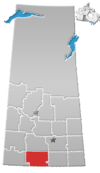
Cardross, originally named Grace, is an unincorporated hamlet in Terrell Rural Municipality No. 101, Saskatchewan, Canada. The hamlet is located approximately 45 km north-east of Assiniboia on Township road 102 & Range road 274.
The Post Office was named Cardross from 1926 until closure. It was located at 10-27-W2, prior to 1926 the name was Grace 1910–1926.
See also
[edit]References
[edit]- ^ National Archives, Archivia Net, Post Offices and Postmasters, archived from the original on October 6, 2006
- ^ Government of Saskatchewan, MRD Home, Municipal Directory System, archived from the original on November 21, 2008
- ^ Canadian Textiles Institute. (2005), CTI Determine your provincial constituency, archived from the original on September 11, 2007
- ^ Commissioner of Canada Elections, Chief Electoral Officer of Canada (2005), Elections Canada On-line, archived from the original on April 21, 2007
49°49′N 105°37′W / 49.817°N 105.617°W


