Southwest Aceh Regency
Southwest Aceh Regency
Kabupaten Aceh Barat Daya | |
|---|---|
 Regent office of Southwest Aceh in Blangpidie | |
| Motto(s): Sapeu Kheun Sahoe Langkah (Same Word Same Step) | |
 Location within Aceh | |
| Coordinates: 3°47′28″N 96°55′00″E / 3.7911°N 96.9166°E | |
| Country | |
| Region | Sumatra |
| Province | |
| Established | 2002 |
| Regency seat | Blangpidie |
| Government | |
| • Regent | Darmansah |
| • Vice Regent | Vacant |
| Area | |
| • Total | 1,882.99 km2 (727.03 sq mi) |
| Population (mid 2023 estimate)[1] | |
| • Total | 156,990 |
| • Density | 83/km2 (220/sq mi) |
| Time zone | UTC+7 (IWST) |
| Area code | (+62) 659 |
| Website | acehbaratdayakab |
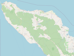
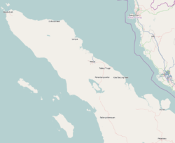
Southwest Aceh Regency (Indonesian: Kabupaten Aceh Barat Daya) is a regency in the Aceh Province of Indonesia. The regency was created on 10 April 2002 from the northwestern districts of South Aceh Regency. It is located on the west side of the island of Sumatra. The regency covers an area of 1,882.99 square kilometres and according to the 2010 census had a population of 126,036;[2] this rose to 140,366 at the 2015 Census, and to 150,775 at the 2020 Census;[3] the official estimate as at mid 2023 was 156,990.[1] The seat of the regency government is the town of Blangpidie.
Administrative districts
[edit]The regency is divided administratively into nine districts (kecamatan), tabulated below with their areas (in km2) and their populations at the 2010 Census[2] and the 2020 Census,[3] together with the official estimates as at mid 2022.[4] The table also includes the locations of the district administrative centres, the number of villages (gampong) in each district, and its postal codes.
| Kode Wilayah |
Name of District (kecamatan) |
Area in km2 |
Pop'n Census 2010 |
Pop'n Census 2020 |
Pop'n Estimate mid 2022 |
Admin centre |
No. of villages |
Post codes |
|---|---|---|---|---|---|---|---|---|
| 11.12.03 | Manggeng | 100.68 | 12,670 | 15,331 | 15,799 | Kedai Manggeng | 18 | 23760 |
| 11.12.09 | Lembah Sabil | 110.23 | 9,771 | 11,121 | 11,325 | Cot Bak U | 14 | 23762 |
| 11.12.02 | Tangan-Tangan | 63.60 | 11,509 | 13,704 | 14,078 | Tanjung Bunga | 15 | 23768 |
| 11.12.07 | Setia | 30.21 | 7,461 | 8,673 | 8,869 | Lhang | 9 | 23763 |
| 11.12.01 | Blangpidie | 486.95 | 20,084 | 23,810 | 24,440 | Pasar Blangpidie | 20 | 23764 |
| 11.12.08 | Jeumpa | 225.78 | 9,481 | 11,338 | 11,657 | Alue Sungai Pinang | 12 | 23769 |
| 11.12.04 | Susoh | 18.71 | 20,901 | 24,619 | 25,238 | Padang Baru | 29 | 23765 |
| 11.12.05 | Kuala Batee | 287.32 | 17,740 | 21,383 | 22,019 | Pasar Kota Bahagia | 21 | 23766 |
| 11.12.06 | Babahrot | 559.52 | 16,419 | 20,796 | 21,621 | Pante Rakyat | 14 | 23767 |
| Totals | 1,882.99 | 126,036 | 150,775 | 155,046 | Blangpidie | 152 |
See also
[edit]References
[edit]- ^ a b Badan Pusat Statistik, Jakarta, 28 February 2024, Kabupaten Aceh Barat Daya Dalam Angka 2024 (Katalog-BPS 1102001.1112)
- ^ a b Biro Pusat Statistik, Jakarta, 2011.
- ^ a b Badan Pusat Statistik, Jakarta, 2021.
- ^ Badan Pusat Statistik, Jakarta, 2023, Kabupaten Aceh Barat Daya Dalam Angka 2023 (Katalog-BPS 1102001.1112)


