Pidie Regency
Pidie Regency
Kabupaten Pidie | |
|---|---|
 Location within Aceh | |
| Coordinates: 4°40′00″N 96°00′00″E / 4.66667°N 96°E | |
| Country | |
| Region | Sumatra |
| Province | |
| Established | 1956 |
| Regency seat | Sigli |
| Government | |
| • Regent | Roni Ahmad |
| • Vice Regent | Fadhlullah T.M. Daud |
| Area | |
| • Total | 3,184.46 km2 (1,229.53 sq mi) |
| Population (mid 2023 estimate)[1] | |
| • Total | 448,085 |
| • Density | 140/km2 (360/sq mi) |
| Time zone | UTC+7 (IWST) |
| Area code | (+62) 653 |
| Website | pidiekab |
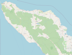
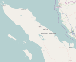
Pidie Regency (also known as: Pidie, Pědir;[2] "king of"; Indonesian: Kabupaten Pidie) is a regency of Aceh Special region, in Indonesia. It is located in the north of the island of Sumatra, in Western Indonesia, bordered by the Malacca Strait and Pidie Jaya Regency (which was formerly a part of Pidie Regency until it was separated out in 2007) in the north, Aceh Besar Regency in the west, Bireuen Regency in the northeast, and Aceh Jaya Regency in the south. The regency covers an area of 3,184.46 square kilometres and had a population of 379,108 people at the 2010 Census[3] and 435,275 at the 2020 Census;[4] the official estimate as at mid 2023 was 448,085 - comprising 223,208 males and 224,877 females.[1] Pidie was the largest rice-producing area of Aceh province, producing some 20% of its total output.[5]
History
[edit]Pidie Regency has a long and storied history, with archaeological evidence suggesting human habitation in the area dating back thousands of years. Pidie Regency also has a rich historical background, with its history intertwined with the broader history of the Aceh region. The area has been influenced by various kingdoms and colonial powers over the centuries. It was once part of the Sultanate of Aceh, which was an important Islamic kingdom in the region. During the Dutch colonial period, Pidie was integrated into the broader colonial administration of Aceh. Historical sites and landmarks can be found in most of the regency, reflecting its diverse past.
Culture
[edit]The population of Pidie Regency is predominantly of Acehnese descent, with a strong Islamic heritage. Traditional customs and ceremonies are an integral part of daily life, and the regency is known for its rich artistic traditions and spiritual practices. Festivals and cultural events are celebrated throughout the year, showcasing the region's unique heritage.
Economy
[edit]The economy of Pidie Regency is largely based on agriculture, with rice, corn, coffee, and other crops being significant contributors to the local economy. Fishing and livestock farming are also important economic activities. In recent years, efforts have been made to improve infrastructure and boost local industries to support economic development.
Administrative divisions
[edit]The regency is divided administratively into twenty-three districts (kecamatan), listed below with their areas and their populations at the 2010 Census[3] and the 2020 Census,[4] together with the official estimates as at mid 2023.[1] The table also includes the locations of the district administrative centres, the number of administrative villages (gampong) in each district, and its post code.
| Kode Wilayah |
Name of District (kecamatan) |
Area in km2 |
Pop'n Census 2010 |
Pop'n Census 2020 |
Pop'n Estimate mid 2023 |
Admin centre |
No. of villages |
Post code |
|---|---|---|---|---|---|---|---|---|
| 11.07.05 | Geumpang | 657.07 | 6,008 | 7,184 | 7,390 | Geumpang | 5 | 24167 |
| 11.07.27 | Mane | 675.04 | 7,786 | 8,905 | 9,144 | Mane | 4 | 24189 |
| 11.07.06 | Glumpang Tiga | 54.84 | 16,888 | 19,348 | 19,948 | Glumpang Minyeuk | 34 | 24183 |
| 11.07.29 | Glumpang Baro | 12.12 | 9,622 | 10,981 | 11,312 | Cot Glumpang | 21 | 24180 |
| 11.07.13 | Mutiara | 16.75 | 18,418 | 21,041 | 21,661 | Beureunuen | 29 | 24173 |
| 11.07.24 | Mutiara Timur (East Mutiara) |
31.24 | 30,767 | 35,319 | 36,360 | Bandar Mutiara | 48 | 24175 |
| 11.07.21 | Tiro (Truseb) | 174.69 | 7,097 | 8,440 | 8,677 | Tiro | 19 | 24174 |
| 11.07.19 | Tangse | 786.58 | 23,509 | 26,948 | 27,761 | Tangse | 28 | 24166 |
| 11.07.22 | Keumala | 49.30 | 8,905 | 10,492 | 10,792 | Keumala | 18 | 24165 |
| 11.07.31 | Titeue | 27.42 | 6,101 | 7,176 | 7,380 | Titeue | 13 | 24168 |
| 11.07.17 | Sakti | 38.52 | 18,817 | 21,374 | 22,019 | Kota Bakti | 49 | 24164 |
| 11.07.11 | Mila | 35.32 | 8,068 | 9,835 | 10,134 | Mila | 20 | 24163 |
| 11.07.14 | Padang Tiji | 257.59 | 19,633 | 24,063 | 24,729 | Padang Tiji | 64 | 24161 |
| 11.07.04 | Delima | 24.99 | 18,659 | 21,673 | 22,299 | Reubee | 44 | 24161 |
| 11.07.25 | Grong-Grong | 7.77 | 6,209 | 6,753 | 6,946 | Grong-Grong | 15 | 24150 |
| 11.07.07 | Indrajaya | 25.41 | 20,715 | 23,325 | 24,033 | Caleue | 49 | 24171 |
| 11.07.15 | Peukan Baro | 17.29 | 18,253 | 20,619 | 21,271 | Lampoih Saka | 48 | 24172 |
| 11.07.08 | Kembang Tanjong | 28.87 | 19,315 | 21,609 | 22,269 | Kembang Tanjong | 45 | 24182 |
| 11.07.18 | Simpang Tiga | 24.86 | 20,291 | 23,211 | 23,900 | Simpang Tiga | 52 | 24181 |
| 11.07.09 | Kota Sigli (Sigli town) |
6.56 | 18,829 | 20,202 | 20,807 | Kota Sigli | 15 | 24115 -24119 |
| 11.07.16 | Pidie (town) | 26.09 | 39,814 | 45,452 | 46,821 | Lhok Keutapang | 64 | 24151 |
| 11.07.03 | Batee | 46.11 | 18,077 | 20,589 | 21,168 | Batee | 28 | 24152 |
| 11.07.12 | Muara Tiga | 160.03 | 17,427 | 20,736 | 21,264 | Laweueng | 18 | 24153 |
| Totals | 3,184.46 | 379,108 | 435,275 | 448,085 | Kota Sigli | 730 |
Notable people
[edit]- Zaini Abdullah (governor of Aceh 2013 - 2018).
- Teungku Chik di Tiro (Indonesian National Hero).
- Daud Beureueh (Military Governor of aceh).
- Teuku Mohammad Hasan (The first governor of Sumatra).
- Ibrahim Hasan (former governor of Aceh and Former Minister for Food).
- Hasballah M Saad (Former minister of indonesian human rights).
- Hasan Tiro (Founder and command center of GAM).
- Sanusi Juned (Former chief minister of Malaysian).
- Ismail Hassan Metareum (Party chairman and Advisory specially Indonesian delegation to the UN).
- Ibrahim Risjad or Richard (influential businessmen in Indonesian).
- Teuku Iskandar (scholar, one of the founders of Syiah Kuala University Aceh).
References
[edit]- ^ a b c Badan Pusat Statistik, Jakarta, 28 February 2024, Kabupaten Pidie Dalam Angka 2024 (Katalog-BPS 1102001.1107)
- ^ Ricklefs, M.C. (2008). History of Modern Indonesia Since c. 1200. Stanford University Press. p. 364.
- ^ a b Biro Pusat Statistik, Jakarta, 2011.
- ^ a b Badan Pusat Statistik, Jakarta, 2021.
- ^ Kell, Tim (2010). The roots of Acehnese rebellion 1989-1992. Jakarta: Equinox Publishing. ISBN 978-602-8397-17-9. OCLC 630315910.


