Celle di Bulgheria
Celle di Bulgheria | |
|---|---|
| Comune di Celle di Bulgheria | |
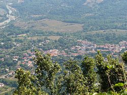
 Panorama from the mount Bulgheria | |
 Celle within the Province of Salerno | |
| Coordinates: 40°06′N 15°24′E / 40.100°N 15.400°E | |
| Country | Italy |
| Region | Campania |
| Province | Salerno (SA) |
| Frazioni | Poderia |
| Government | |
| • Mayor | Gino Marotta |
| Area | |
• Total | 31.62 km2 (12.21 sq mi) |
| Elevation | 234 m (768 ft) |
| Population (1 January 2018)[2] | |
• Total | 1,861 |
| • Density | 59/km2 (150/sq mi) |
| Demonym | Cellesi |
| Time zone | UTC+1 (CET) |
| • Summer (DST) | UTC+2 (CEST) |
| Postal code | 84040 |
| Dialing code | 0974 |
| Patron saint | Madonna of the Snow |
| Saint day | 5 August |
| Website | Official website |
Celle di Bulgheria, also shortened as Celle, is a town and comune in the province of Salerno in the Campania region of south-western Italy.
History
[edit]The town was named after the Bulgars settled here with their leader Altsek (whose father was the second ever leader of Old Great Bulgaria) in the early Middle Ages.[3]
Geography
[edit]Celle Bulgheria is located in Southern Cilento, near the mount Bulgheria, and is part of the Cilento and Vallo di Diano National Park. It borders with the municipalities of Camerota, Centola, Laurito, Montano Antilia and Roccagloriosa.[4] Its hamlet (frazione) is the nearby village of Poderia.[5]
Main sights
[edit]- De Luca Palace
- Madonna della Neve (Our Lady of the Snow) church
- Saint Sophia church, in Poderia
- Mount Bulgheria
Transport
[edit]Celle di Bulgheria counts a railway station, Celle Bulgheria-Roccagloriosa, on the Naples-Salerno-Reggio Calabria railway line.
Crossed by the "Cilentana" highway Salerno-Sapri to the south, has the nearest exits at Poderia (west) and Roccagloriosa (east).
People
[edit]- Antonio Maria De Luca (1764–1828), priest and patriot
- Salvatore Venuta (1944–2007), biologist and oncologist
Twin towns
[edit]See also
[edit]References
[edit]- ^ "Superficie di Comuni Province e Regioni italiane al 9 ottobre 2011". Italian National Institute of Statistics. Retrieved 16 March 2019.
- ^ (in Italian) Source: Istat 2011
- ^ [1] MONUMENT OF ANCIENT BULGAR LEADER ALTSEK OPENED IN ITALY’S CELLE DI BULGHERIA TO CELEBRATE ANCIENT BULGAR HERITAGE
- ^ 40261 Celle di Bulgheria on OpenStreetMap
- ^ 1253558258 Poderia on OpenStreetMap
External links
[edit]- Official website (in Italian)
- Tourist info about Celle (in Italian)


