Pertosa
Appearance
You can help expand this article with text translated from the corresponding article in Italian. (January 2022) Click [show] for important translation instructions.
|
Pertosa | |
|---|---|
| Comune di Pertosa | |
 Panorama | |
 Pertosa within the Province of Salerno | |
| Coordinates: 40°33′N 15°27′E / 40.550°N 15.450°E | |
| Country | Italy |
| Region | Campania |
| Province | Salerno (SA) |
| Frazioni | Muraglione[1] |
| Area | |
• Total | 6 km2 (2 sq mi) |
| Elevation | 310 m (1,020 ft) |
| Population (31-12-2010)[3] | |
• Total | 714 |
| • Density | 120/km2 (310/sq mi) |
| Demonym | Pertosani |
| Time zone | UTC+1 (CET) |
| • Summer (DST) | UTC+2 (CEST) |
| Postal code | 84030 |
| Dialing code | 0975 |
| Website | Official website |
Pertosa is a village and comune of the province of Salerno in the Campania region of south-west Italy. In 2010 its population was 714.[4]
History
[edit]This section is empty. You can help by adding to it. (May 2010) |
Geography
[edit]The village is situated in the eastern side of the province of Salerno, close to the municipalities of Auletta, Polla and Caggiano and to Alburni mountains. Its only hamlet (frazione) is the little village of Muraglione, in which are located the show caves.
Demographics
[edit]At the census in 2001 the town had a population of 727, a drop from the 897 at the previous census in 1991.[5]

Main sights
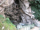
[edit]Pertosa is a receptive tourist place principally for its karst show cave system, the Pertosa Caves (Grotte di Pertosa). The caves are located in the valley below the town, by the river Tanagro.
Gallery
[edit]-
Entrance of the touristic caves
-
Street in Pertosa
-
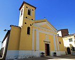
Santa Maria delle Grazie
See also
[edit]References
[edit]- ^ Location of the caves
- ^ "Superficie di Comuni Province e Regioni italiane al 9 ottobre 2011". Italian National Institute of Statistics. Retrieved 16 March 2019.
- ^ "Popolazione Residente al 1° Gennaio 2018". Italian National Institute of Statistics. Retrieved 16 March 2019.
- ^ (in Italian) Source: Istat 2010
- ^ Pertosa on campania.indettaglio.it
External links
[edit]Wikimedia Commons has media related to Pertosa.
- (in Italian) Pertosa municipal website
- (in English and Italian) Official site of the caves


