Mukhaizna Airport
Appearance
Mukhaizna Airport | |||||||||||
|---|---|---|---|---|---|---|---|---|---|---|---|
| Summary | |||||||||||
| Airport type | Public | ||||||||||
| Serves | Mukhaizna oil field, Oman | ||||||||||
| Elevation AMSL | 479 ft / 146 m | ||||||||||
| Coordinates | 19°23′24″N 56°23′52″E / 19.39000°N 56.39778°E | ||||||||||
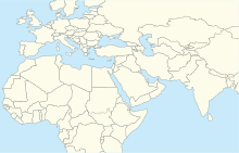
| Map | |||||||||||
 | |||||||||||
| Runways | |||||||||||
| |||||||||||
Mukhaizna Airport (IATA: UKH, ICAO: OOMK) is an airport serving the Mukhaizna oil field in Oman. The runway has 300 metres (980 ft) overruns on each end.
The Haima VOR-DME (Ident: HAI) is located 35.3 nautical miles (65 km) north-northwest of the airport.[4]
Airlines and destinations
[edit]| Airlines | Destinations |
|---|---|
| Oman Air | Charter: Muscat |
| SalamAir | Charter: Muscat[5] |
See also
[edit]References
[edit]- ^ Google Maps - Mukhaizna
- ^ "Mukhaizna Airport". skyvector.com. Retrieved 22 April 2016.
- ^ Airport information for Mukhaizna Airport at Great Circle Mapper.
- ^ "Haima VOR". Our Airports. Retrieved 1 February 2019.
- ^ "Salam Air plans Mukhaizna charters from June 2018".
External links
[edit]


