Marmul Airport
Appearance
Marmul Airport | |||||||||||
|---|---|---|---|---|---|---|---|---|---|---|---|
| Summary | |||||||||||
| Airport type | Public | ||||||||||
| Serves | Marmul | ||||||||||
| Elevation AMSL | 909 ft / 277 m | ||||||||||
| Coordinates | 18°08′20″N 55°10′40″E / 18.13889°N 55.17778°E | ||||||||||
| Map | |||||||||||
 | |||||||||||
| Runways | |||||||||||
| |||||||||||
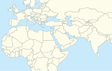
Marmul Airport (IATA: OMM, ICAO: OOMX) is an airport serving the Petroleum Development Oman (PDO) operations at the Marmul heavy oil field in the Dhofar Governorate of Oman. The airport is 6 kilometres (3.7 mi) southwest of the main PDO camp.
The Marmul VOR-DME (Ident: MRL) is located on the field.[3]
See also
[edit]References
[edit]- ^ Google Maps - Marmul
- ^ Airport information for Marmul Airport at Great Circle Mapper.
- ^ Marmul VOR
External links
[edit]- OurAirports - Marmul Airport
- Marmul - FallingRain
- Accident history for Marmul Airport at Aviation Safety Network


