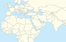
Lekhwair Airport
Appearance
Lekhwair Airport | |||||||||||
|---|---|---|---|---|---|---|---|---|---|---|---|
| Summary | |||||||||||
| Airport type | Public | ||||||||||
| Serves | Lekhwair | ||||||||||
| Elevation AMSL | 354 ft / 108 m | ||||||||||
| Coordinates | 22°48′20″N 55°22′30″E / 22.80556°N 55.37500°E | ||||||||||
| Map | |||||||||||
 | |||||||||||
| Runways | |||||||||||
| |||||||||||
Lekhwair (IATA: LKW, ICAO: OOLK) is an airport serving the Lekhwair petroleum facility in western Oman.
The Fahud VOR-DME is located 67.5 nautical miles (125 km) east-southeast of the airport.[3]
See also
[edit]References
[edit]- ^ Google Maps - Lekhwair
- ^ Airport information for Lekhwair Airport at Great Circle Mapper.
- ^ "Fahud VOR". Our Airports. Retrieved 2 February 2019.
External links
[edit]- OpenStreetMap - Lekhwair Airport
- OurAirports - Lekhwair Airport
- MBendi - Lekhwair
- Accident history for Lekhwair Airport at Aviation Safety Network


