Mayor Buenaventura Vivas Airport
Appearance
Mayor Buenaventura Vivas Airport | |||||||||||
|---|---|---|---|---|---|---|---|---|---|---|---|
 | |||||||||||
| Summary | |||||||||||
| Airport type | Civil/Military | ||||||||||
| Location | Santo Domingo, Táchira, Venezuela | ||||||||||
| Elevation AMSL | 1,083 ft / 330 m | ||||||||||
| Coordinates | 7°33′55″N 72°02′10″W / 7.56528°N 72.03611°W | ||||||||||
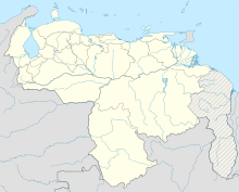
| Map | |||||||||||
 | |||||||||||
| Runways | |||||||||||
| |||||||||||
Mayor Buenaventura Vivas Airport (IATA: STD, ICAO: SVSO), is an airport serving Santo Domingo in the Táchira state of Venezuela.
The runway is just southwest of the town. The Santo Domingo VORTAC (Ident: STD) is located in the town.[4][5]
Airlines and destinations
[edit]| Airlines | Destinations |
|---|---|
| Aerolíneas Estelar | Caracas, Maracaibo |
| Conviasa | Caracas, Maturín,[6] Porlamar |
| RUTACA Airlines | Caracas |
| Turpial Airlines | Valencia |
See also
[edit]References
[edit]- ^ "Airport information for SVSO". World Aero Data. Archived from the original on 2019-03-05.
{{cite web}}: CS1 maint: unfit URL (link) Data current as of October 2006. - ^ Airport information for STD at Great Circle Mapper.
- ^ Google Maps - Mayor Buenaventura Vivas
- ^ STD Tacan
- ^ SkyVector IFR Chart - Santo Domingo VORTAC
- ^ "Conviasa Adds Maturin – Santo Domingo (VE) Service in Late-March 2024". Aeroroutes. March 19, 2024. Retrieved March 19, 2024.
External links
[edit]

