La Chinita International Airport
La Chinita International Airport Aeropuerto Internacional La Chinita | |||||||||||||||
|---|---|---|---|---|---|---|---|---|---|---|---|---|---|---|---|
 | |||||||||||||||
| Summary | |||||||||||||||
| Airport type | Public / Military | ||||||||||||||
| Operator | Government | ||||||||||||||
| Serves | Maracaibo | ||||||||||||||
| Location | San Francisco, Zulia | ||||||||||||||
| Opened | 16 November 1969 | ||||||||||||||
| Hub for | Venezolana | ||||||||||||||
| Focus city for | Conviasa | ||||||||||||||
| Elevation AMSL | 235 ft / 72 m | ||||||||||||||
| Coordinates | 10°33′30″N 71°43′40″W / 10.55833°N 71.72778°W | ||||||||||||||
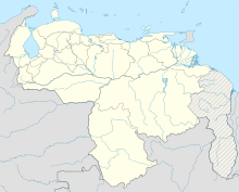
| Map | |||||||||||||||
 | |||||||||||||||
| Runways | |||||||||||||||
| |||||||||||||||
| Statistics (2008) | |||||||||||||||
| |||||||||||||||
La Chinita International Airport (IATA: MAR, ICAO: SVMC) is an international airport serving Maracaibo, the capital of Zulia. It is located southwest of Maracaibo proper in the municipality of San Francisco. La Chinita is Venezuela's second most important airport in terms of passenger and aircraft movements, after Simón Bolívar International Airport near Caracas.
History
[edit]This airport construction was accelerated due to the accident of Viasa Flight 742 on 16 March 1969, resulting in the death of 155 people and the closure of Grano de Oro Airport, where the airport is located too close to the city centre and surrounded neighbourhoods. (1960 diagram)
The airport opened on 16 November 1969, during the administration of President Rafael Caldera, to open a gateway to the western part of the country and to alleviate congestion from Simón Bolívar International Airport, which manages about half of the international flights in Venezuela.
Facilities
[edit]Runway 03L/21R length does not include a 300 metres (980 ft) paved overrun on the north end. The Maracaibo VORTAC (Ident: MAR) is located 0.81 nautical miles (1.50 km) northeast of the threshold of Runway 21R.[4]
Airlines and destinations
[edit]Passenger
[edit]Cargo
[edit]| Airlines | Destinations |
|---|---|
| Aerosucre | Bogotá[7] |
| Transcarga | Caracas[citation needed] |
Accidents and incidents
[edit]- On 1 November 1971, Vickers Viscount YV-C-AMZ of Linea Aeropostal Venezolana crashed shortly after take-off. All four people on board were killed.[8]
- On March 5, 1991, Aeropostal Alas de Venezuela Flight 108 crashed in to a nearby mountain soon after takeoff, killing all 45 passenger and crew.[9]
See also
[edit]External links
[edit]- Airport information for MAR at Great Circle Mapper.
- SkyVector - La Chinita
- OurAirports - La Chinita
- OpenStreetMap - La Chinita
References
[edit]- ^ Dirección de Operaciones
- ^ World Data Aero[usurped]
- ^ Google Maps - La Chinita
- ^ MAR VOR
- ^ "SATENA Sep 2024 Network Expansion". Aeroroutes. Retrieved 26 July 2024.
- ^ "Skyhigh Dominicana Adds Maracaibo Service From June 2024". Aeroroutes. Retrieved 9 May 2024.
- ^ "Rutas". Aerosucre.com (in Spanish). Retrieved 7 March 2022.
- ^ "Accident description". Aviation Safety Network. Retrieved 8 October 2009.
- ^ "ASN Aircraft accident McDonnell Douglas DC-9-32 YV-23C Valera". aviation-safety.net. Retrieved 26 January 2023.

