La Orchila Airport
Appearance
La Orchila Airport | |||||||||||
|---|---|---|---|---|---|---|---|---|---|---|---|
| Summary | |||||||||||
| Airport type | Public | ||||||||||
| Serves | La Orchila | ||||||||||
| Elevation AMSL | 5 ft / 2 m | ||||||||||
| Coordinates | 11°48′30″N 66°10′48″W / 11.80833°N 66.18000°W | ||||||||||
| Map | |||||||||||
 | |||||||||||
| Runways | |||||||||||
| |||||||||||
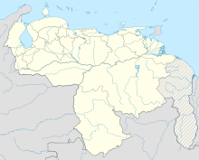
La Orchila Airport (ICAO: SVLO) is an airport serving the island of La Orchila in the Caribbean Sea 130 kilometres (81 mi) north of the Venezuelan coast. La Orchila is in the Federal Dependencies of Venezuela.
The La Orchila VOR-DME (Ident: LOR) is located on the field.[3]
See also
[edit]References
[edit]- ^ Airport information for SVLO at Great Circle Mapper.
- ^ Google Maps - La Orchila
- ^ SkyVector Aeronautical Charts
External links
[edit]- OpenStreetMap - La Orchila
- OurAirports - La Orchila
- SkyVector - La Orchila Isla Airport
- HERE/Nokia - La Orchila Island

