Marion Airport
Marion Airport | |||||||||||
|---|---|---|---|---|---|---|---|---|---|---|---|
| Summary | |||||||||||
| Airport type | Public use | ||||||||||
| Owner | City of Marion - managed by Perry & Jan Walton | ||||||||||
| Serves | Marion, Iowa | ||||||||||
| Elevation AMSL | 862 ft / 263 m | ||||||||||
| Coordinates | 42°01′47″N 091°31′54″W / 42.02972°N 91.53167°W | ||||||||||
| Map | |||||||||||
 | |||||||||||
| Runways | |||||||||||
| |||||||||||
| Statistics (2010) | |||||||||||
| |||||||||||
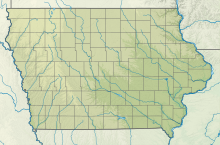
Marion Airport (FAA LID: C17) is a city-owned, public-use airport located three nautical miles (6 km) east of the central business district of Marion, a city in Linn County, Iowa, United States.[1]
Facilities and aircraft
[edit]Marion Airport covers an area of 40 acres (16 ha) at an elevation of 862 feet (263 m) above mean sea level. It has one runway designated 17/35 with an asphalt and turf surface measuring 3,775 by 100 feet. The width has 26 feet of center pavement, with the remainder being turf.[1]
For the 12-month period ending August 26, 2010, the airport had 11,372 aircraft operations, an average of 31 per day: 99% general aviation, 1% air taxi, and <1% military. At that time there were 51 aircraft based at this airport: 76% single-engine, 8% helicopter, 8% ultralight, 6% multi-engine, and 2% glider.[1]
In October 2019 expansion started to extend the main runway to 3,775 ft. long. It was completed July 28, 2020. [2]

See also
[edit]References
[edit]- ^ a b c d FAA Airport Form 5010 for C17 PDF. Federal Aviation Administration. Effective November 15, 2012.
- ^ King, Grace. "Marion Airport runway expansion underway". The Gazette.
External links
[edit]- Marion Airport (C17) at Iowa DOT Airport Directory
- Aerial image as of March 1990 from USGS The National Map
- Resources for this airport:
- FAA airport information for C17
- AirNav airport information for C17
- FlightAware airport information and live flight tracker
- SkyVector aeronautical chart for C17


