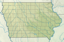
Fairfield Municipal Airport (Iowa)
41°03′21″N 091°58′51″W / 41.05583°N 91.98083°W
Fairfield Municipal Airport | |||||||||||||||
|---|---|---|---|---|---|---|---|---|---|---|---|---|---|---|---|
| Summary | |||||||||||||||
| Airport type | Public | ||||||||||||||
| Owner | City of Fairfield | ||||||||||||||
| Serves | Fairfield, Iowa | ||||||||||||||
| Elevation AMSL | 799 ft / 244 m | ||||||||||||||
| Map | |||||||||||||||
 | |||||||||||||||
| Runways | |||||||||||||||
| |||||||||||||||
| Statistics (2005) | |||||||||||||||
| |||||||||||||||
Fairfield Municipal Airport (IATA: FFL, ICAO: KFFL, FAA LID: FFL) is a public airport located three miles (5 km) northwest of the central business district of Fairfield, a city in Jefferson County, Iowa, United States. It is owned by the City of Fairfield.[1]
Facilities and aircraft
[edit]Fairfield Municipal Airport covers an area of 118 acres (48 ha) which contains two runways: 18/36 with a concrete pavement measuring 5,500 x 100 ft (1,676 x 30 m) and 8/26 with a turf surface 2,450 x 165 ft (747 x 50 m).[1]
For the 12-month period ending November 15, 2005, the airport had 9,380 aircraft operations, an average of 25 per day: 89% general aviation, 9% military and 2% air taxi. There are 36 aircraft based at this airport: 81% single engine, 8% multi-engine, 3% jet and 8% ultralight.[1]
Historical aircraft
[edit]A former USAF F-84F Thunderstreak is on static display near the airport terminal.
See also
[edit]References
[edit]External links
[edit]- Resources for this airport:
- FAA airport information for FFL
- AirNav airport information for KFFL
- ASN accident history for FFL
- FlightAware airport information and live flight tracker
- NOAA/NWS weather observations: current, past three days
- SkyVector aeronautical chart, Terminal Procedures


