Keokuk Municipal Airport
Appearance
Keokuk Municipal Airport | |||||||||||||||
|---|---|---|---|---|---|---|---|---|---|---|---|---|---|---|---|
| Summary | |||||||||||||||
| Airport type | Public | ||||||||||||||
| Owner | City of Keokuk | ||||||||||||||
| Serves | Keokuk, Iowa | ||||||||||||||
| Elevation AMSL | 671 ft / 205 m | ||||||||||||||
| Coordinates | 40°27′36″N 091°25′43″W / 40.46000°N 91.42861°W | ||||||||||||||
| Map | |||||||||||||||
 | |||||||||||||||
| Runways | |||||||||||||||
| |||||||||||||||
| Statistics | |||||||||||||||
| |||||||||||||||
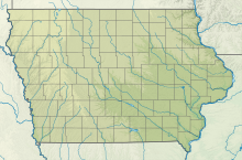
Keokuk Municipal Airport (IATA: EOK, ICAO: KEOK, FAA LID: EOK) is five miles northwest of Keokuk, in Lee County, Iowa.[1] The National Plan of Integrated Airport Systems for 2017–2021 categorized it as a general aviation facility.[2]
Ozark Airlines DC-3s stopped at Keokuk from 1950 to 1954.
Facilities
[edit]The airport covers 372 acres (151 ha) at an elevation of 671 feet (205 m). It has two concrete runways: 8/26 is 5,500 by 100 feet (1,676 x 30 m) and 14/32 is 3,576 by 100 feet (1,090 x 30 m).[1]
In the year ending July 21, 2015 the airport had 8,050 aircraft operations, average 22 per day: 94% general aviation and 6% air taxi. In January 2017, 17 aircraft were based at the airport: 15 single-engine and 2 multi-engine.[1]
See also
[edit]References
[edit]- ^ a b c d FAA Airport Form 5010 for EOK PDF. Federal Aviation Administration. Effective Jan 5, 2017.
- ^ "2011–2015 NPIAS Report, Appendix A" (PDF). National Plan of Integrated Airport Systems. Federal Aviation Administration. October 4, 2010. Archived from the original (PDF, 2.03 MB) on September 27, 2012.
External links
[edit]- Aerial image as of April 1999 from USGS The National Map
- FAA Terminal Procedures for EOK, effective October 31, 2024
- Resources for this airport:
- FAA airport information for EOK
- AirNav airport information for KEOK
- ASN accident history for EOK
- FlightAware airport information and live flight tracker
- NOAA/NWS weather observations: current, past three days
- SkyVector aeronautical chart, Terminal Procedures


