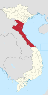
Hậu Lộc district
Appearance
You can help expand this article with text translated from the corresponding article in Vietnamese. (March 2009) Click [show] for important translation instructions.
|
Hậu Lộc district
Huyện Hậu Lộc | |
|---|---|
 Entrance to Lady Trieu (Bà Triệu) temple | |
 | |
| Country | |
| Region | North Central Coast |
| Province | Thanh Hóa |
| Capital | Hậu Lộc |
| Area | |
• Total | 54 sq mi (141 km2) |
| Population (2003) | |
• Total | 183,852 |
| Time zone | UTC+7 (UTC + 7) |
Hậu Lộc is a district (huyện) of Thanh Hóa province in the North Central Coast region of Vietnam. As of 2003 the district had a population of 183,852.[1] The district covers an area of 141 km2 (54 square miles). The district capital lies at Hậu Lộc.[1]
The village of Phú Điền, in xã Triệu Lộc is the site of the Bà Triệu Temple.[2]
References
[edit]- ^ a b "Districts of Vietnam". Statoids. Retrieved March 19, 2009.
- ^ Anh Thư Hà, Hò̂ng Đức Trà̂n A brief chronology of Vietnam's history- 2000 Page 18 "While their stratagem succeeded in winning a number of people, Lady Triệu continued the struggle. She died in Tùng mountain (Hậu Lộc, Thanh Hóa) at the age of 23. A temple was built in Phú Điển (Thanh Hóa) in memory of the Heroine."

