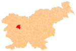
Zapreval
Zapreval | |
|---|---|
 | |
| Coordinates: 46°10′30.01″N 14°11′13.29″E / 46.1750028°N 14.1870250°E | |
| Country | |
| Traditional region | Upper Carniola |
| Statistical region | Upper Carniola |
| Municipality | Gorenja Vas–Poljane |
| Area | |
| • Total | 1.33 km2 (0.51 sq mi) |
| Elevation | 860.4 m (2,822.8 ft) |
| Population (2020) | |
| • Total | 30 |
| • Density | 23/km2 (58/sq mi) |
| [1] | |
Zapreval (pronounced [zaˈpɾeːʋal]; in older sources also Zaprevolam,[2] German: Saprevolam[2]) is a dispersed settlement in the Škofja Loka Hills in the Municipality of Gorenja Vas–Poljane in the Upper Carniola region of Slovenia.[3]
Name
[edit]Zapreval was attested in historical sources as Prewalt in 1291, Prewal in 1453, and Dolenigriboitzi and Gorenigriboitzi in 1500, among other names and spellings.[4] The name is a fused prepositional phrase that has lost case inflection, from za 'behind' + Preval (literally, 'crest, mountain pass'), referring to its position behind Preval Hill (elevation 924 meters or 3,031 feet) southeast of the village. Locally, the village is also known as za Prevalom.[5]
Recreation
[edit]Zapreval lies by the Stari Vrh ski slopes with fifty hectares of slopes, a new 6-chair lift and 5 ski tows.[6]
References
[edit]- ^ Statistical Office of the Republic of Slovenia Archived November 18, 2008, at the Wayback Machine
- ^ a b Leksikon občin kraljestev in dežel zastopanih v državnem zboru, vol. 6: Kranjsko. 1906. Vienna: C. Kr. Dvorna in Državna Tiskarna, p. 58.
- ^ Gorenja Vas–Poljane municipal site
- ^ "Zapreval". Slovenska historična topografija. ZRC SAZU Zgodovinski inštitut Milka Kosa. Retrieved August 13, 2020.
- ^ Savnik, Roman (1968). Krajevni leksikon Slovenije, vol. 1. Ljubljana: Državna založba Slovenije. p. 385.
- ^ Slovenian Tourist Board site
External links
[edit] Media related to Zapreval at Wikimedia Commons
- Zapreval on Geopedia


