Vila Leopoldina
Appearance
(Redirected from Vila Leopoldina (district of São Paulo))
Vila Leopoldina | |
|---|---|
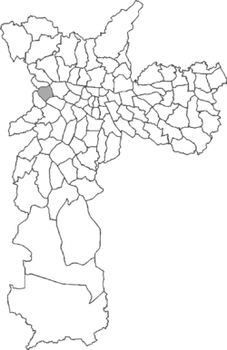
 Location in the city of São Paulo | |
| Country | Brazil |
| State | São Paulo |
| City | São Paulo |
| Government | |
| • Type | Subprefecture |
| • Subprefect | Soninha Francine |
| Area | |
| • Total | 5.6 km2 (2.2 sq mi) |
| Population (2000) | |
| • Total | 26.870 |
| HDI | 0.907 –high |
| Website | Subprefecture of Lapa |
Vila Leopoldina is a district in the subprefecture of Lapa in the city of São Paulo, Brazil.
22°46′S 43°18′W / 22.767°S 43.300°W

