User:Typhoon2013/2015 Pacific typhoon season
| Typhoon2013/2015 Pacific typhoon season | |
|---|---|
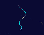
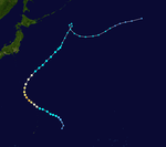
 Season summary map | |
| Seasonal boundaries | |
| First system formed | January 3, 2015 |
| Last system dissipated | Currently active |
| Strongest storm | |
| Name | Soudelor |
| • Maximum winds | 230 km/h (145 mph) (10-minute sustained) |
| • Lowest pressure | 898 hPa (mbar) |
| Seasonal statistics | |
| Total depressions | 38 |
| Total storms | 27 |
| Typhoons | 20 |
| Super typhoons | 9 (unofficial) |
| Total fatalities | 23 |
| Total damage | $69 million (2015 USD) |
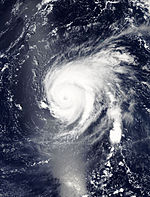
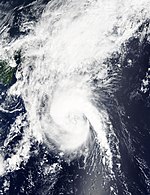
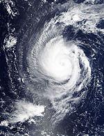
The 2015 Pacific typhoon season is an ongoing event in the annual cycle of tropical cyclone formation, in which tropical cyclones form in the western Pacific Ocean. The season will run throughout 2015, though most tropical cyclones typically develop between May and October. The scope of this article is limited to the Pacific Ocean to the north of the equator between 100°E and 180th meridian. Within the northwestern Pacific Ocean, there are two separate agencies that assign names to tropical cyclones which can often result in a cyclone having two names. The Japan Meteorological Agency (JMA) will name a tropical cyclone should it be judged to have 10-minute sustained wind speeds of at least 65 km/h (40 mph) anywhere in the basin, whilst the Philippine Atmospheric, Geophysical and Astronomical Services Administration (PAGASA) assigns names to tropical cyclones which move into or form as a tropical depression in their area of responsibility located between 135°E and 115°E and between 5°N–25°N regardless of whether or not a tropical cyclone has already been given a name by the JMA. Tropical depressions that are monitored by the United States' Joint Typhoon Warning Center (JTWC) are given a number with a "W" suffix.
Season summary
[edit]
Storms
[edit]Typhoon Mekkhala (Amang)
[edit]| Very strong typhoon (JMA) | |
| Category 2 typhoon (SSHWS) | |
| Duration | January 11 – January 19 |
|---|---|
| Peak intensity | 155 km/h (100 mph) (10-min); 974 hPa (mbar) |
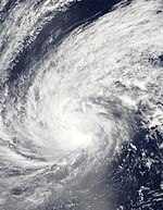
On January 9, the JTWC started to monitor a weak tropical disturbance south-southwest of Pohnpei. During the next day, the system gained convective activity near the center, as the JMA upgraded the system to a tropical depression early on January 13.[1] At the same time, the JTWC issued a TCFA on the depression. Later that day, the JTWC followed suit, giving the designation 01W. The next day, the JMA upgraded 01W to a tropical storm, receiving the name Mekkhala, although the JTWC didn't upgrade it as it rapidly moved in a westerly direction.[2] On January 15, the PAGASA had reported that Mekkhala had entered the PAR, giving the local name Amang.[3][4][5] The next day, due to an increase of convection and some favorable environments, Mekkhala intensified to a severe tropical storm by the JMA. Later that day, the JTWC instead classified the storm to a minimal typhoon. The JMA followed suit early on January 17.[6] Later that day, land reaction occurred to the storm as both the JMA and JTWC downgraded it to a tropical storm the next day and started to move northwards. On January 18, Mekkhala encountered moderate vertical wind shear as both agencies made their final warning on the system. However, the JMA tracked the system until January 20.
Typhoon Higos
[edit]| Very strong typhoon (JMA) | |
| Category 3 typhoon (SSHWS) | |
| Duration | February 6 – February 12 |
|---|---|
| Peak intensity | 155 km/h (100 mph) (10-min); 943 hPa (mbar) |
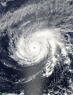
During February 4, the JTWC started to monitor a tropical disturbance, that had developed within an area marginal for further development near Kosrae.[7] Over the next couple of days the system gradually developed further and was classified as a tropical depression by the JMA during February 6. During the next day, the JMA reported that the depression had intensified into a tropical storm and named Higos.[8] The JTWC simultaneously upgraded the storm to Tropical Storm 02W as it started to intensify under favorable conditions. The next day, both agencies upgraded it to a minimal typhoon. On February 9, Higos underwent rapid deepening until it was classified a Category 4 typhoon according to the JTWC. Shortly after, however, stronger vertical wind shear and drier air quickly weakened Higos to a tropical depression.
At its peak Higos was the strongest Typhoon on record in February since 1970.[9]
Severe Tropical Storm Bavi (Betty)
[edit]| Severe tropical storm (JMA) | |
| Tropical storm (SSHWS) | |
| Duration | March 12 – March 18 |
|---|---|
| Peak intensity | 100 km/h (65 mph) (10-min); 982 hPa (mbar) |
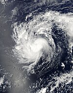
During March 8, the JTWC started to monitor a tropical disturbance that had developed, within a favourable environment for further development to the south east of Kwajalein in the Marshall Islands.[10] Over the next couple of days the system gradually developed further and was classified as a tropical depression by the JMA during March 10.[11][12]
The JTWC followed suit on March 11, as they designated it as 03W. Later that day, the JMA upgraded 03W to a tropical storm, naming the system Bavi as its low-level circulation center became exposed for a brief period.[13] Bavi moved in a westerly direction until it reached peak intensity as a strong tropical storm on March 14. The next day, Bavi encountered unfavorable environments due to moderate to high vertical wind shear. On March 17, the PAGASA had reported that Bavi had entered their area, receiving the name Betty.[14][15] Later the same day, both agencies downgraded Bavi to a tropical depression as its center became exposed. On March 18, both the JMA and the JTWC made their final warning. The PAGASA finally downgraded the system to a low-pressure area on March 19. The JMA, however, tracked the system until March 23, when it dissipated west of Manila, Philippines.
Swells stemming from Bavi affected parts of Kiribati which was still recovering from damaging king tides produced by Cyclone Pam.[16]
Typhoon Maysak (Chedeng)
[edit]| Violent typhoon (JMA) | |
| Category 5 super typhoon (SSHWS) | |
| Duration | March 26 – April 5 |
|---|---|
| Peak intensity | 220 km/h (140 mph) (10-min); 899 hPa (mbar) |
A day after Bavi dissipated, a low-pressure area formed near the Marshall Islands. It slowly drifted northwestward and became more organised over the next two days.[17] The next day, the JMA started tracking the system as a tropical depression.[18] On March 27, the JTWC started tracking the system as a tropical depression, and designated it 04W.[19] Moving west-northwestward, the system's center became more consolidated with convective banding becoming wrapped into it. The JTWC upgraded 04W to a tropical storm the same day.[20] The JMA followed suit later that day, when it was named Maysak.[21] On March 28, Maysak developed an eye,[22] and the JMA further upgraded it to a severe tropical storm.[23] The eye became more well defined with deep convection persisting along the southern quadrant of the storm. The overcast became more consolidated,[24] as the JMA upgraded Maysak to a typhoon on the same day.[25] On March 29, Maysak rapidly intensified over a period of 6 hours, attaining 1-min maximum sustained winds of 230 km/h (145 mph), making it a Category 4 equivalent on the SSHWS.[26] On the next day, Maysak further intensified into a Category 5-equivalent super typhoon. On April 1, the PAGASA stated tracking on the system, naming it as Chedeng.[27]
Typhoon Maysak passed directly over Chuuk State in the Federated States of Micronesia on March 29, causing extensive damage. High winds, measured up to 114 km/h (71 mph) at the local National Weather Service office, downed numerous trees, power lines, and tore off roofs. An estimated 80–90 percent of homes in Chuuk sustained damage. Power to most of the island was knocked out and communication was difficult. Early reports indicate that five people lost their lives.[28]
Tropical Storm Haishen
[edit]| Tropical storm (JMA) | |
| Tropical storm (SSHWS) | |
| Duration | April 2 – April 6 |
|---|---|
| Peak intensity | 75 km/h (45 mph) (10-min); 999 hPa (mbar) |
On April 1, the JTWC started to monitor a tropical disturbance over the Marshall Islands.[29] The system slowly intensified as it moved westwards and by April 2, the JMA classified the system as a weak tropical depression.[30] At the same time, the JTWC upgraded it to Tropical Depression 05W as it was over favorable environments with a good outflow surrounding the system.[31] The next day, the JTWC upgraded 05W to a tropical storm, while the JMA followed suit and named the storm Haishen. However, it didn't intensify any further and it dissipated on April 6.
Typhoon Noul (Dodong)
[edit]| Very strong typhoon (JMA) | |
| Category 4 super typhoon (SSHWS) | |
| Duration | May 1 – May 12 |
|---|---|
| Peak intensity | 175 km/h (110 mph) (10-min); 917 hPa (mbar) |
On April 30, a tropical disturbance developed near Chuuk.[32] On May 2, the JMA began to track the system as a weak tropical depression.[33] The following day, the JMA upgraded the depression to a tropical storm and assigned the name Noul.[34] On May 5, the JMA upgraded the system to a severe tropical storm while the JTWC upgraded it to a minimal typhoon.[35] The following day, the JMA also upgraded Noul to a typhoon. Early on May 7, Noul entered the Philippine Area of Responsibility and was assigned the name Dodong by PAGASA.[36] Later that day, the JTWC upgraded Noul to a Category 3 typhoon as a small eye had developed.[37] At the same time, according to Jeff Masters of Weather Underground, Noul had taken on annular characteristics.[38] Although Noul weakened to a Category 2 typhoon early on May 9, six hours later, the JTWC upgraded Noul back to a Category 3 typhoon, as its eye became clearer and well-defined. The JTWC upgraded Noul to a Category 4 super typhoon later that day after it began rapid deepening. On May 10, the JTWC further upgraded Noul to a Category 5 super typhoon, and the JMA assessed Noul with 10-minute sustained winds of 205 km/h (125 mph) and a minimum pressure of 920 mbar, its peak intensity.[39][40] Later that day, Noul made landfall on Pananapan Point, Santa Ana, Cagayan.[41] After making a direct hit on the northeastern tip of Luzon, the storm began to weaken, and the JTWC downgraded it to a Category 4 super typhoon.[42] Subsequently, it began rapidly weakening and by May 12, it had weakened to a severe tropical storm.
Typhoon Dolphin
[edit]| Violent typhoon (JMA) | |
| Category 5 super typhoon (SSHWS) | |
| Duration | May 5 – May 20 |
|---|---|
| Peak intensity | 195 km/h (120 mph) (10-min); 924 hPa (mbar) |
On May 3, a tropical disturbance south to southeast of Pohnpei began to organize, and the JMA upgraded the disturbance into a tropical depression. Late on May 6, the JTWC started issuing advisories and designated it as 07W. On May 9, the JMA upgraded the depression into a tropical storm and named it Dolphin. The JMA further upgraded Dolphin to a severe tropical storm on May 12, and on the following day, the JTWC upgraded Dolphin to a typhoon. Six hours later, the JMA had followed suit. Over the next few days, Dolphin continued to intensify until it reached Category 5 super typhoon status on May 16. It weakened into a category 4 super typhoon 12 hours later, until it weakened into a category 4 equivalent typhoon after maintaining super typhoon status for 30 hours. Dolphin weakened further into a severe tropical storm on May 19, as the JTWC downgraded Dolphin into a tropical storm and issued their final warning. On May 20, the JMA issued their final warning, and the JTWC and the JMA declared that Dolphin had become an extratropical cyclone.
Tropical Storm Kujira
[edit]| Tropical storm (JMA) | |
| Tropical storm (SSHWS) | |
| Duration | June 20 – June 25 |
|---|---|
| Peak intensity | 85 km/h (50 mph) (10-min); 993 hPa (mbar) |
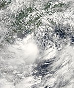
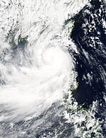
During June 19 the JMA started to monitor a tropical depression that had developed within the South China Sea about 940 km (585 mi)* to the southeast of Hanoi, Vietnam.[43] Over the next day the system gradually developed further before the JTWC initiated advisories on the system and designated it as Tropical Depression 08W.[44] Deep convection obscured its low-level circulation center however upper level analysis indicated that 08W was in an area of moderate vertical windshear.[45] On June 21, the JMA had reported that 08W had intensified into a tropical storm, naming it Kujira.[46][47] Kujira slightly intensified and the JTWC finally upgraded the system to a tropical storm by June 22.[48][49] In the same time, Kujira's circulation became exposed but convection remained stable.[50] Therefore, according to both agencies, Kujira reached its peak intensity with a minimum pressure of 985 mbar later in the same day.[51] Kujira would've been a severe tropical storm but due to displaced convection and moderate to high windshear, the storm began a weakening trend.[52] The JTWC downgraded Kujira to a tropical storm as it was located in an area of very unfavorable environments early on June 23,[53] however by their next advisory it was reported that Kujira entered an area of warm waters and was upgraded back to tropical storm status.[54] During June 24, Kujira made landfall on Vietnam to the east of Hanoi and weakened into a tropical depression.[43] The system was subsequently last noted during the next day, as it made dissipated to the north of Hanoi.[43]
Although outside the Philippine area of responsibility, Kujira's circulation enhanced the southwest monsoon and marked the beginning of the nation's rainy season.[55] Striking Hainan on June 20, Kujira produced torrential rain across the island with an average of 102 mm (4.0 in) falling across the province on June 20; accumulations peaked at 732 mm (28.8 in). The ensuing floods affected 7,400 hectares (18,300 acres) of crops and left ¥88 million (US$14.4 million) in economic losses.[56] Flooding in northern Vietnam killed at least nine people, including eight in Sơn La Province, and left six others missing.[57] Across the country, 70 homes were destroyed while a further 382 were damaged.[58]
Typhoon Chan-hom (Falcon)
[edit]| Very strong typhoon (JMA) | |
| Category 4 typhoon (SSHWS) | |
| Duration | June 27 – July 13 |
|---|---|
| Peak intensity | 165 km/h (105 mph) (10-min); 936 hPa (mbar) |
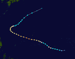
On June 25, the JTWC started to monitor a weak tropical disturbance embedded in the active ITCZ.[59] Convection increased within the system as the JMA and the JTWC upgraded the system to a tropical depression on June 30 while it was located near the island of Kosrae.[60][61] Later that day, the JMA upgraded the depression to a tropical storm and assigned the name Chan-hom.[62] Although it was upgraded to a typhoon on July 1,[63][64] increasing wind shear caused the system to weaken back into a tropical storm as it neared Guam.[65][66]
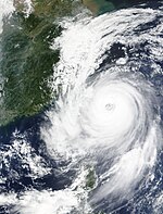
On July 5, as it started to move north then northwest, Chan-hom showed good outflow aloft and low vertical windshear was within the area.[67] Both agencies upgraded the storm to a typhoon again on July 6, as an eye developed.[68][69][70] On July 7, PAGASA had reported that Chan-hom had entered their Area of Responsibility and was assigned the name Falcon.[71] With a clear and defined eye and an expanding gale-force winds,[72][73][74] both agencies classified Chan-hom as a Category 4 typhoon on July 9,[75] with a 10-minute wind peak of 165 km/h (105 mph) and a minimum pressure of 935 millibars.[76] On July 10, Chan-hom further weakened as an eyewall replacement cycle developed with moderate to high vertical windshear as it neared eastern China.[77][78] Chan-ho made landfall southeast of Shanghai later that day.[79] Due to cooler waters, Chan-hom weakened below typhoon status.[80][81] The next day, it was reported that Chan-hom's LLCC became exposed as it neared Korea.[82][83] The system's low-level center completely exposed on July 12 as it approached the Korean Peninsula.[82][83] Between 15:00 and 18:00 UTC, Chan-hom moved ashore over South Hwanghae Province, North Korea, with winds of 95 km/h (60 mph).[84][85] By 00:00 UTC on July 13 the system transitioned into an extratropical cyclone while retaining gale-force winds.[86] The JTWC issued its final advisory late on July 12.[87] However the JMA continued to track Chan-hom until early on July 13 when it became extratropical.[88]
Ahead of the typhoon's arrival in East China, officials evacuated over 1.1 million people.[89] Total economic losses in Zhejiang amounted to ¥5.86 billion (US$944 million).[90] Even though Chan-hom didn't affect the Philippines, the typhoon enhanced the southwest monsoon which killed about 4 people and damages of about $90 thousand.[91]
Typhoon Linfa (Egay)
[edit]| Typhoon (JMA) | |
| Category 1 typhoon (SSHWS) | |
| Duration | July 2 – July 10 |
|---|---|
| Peak intensity | 120 km/h (75 mph) (10-min); 977 hPa (mbar) |
A weak low-pressure area developed into a tropical disturbance near Palau on June 30. The system stalled over the Philippine Sea for several days, and there was initially no intensification of the system. However, on July 1, the JMA upgraded the system to a tropical depression while it was located east of Visayas, Philippines. By the next day, the PAGASA started issuing advisories on the system, assigning the name Egay. The JTWC followed suit a few hours later, giving the designation 10W. the JMA followed suit, named as Linfa. Linfa became a severe tropical storm on July 3. On July 5, Linfa continued to move north while slowly strengthening. On July 9, Linfa strengthened from a severe tropical storm to a typhoon, and slowly moved towards Hong Kong.[citation needed] Linfa made landfall on the city of Lufeng in Guangdong on the evening of July 9 [92]
According to preliminary estimates in southern China, economic losses from the storm reached ¥1.2 billion (US$213 million). A total of 288 homes collapsed and 56,000 people were displaced.[93] A gust of 171 km/h (106 mph) was observed in Jieyang.[94]
Typhoon Nangka
[edit]| Violent typhoon (JMA) | |
| Category 5 super typhoon (SSHWS) | |
| Duration | July 3 – July 18 |
|---|---|
| Peak intensity | 205 km/h (125 mph) (10-min); 916 hPa (mbar) |
On July 3, the JMA started to monitor a tropical depression over the Marshall Islands.[95] Later that day, the system started to intensify, as it was designated as 11W by the JTWC.[96] The JMA followed suit of upgrading it to a tropical storm, naming it Nangka.[97] After three days of slow strengthening, Nangka was upgraded to a severe tropical storm on July 6, due to favorable environments such as a symmetrical cyclone, an improving outflow and low vertical windshear .[98][99] Shortly afterwards, rapid intensification ensued and Nangka was upgraded to a Category 2 typhoon 24 hours later.[100][101] The intensification trend continued, and Nangka reached its first peak as a Category 4 typhoon as an eye developed.[102][103]
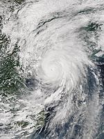
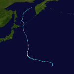
Shortly after its first peak, Nangka slightly weakened and its eye became cloud-fulled.[104] Although some vertical wind shear initially halted the intensification trend, the storm resumed intensifying on July 9, and was upgraded to a Category 4 super typhoon with 1-minute sustained winds of 250 km/h (155 mph). In the same time, Nangka's structure became symmetrical and its eye re-developed clearly.[105][106][107] The JMA also assessed Nangka's peak with 10-minute winds of 185 km/h (115 mph).[108] Nangka maintained super typhoon strength for 24 hours before weakening to a typhoon on July 10 as it entered an area of some unfavorable environments.[109] Nangka weakened to a Category 1-equivalent typhoon on July 11, but began strengthening again late on July 12, reaching a secondary peak as a Category 3-equivalent typhoon as its eye became clear once more.[110][111] An eyewall replacement cycle interrupted the intensification the following day, and Nangka weakened due to drier air from the north.[112][113] At around 14:00 UTC on July 16, Nangka made landfall over Muroto, Kōchi of Japan.[114] A few hours later, Nangka made its second landfall over the island of Honshu, as the JMA downgraded Nangka's intensity to a severe tropical storm.[114][115][116] Due to land reaction and cooler waters, Nangka's circulation began to deteriorate and was downgraded to a tropical depression by both agencies late on July 17.[117][118] On July 18, both agencies issued their final warning on Nangka as it weakened to a remnant low.[119][120]
On Majuro atoll in the Marshall Islands, high winds from Nangka tore roofs from homes and downed trees and power lines. Nearly half of the nation's capital city of the same name were left without power. Tony deBrum, the Marshall Island's foreign minister, stated "Majuro [is] like a war zone."[121] At least 25 vessels in the island's lagoon broke loose from or were dragged by their moorings. Some coastal flooding was also noted.[121]
Typhoon Halola (Goring)
[edit]| Typhoon (JMA) | |
| Category 2 typhoon (SSHWS) | |
| Duration | July 12 (entered basin) – Currently active |
|---|---|
| Peak intensity | 130 km/h (80 mph) (10-min); 975 hPa (mbar) |
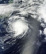
During July 13, Tropical Storm Halola moved into the Western Pacific basin from the Central Pacific basin, and was immediately classified as a severe tropical storm by the JMA.[122][123] By the next day, Halola quickly strengthened into a typhoon.[124][125] Later that day, both the JMA and JTWC reported that Halola reached peak intensity as a Category 2 typhoon.[126][127] However weakening convection and moderate vertical windshear caused the typhoon to weaken on July 15.[128][129] Halola further weakened to a tropical depression as the JMA issued its final advisory on July 18, however the JTWC continued tracking Halola.[130][131]
On July 19, the JMA re-issued advisories and Halola showed signs of further intensification.[132][133] An improved convective signature, expanding moisture field and shallow banding wrapped into the system prompted both agencies to upgrade it to a tropical storm, early on July 20.[134][135] Halola intensified into a typhoon again the next day, as the typhoon became more symmetrical than before.[136][137][138] By July 22, Halola reached its second peak intensity as a Category 2 typhoon, but this time it was a little stronger with a minimum pressure down to 955 millibars and 10-minute sustained winds of 150 km/h (90 mph).[139][140][141] PAGASA reported that Halola entered their Area of Responsibility receiving the name Goring early on July 23.[142][143] On the next day, Halola encountered northeasterly vertical windshear as the system started to weaken.[144] The PAGASA issued its final warning on Halola (Goring) as it already exited their area.[145] During the days of July 25 and 26, Halola weakened to tropical storm strength and passed the southwestern Japanese Islands.[146] Both agencies downgraded Halola to a remnant low and issued their final advisory.[147][148]
At around 09:30 UTC on July 26, Halola made landfall over Saikai, Nagasaki of Japan.[149] Throughout the Daitō Islands, sugarcane farms were significantly affected by Typhoon Halola, resulting damage of about 154 million Japanese yen ($1.2 million USD).[150]
Tropical Depression 12W
[edit]| Tropical depression (JMA) | |
| Tropical storm (SSHWS) | |
| Duration | July 22 – July 26 |
|---|---|
| Peak intensity | 55 km/h (35 mph) (10-min); 1003 hPa (mbar) |
During July 23, the JMA and JTWC started monitoring Tropical Depression 12W, that had developed to the northeast of Manila, Philippines.[151][152] Over the next day the system moved towards the north-northeast along the subtropical ridge, in an environment that was considered marginal for further development.[153] During the next day, despite Dvorak estimates from various agencies decreasing due to a lack on convection surrounding the system, the JTWC reported that the system had become a tropical storm.[154] This was based on an image from the advanced scatterometer, which showed winds of 65–75 km/h (40–45 mph)* along the systems western periphery.[154] The system subsequently directly interacted with Typhoon Halola, before increased vertical wind shear and subsidence from the interaction caused the depression to deteriorate.[155][156] As a result, the systems low level circulation became weak and fully exposed, with deep convection displaced to the systems western semi circle.[155][156] The system was subsequently last noted by the JMA and JTWC during July 25, as it dissipated to the east of Taiwan.[156]
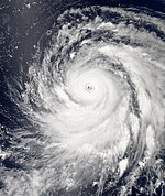
Typhoon Soudelor (Hanna)
[edit]| Violent typhoon (JMA) | |
| Category 5 super typhoon (SSHWS) | |
| Duration | July 27 – August 10 |
|---|---|
| Peak intensity | 230 km/h (145 mph) (10-min); 898 hPa (mbar) |
Tropical Depression 14W
[edit]| Tropical depression (JMA) | |
| Tropical depression (SSHWS) | |
| Duration | August 1 – August 3 |
|---|---|
| Peak intensity | 30 km/h (15 mph) (10-min); 1013 hPa (mbar) |
Severe Tropical Storm Molave
[edit]| Severe tropical storm (JMA) | |
| Tropical storm (SSHWS) | |
| Duration | August 5 – August 14 |
|---|---|
| Peak intensity | 100 km/h (65 mph) (10-min); 981 hPa (mbar) |
Typhoon Goni (Ineng)
[edit]| Very strong typhoon (JMA) | |
| Category 4 super typhoon (SSHWS) | |
| Duration | August 11 – August 26 |
|---|---|
| Peak intensity | 185 km/h (115 mph) (10-min); 927 hPa (mbar) |
Typhoon Atsani
[edit]| Violent typhoon (JMA) | |
| Category 5 super typhoon (SSHWS) | |
| Duration | August 13 – August 25 |
|---|---|
| Peak intensity | 215 km/h (130 mph) (10-min); 912 hPa (mbar) |
Tropical Storm Loke
[edit]| Tropical storm (SSHWS) | |
| Duration | August 27 (entered basin) – August 27 |
|---|---|
| Peak intensity | 65 km/h (40 mph) (1-min); 998 hPa (mbar) |
Typhoon2013 says that Loke entered the basin at TS strength but not recognized by JTWC.
Typhoon Kilo
[edit]| Typhoon (JMA) | |
| Category 3 typhoon (SSHWS) | |
| Duration | September 1 (entered basin) – September 11 |
|---|---|
| Peak intensity | 140 km/h (85 mph) (10-min); 958 hPa (mbar) |
Severe Tropical Storm Etau
[edit]| Severe tropical storm (JMA) | |
| Category 1 typhoon (SSHWS) | |
| Duration | September 4 – September 9 |
|---|---|
| Peak intensity | 95 km/h (60 mph) (10-min); 988 hPa (mbar) |
Tropical Storm Vamco
[edit]| Tropical storm (JMA) | |
| Tropical storm (SSHWS) | |
| Duration | September 13 – September 15 |
|---|---|
| Peak intensity | 85 km/h (50 mph) (10-min); 997 hPa (mbar) |
Typhoon Krovanh
[edit]| Very strong typhoon (JMA) | |
| Category 3 typhoon (SSHWS) | |
| Duration | September 14 – September 21 |
|---|---|
| Peak intensity | 155 km/h (100 mph) (10-min); 956 hPa (mbar) |
Typhoon Dujuan (Jenny)
[edit]| Very strong typhoon (JMA) | |
| Category 4 super typhoon (SSHWS) | |
| Duration | September 18 – September 30 |
|---|---|
| Peak intensity | 175 km/h (110 mph) (10-min); 926 hPa (mbar) |
Typhoon Mujigae (Kabayan)
[edit]| Very strong typhoon (JMA) | |
| Category 3 typhoon (SSHWS) | |
| Duration | September 30 – October 5 |
|---|---|
| Peak intensity | 155 km/h (100 mph) (10-min); 963 hPa (mbar) |
Typhoon Choi-wan
[edit]| Typhoon (JMA) | |
| Category 1 typhoon (SSHWS) | |
| Duration | October 1 – October 8 |
|---|---|
| Peak intensity | 130 km/h (80 mph) (10-min); 962 hPa (mbar) |
Tropical Depression 08C
[edit]| Tropical depression (JMA) | |
| Tropical depression (SSHWS) | |
| Duration | October 6 (entered basin) – October 10 |
|---|---|
| Peak intensity | 55 km/h (35 mph) (10-min); 999 hPa (mbar) |
Typhoon Koppu (Lando)
[edit]| Very strong typhoon (JMA) | |
| Category 4 typhoon (SSHWS) | |
| Duration | October 11 – October 22 |
|---|---|
| Peak intensity | 155 km/h (100 mph) (10-min); 941 hPa (mbar) |
Typhoon Champi
[edit]| Very strong typhoon (JMA) | |
| Category 4 super typhoon (SSHWS) | |
| Duration | October 12 – October 25 |
|---|---|
| Peak intensity | 165 km/h (105 mph) (10-min); 931 hPa (mbar) |
Tropical Storm 26W
[edit]| Tropical storm (JMA) | |
| Tropical storm (SSHWS) | |
| Duration | October 20 – October 24 |
|---|---|
| Peak intensity | 65 km/h (40 mph) (10-min); 992 hPa (mbar) |
Typhoon In-fa (Marilyn)
[edit]| Very strong typhoon (JMA) | |
| Category 4 typhoon (SSHWS) | |
| Duration | November 12 – Currently active |
|---|---|
| Peak intensity | 165 km/h (105 mph) (10-min); 938 hPa (mbar) |
Other storms
[edit]Early on January 2, the JMA reported that a tropical depression had developed to the northwest of Brunei, within an area that was marginally favourable for further development.[157][158] Over the next day the system moved into an area of moderate vertical wind shear, with atmospheric convection becoming displaced to the west of the fully exposed low level circulation centre.[159] The system was subsequently last noted by the JMA during January 4, as it dissipated in the South China Sea near the Malaysian-Indonesian border.[160][161][162]
Names
[edit]International names
[edit]Tropical cyclones are named from a set of five naming lists set by the JMA's Regional Specialized Meteorological Centre in Tokyo, Japan, once they reach tropical storm strength.[163] Names are contributed by members of the ESCAP/WMO Typhoon Committee. Each of the 14 nations and territories submitted ten names, which are used in alphabetical order, by the official English name of the country.[164] The next 24 names on the naming list are listed here along with their international numeric designation, if they are used. The next name to be used within the basin is Melor.
|
|
|
|
Philippines
[edit]PAGASA uses its own naming scheme for tropical cyclones in their area of responsibility. PAGASA assigns names to tropical depressions that form within their area of responsibility and any tropical cyclone that might move into their area of responsibility. Should the list of names for a given year be exhausted, names will be taken from an auxiliary list, the first ten of which are published each year before the season starts. Names not retired from this list will be used again in the 2019 season. This is the same list used in the 2011 season, with the exception of Betty, Jenny, Marilyn, Perla and Sarah which replaced Bebeng and Juaning, Mina, Pedring and Sendong. The next name to be used within the area is Nonoy.[165]
|
|
|
|
|
Auxiliary list
|
|
|
|
|
See also
[edit]- List of Pacific hurricanes
- List of Pacific hurricane seasons
- 2015 Atlantic hurricane season
- 2015 Pacific typhoon season
- 2015 Pacific hurricane season
- 2015 North Indian Ocean cyclone season
- South-West Indian Ocean cyclone seasons: 2014–15, 2015–16
- Australian region cyclone seasons: 2014–15, 2015–16
- South Pacific cyclone seasons: 2014–15, 2015–16
- South Atlantic tropical cyclone
References
[edit]- ^ "Tropical Cyclone Advisory for Analysis and Forecast 2015-01-13T21:00:00Z". Japan Meteorological Agency. Retrieved January 12, 2015.
- ^ "Guidance – Forecast Track by Numerical Weather Prediction 2015-01-14T06:00:00Z". Japan Meteorological Agency. Retrieved January 14, 2015.
- ^ "Tropical storm amang enters PAR, fisher folk in parts of Luzon, Visayas warned". GMA News. January 15, 2015. Retrieved January 15, 2015.
- ^ http://www.usno.navy.mil/NOOC/nmfc-ph/RSS/jtwc/warnings/wp0115.gif
- ^ http://edition.cnn.com/2015/01/16/world/pope-philippines-visit-typhoon/index.html
- ^ "Tropical Cyclone Prognostic Reasoning 2015-01-17T00:00:00Z". Japan Meteorological Agency. Retrieved January 17, 2015.
- ^ Joint Typhoon Warning Center. "Significant Tropical Weather Advisory for the Western and South Pacific Oceans February 5, 2015 00z". United States Navy, United States Airforce. Archived from the original on February 5, 2015. Retrieved February 15, 2015.
- ^ "Forecast Track by Numerical Weather Prediction 2015-02-07T18:00:00Z". Japan Meteorological Agency. Retrieved February 7, 2015.
- ^ "Typhoon Higos Makes History in NW Pacific; Heavy Snow, Floods Pummel Southern Europe". Retrieved February 11, 2015.
- ^ Joint Typhoon Warning Center. "Significant Tropical Weather Advisory for the Western and South Pacific Oceans March 8, 2015 23z". United States Navy, United States Airforce. Archived from the original on March 8, 2015. Retrieved March 22, 2015.
- ^ "JMA WWJP25 Warning and Summary March 10, 2015 06z". Japan Meteorological Agency. March 10, 2015. Archived from the original on March 10, 2015. Retrieved March 22, 2015.
- ^ "Special Weather Statement March 10, 2015 00z". NWS Guam. March 10, 2015. Archived from the original on March 10, 2015. Retrieved March 22, 2015.
- ^ "Forecast Track by Numerical Weather Prediction 2015-03-11T18:00:00Z". Japan Meteorological Agency. Retrieved March 11, 2015.
- ^ "Tropical Storm Bavi enters PAR, codenamed Betty". GMA News. Retrieved March 17, 2015.
- ^ "Severe Weather Bulletin No.1 Tropical Storm BETTY (BAVI)" (PDF). NDRRMC. March 17, 2015. Retrieved March 17, 2015.
- ^ Emergency Plan of Action (EPoA) Kiribati: Tropical Cyclone Pam (PDF). International Federation of Red Cross and Red Crescent Societies (Report). ReliefWeb. March 16, 2015. Retrieved March 17, 2015.
- ^ "MEDIUM from ABPW10 2015-03-25". Joint Typhoon Warning Center. Retrieved 27 March 2015.
- ^ "Tropical Depression (< 30kts) from JMA 2015-03-26". Japan Meteorological Agency. Retrieved 27 March 2015.
- ^ "JTWC Warning 001 for TD 04W". JTWC. Retrieved 27 March 2015.
- ^ "Prognostic Reasoning for Warning 003 on Tropical Storm 04W". Joint Typhoon Warning Center. Retrieved 27 March 2015.
- ^ "Tropical Storm Maysak from JMA 2015-03-27". JMA. Retrieved 28 March 2015.
- ^ "Prognostic Reasoning for Warning 007 of Tropical Storm Maysak". Joint Typhoon Warning Center. Retrieved 28 March 2015.
- ^ "STS Maysak from JMA 281200". Japan Meteorological Agency. Retrieved 28 March 2015.
- ^ "Prognostic Reasoning for Warning 008 on Typhoon Maysak". Joint Typhoon Warning Center. Retrieved 29 March 2015.
- ^ "Typhoon Maysak from JMA 281800". Japan Meteorological Agency. Retrieved 29 March 2015.
- ^ "Prognostic Reasoning for Warning 16 on Typhoon Maysak". JTWC. Retrieved 31 March 2015.
- ^ "NDRRMC Update re Severe Weather Bulletin No. 01 Typhoon Chedeng" (PDF). NDRRMC. Retrieved April 1, 2015.
- ^ Robert Q. Tupaz (March 31, 2015). "Chuuk hit hard by Typhoon Maysak". Marianas Variety. Retrieved March 31, 2015.
- ^ "TROPICAL DEPRESSION 05W (FIVE) WARNING NR 001". Joint Typhoon Warning Center.
{{cite web}}:|archive-date=requires|archive-url=(help) - ^ "WWJP25 RJTD 030000 WARNING AND SUMMARY 030000". Japan Meteorological Agency.
{{cite web}}:|archive-date=requires|archive-url=(help) - ^ "PROGNOSTIC REASONING FOR TROPICAL DEPRESSION 05W (FIVE) WARNING NR 01". Joint Typhoon Warning Center.
{{cite web}}:|archive-date=requires|archive-url=(help) - ^ "Significant Tropical Weather Advisory for the Western and South Pacific Oceans Reissued 301400Z Apr 2015-010600Z May 2015". Joint Typhoon Warning Center. Archived from the original on April 30, 2015. Retrieved May 10, 2015.
- ^ "Tropical Cyclone Advisory for Analysis and Forecast 2015-05-02T21:00:00Z". Japan Meteorological Agency. Retrieved May 2, 2015.
- ^ "Forecast Track by Numerical Weather Prediction 2015-05-03T18:00:00Z". Japan Meteorological Agency. Retrieved May 3, 2015.
- ^ "Forecast Track by Numerical Weather Prediction 2015-05-05T18:00:00Z". Japan Meteorological Agency. Retrieved May 5, 2015.
- ^ "Severe Weather Bulletin No.01 re TY DODONG (NOUL)" (PDF). NDRRMC. May 7, 2015. Retrieved May 7, 2015.
- ^ "Powerful Typhoon Noul targets northern Philippines this weekend". Jason Samenow. May 7, 2015.
- ^ Masters, Jeff (May 8, 2015). "Subtropical Storm Ana More Organized; Philippines' Cat 3 Noul Intensifying". Weather Underground. Retrieved May 9, 2015.
- ^ "RSMC Tropical Cyclone Advisory 100000". Japan Meteorological Agency. Archived from the original on May 10, 2015. Retrieved May 10, 2015.
- ^ "Prognostic Reasoning for Super Typhoon 06W (Noul) Warning Nr 29". Joint Typhoon Warning Center. Archived from the original on May 10, 2015. Retrieved May 10, 2015.
- ^ "Severe Weather Bulletin #15 for: Typhoon "Dodong"". Philippine Atmospheric, Geophysical and Astronomical Services Administration. Archived from the original (PDF) on May 10, 2015. Retrieved May 10, 2015.
- ^ "Prognostic Reasoning for Super Typhoon 06W (Noul) Warning Nr 28". Joint Typhoon Warning Center. Archived from the original on May 9, 2015. Retrieved May 10, 2015.
- ^ a b c Tropical Storm Kujira (RSMC Tropical Cyclone Best Track). Japan Meteorological Agency. July 17, 2015. Archived from the original on July 17, 2015. Retrieved August 15, 2015.
- ^ "Prognostic Reasoning for Tropical Depression 08W (Eight) Warning Nr 01". Joint Typhoon Warning Center. March 12, 2015. Archived from the original on March 12, 2015. Retrieved August 8, 2015.
- ^ "Prognostic Reasoning for Tropical Depression 08W (Eight) Warning Nr 02". Joint Typhoon Warning Center. Retrieved June 20, 2015.
- ^ "Guidance – Forecast Track by Numerical Weather Prediction 2015-06-21T00:00:00Z". Japan Meteorological Agency. Retrieved June 21, 2015.
- ^ "TS 1508 KUJIRA (1508) UPGRADED FROM TD". Japan Meteorological Agency. Retrieved June 21, 2015.
- ^ "Tropical Cyclone Advisory for Analysis and Forecast 2015-06-22T09:00:00Z". Japan Meteorological Agency. Retrieved June 22, 2015.
- ^ "Prognostic Reasoning for Tropical Storm 08W (Kujira) Warning Nr 07". Joint Typhoon Warning Center. Retrieved June 22, 2015.
- ^ "Prognostic Reasoning for Tropical Storm 08W (Kujira) Warning Nr 08". Joint Typhoon Warning Center. Retrieved June 22, 2015.
- ^ "TS 1508 KUJIRA (1508)". Japan Meteorological Agency. Retrieved June 22, 2015.
- ^ "Prognostic Reasoning for Tropical Storm 08W (Kujira) Warning Nr 09". Joint Typhoon Warning Center. Retrieved June 22, 2015.
- ^ "Prognostic Reasoning for Tropical Depression 08W (Kujira) Warning Nr 11". Joint Typhoon Warning Center. Retrieved June 23, 2015.
- ^ "Prognostic Reasoning for Tropical Storm 08W (Kujira) Warning Nr 12". Joint Typhoon Warning Center. Retrieved June 23, 2015.
- ^ Joel Locsin (June 23, 2015). "PAGASA: Start of rainy season to raise dam water levels, help irrigation". GMA News. Retrieved July 2, 2015.
- ^ "Typhoon Kujira affects 193,000 in Hainan". Beijing, China: English.news.cn. Xinhua General News. June 24, 2015. Retrieved June 30, 2015.
- ^ Phan Hau-Ngoc Khanh (June 26, 2015). "9 dead, 6 missing in flash floods unleashed by Typhoon Kujira". Thanh Nien News. Retrieved June 30, 2015.
- ^ "Flash floods kill 9, leave 6 others missing in northern Vietnam". Tuoi Tre News. June 28, 2015. Retrieved June 30, 2015.
- ^ Significant Tropical Weather Outlook for the Western and South Pacific Oceans (Report). Joint Typhoon Warning Center. June 25, 2015. Archived from the original on June 28, 2015. Retrieved July 12, 2015.
- ^ "RSMC Tropical Cyclone Advisory". Japan Meteorological Agency. June 30, 2015. Archived from the original on July 2, 2015. Retrieved July 12, 2015.
- ^ Prognostic Reasoning for Tropical Depression 09W (Chan-hom) Warning Nr 01 (Report). Joint Typhoon Warning Center. June 30, 2015. Archived from the original on July 2, 2015. Retrieved July 12, 2015.
- ^ "RSMC Tropical Cyclone Advisory". Japan Meteorological Agency. June 30, 2015. Archived from the original on July 2, 2015. Retrieved July 12, 2015.
- ^ Prognostic Reasoning for Typhoon 09W (Chan-hom) Warning Nr 09 (Report). Joint Typhoon Warning Center. July 2, 2015. Archived from the original on July 2, 2015. Retrieved July 12, 2015.
- ^ "RSMC Tropical Cyclone Advisory". Japan Meteorological Agency. July 2, 2015. Archived from the original on July 3, 2015. Retrieved July 12, 2015.
- ^ Prognostic Reasoning for Tropical Storm 09W (Chan-hom) Warning Nr 11 (Report). Joint Typhoon Warning Center. July 3, 2015. Archived from the original on July 3, 2015. Retrieved July 12, 2015.
- ^ Prognostic Reasoning for Typhoon 09W (Chan-hom) Warning Nr 10 (Report). Joint Typhoon Warning Center. July 2, 2015. Archived from the original on July 3, 2015. Retrieved July 12, 2015.
- ^ Prognostic Reasoning for Tropical Storm 09W (Chan-hom) Warning Nr 21 (Report). Joint Typhoon Warning Center. July 5, 2015. Archived from the original on July 5, 2015. Retrieved July 12, 2015.
- ^ Prognostic Reasoning for Typhoon 09W (Chan-hom) Warning Nr 25 (Report). Joint Typhoon Warning Center. July 6, 2015. Archived from the original on July 7, 2015. Retrieved July 12, 2015.
- ^ "RSMC Tropical Cyclone Advisory". Japan Meteorological Agency. July 6, 2015. Archived from the original on July 7, 2015. Retrieved July 12, 2015.
- ^ Prognostic Reasoning for Typhoon 09W (Chan-hom) Warning Nr 27 (Report). Joint Typhoon Warning Center. July 7, 2015. Archived from the original on July 7, 2015. Retrieved July 12, 2015.
- ^ Severe Weather Bulletin No. 01 re Typhoon "Falcon" (PDF) (Report). National Disaster Risk Reduction and Management Council. July 7, 2015. Retrieved July 12, 2015.
- ^ Prognostic Reasoning for Typhoon 09W (Chan-hom) Warning Nr 30 (Report). Joint Typhoon Warning Center. July 7, 2015. Archived from the original on July 7, 2015. Retrieved July 12, 2015.
- ^ Prognostic Reasoning for Typhoon 09W (Chan-hom) Warning Nr 33 (Report). Joint Typhoon Warning Center. July 8, 2015. Archived from the original on July 8, 2015. Retrieved July 12, 2015.
- ^ Prognostic Reasoning for Typhoon 09W (Chan-hom) Warning Nr 33 (Report). Joint Typhoon Warning Center. July 9, 2015. Archived from the original on July 9, 2015. Retrieved July 12, 2015.
- ^ Prognostic Reasoning for Typhoon 09W (Chan-hom) Warning Nr 39 (Report). Joint Typhoon Warning Center. July 10, 2015. Archived from the original on July 10, 2015. Retrieved July 12, 2015.
- ^ "RSMC Tropical Cyclone Advisory". Japan Meteorological Agency. July 9, 2015. Archived from the original on July 9, 2015. Retrieved July 12, 2015.
- ^ Prognostic Reasoning for Typhoon 09W (Chan-hom) Warning Nr 40 (Report). Joint Typhoon Warning Center. July 10, 2015. Archived from the original on July 10, 2015. Retrieved July 16, 2015.
- ^ Prognostic Reasoning for Typhoon 09W (Chan-hom) Warning Nr 41 (Report). Joint Typhoon Warning Center. July 10, 2015. Archived from the original on July 10, 2015. Retrieved July 16, 2015.
- ^ Jeff Masters (July 11, 2015). "Category 2 Typhoon Chan-hom Makes Landfall 80 Miles From Shanghai, China". Weather Underground. Retrieved July 16, 2015.
- ^ Prognostic Reasoning for Typhoon 09W (Chan-hom) Warning Nr 46 (Report). Joint Typhoon Warning Center. July 11, 2015. Archived from the original on July 12, 2015. Retrieved July 16, 2015.
- ^ "RSMC Tropical Cyclone Advisory". Japan Meteorological Agency. July 11, 2015. Archived from the original on July 11, 2015. Retrieved July 16, 2015.
- ^ a b Prognostic Reasoning for Tropical Storm 09W (Chan-hom) Warning Nr 49 (Report). Joint Typhoon Warning Center. July 12, 2015. Archived from the original on July 12, 2015. Retrieved July 16, 2015.
- ^ "RSMC Tropical Cyclone Advisory". Japan Meteorological Agency. July 12, 2015. Archived from the original on July 12, 2015. Retrieved July 16, 2015.
- ^ "RSMC Tropical Cyclone Advisory". Japan Meteorological Agency. July 12, 2015. Archived from the original on July 12, 2015. Retrieved July 16, 2015.
- ^ "RSMC Tropical Cyclone Advisory". Japan Meteorological Agency. July 13, 2015. Archived from the original on July 14, 2015. Retrieved July 16, 2015.
- ^ "Prognostic Reasoning for Tropical Storm 09W (Chan-hom) Warning Nr 49". Joint Typhoon Warning Center. July 12, 2015.
- ^ "DEVELOPED LOW FORMER TS 1509 CHAN-HOM (1509)". Japan Meteorological Agency. July 13, 2015.
- ^ "Typhoon Chan-hom: Extensive damage reported as system loses strength; departs eastern China for Korean peninsula". Australian Broadcasting Corporation. July 11, 2015. Retrieved July 11, 2015.
- ^ "Super typhoon Chan-hom batters Chinese coast". CCTV America. Associated Press. July 13, 2015. Retrieved July 13, 2015.
- ^ SitRep No. 06 re Effects of Enhanced Southwest Monsoon (PDF) (Report). National Disaster Risk Reduction and Management Council. July 11, 2015. Retrieved July 12, 2015.
- ^ Hong Kong Observatory lowers storm signal to T3 as Linfa weakens after making landfall in Guangdong
- ^ "Typhoon Linfa affects over one million in China". Beijing, China: Zee News. July 10, 2015. Retrieved July 10, 2015.
- ^ "台风"莲花"登陆 陆丰48万人受灾" (in Chinese). Southcn. July 10, 2015. Retrieved July 10, 2015.
- ^ "RSMC Tropical Cyclone Advisory 030000". Japan Meteorological Agency. Archived from the original on July 3, 2015. Retrieved July 16, 2015.
- ^ "Prognostic Reasoning for Tropical Depression 11W (Eleven) Warning Nr 001". Joint Typhoon Warning Center. Archived from the original on July 16, 2015. Retrieved July 16, 2015.
- ^ "RSMC Tropical Cyclone Advisory 031800". Japan Meteorological Agency. Archived from the original on July 3, 2015. Retrieved July 16, 2015.
- ^ "RSMC Tropical Cyclone Advisory 051200". Japan Meteorological Agency. Archived from the original on July 5, 2015. Retrieved July 16, 2015.
- ^ "Prognostic Reasoning for Tropical Storm 11W (Nangka) Warning Nr 09". Joint Typhoon Warning Center. Archived from the original on July 5, 2015. Retrieved July 16, 2015.
- ^ "Prognostic Reasoning for Typhoon 11W (Nangka) Warning Nr 12". Joint Typhoon Warning Center. Archived from the original on July 6, 2015. Retrieved July 16, 2015.
- ^ "RSMC Tropical Cyclone Advisory 061200". Japan Meteorological Agency. Archived from the original on July 6, 2015. Retrieved July 16, 2015.
- ^ "RSMC Tropical Cyclone Advisory 071200". Japan Meteorological Agency. Archived from the original on July 7, 2015. Retrieved July 16, 2015.
- ^ "Prognostic Reasoning for Typhoon 11W (Nangka) Warning Nr 17". Joint Typhoon Warning Center. Archived from the original on July 7, 2015. Retrieved July 16, 2015.
- ^ "Prognostic Reasoning for Typhoon 11W (Nangka) Warning Nr 19". Joint Typhoon Warning Center. Archived from the original on July 8, 2015. Retrieved July 16, 2015.
- ^ "Prognostic Reasoning for Typhoon 11W (Nangka) Warning Nr 21". Joint Typhoon Warning Center. Archived from the original on July 8, 2015. Retrieved July 30, 2015.
- ^ "Prognostic Reasoning for Typhoon 11W (Nangka) Warning Nr 22". Joint Typhoon Warning Center. Archived from the original on July 8, 2015. Retrieved July 30, 2015.
- ^ "Prognostic Reasoning for Typhoon 11W (Nangka) Warning Nr 26". Joint Typhoon Warning Center. Archived from the original on July 8, 2015. Retrieved July 30, 2015.
- ^ "RSMC Tropical Cyclone Advisory 061200". Japan Meteorological Agency. Archived from the original on July 9, 2015. Retrieved July 30, 2015.
- ^ "Prognostic Reasoning for Typhoon 11W (Nangka) Warning Nr 28". Joint Typhoon Warning Center. Archived from the original on July 10, 2015. Retrieved July 30, 2015.
- ^ "Prognostic Reasoning for Typhoon 11W (Nangka) Warning Nr 37". Joint Typhoon Warning Center. Archived from the original on July 12, 2015. Retrieved July 30, 2015.
- ^ "Prognostic Reasoning for Typhoon 11W (Nangka) Warning Nr 39". Joint Typhoon Warning Center. Archived from the original on July 13, 2015. Retrieved July 30, 2015.
- ^ "Prognostic Reasoning for Typhoon 11W (Nangka) Warning Nr 43". Joint Typhoon Warning Center. Archived from the original on July 14, 2015. Retrieved July 30, 2015.
- ^ "Prognostic Reasoning for Typhoon 11W (Nangka) Warning Nr 44". Joint Typhoon Warning Center. Archived from the original on July 14, 2015. Retrieved July 30, 2015.
- ^ a b "平成27年 台風第11号に関する情報 第45号" (in Japanese). Japan Meteorological Agency. Retrieved July 16, 2015.
{{cite web}}:|archive-url=is malformed: save command (help) - ^ "STS 1511 Nangka (1511) Downgraded from TY". Japan Meteorological Agency. Archived from the original on July 16, 2015. Retrieved July 30, 2015.
- ^ "平成27年 台風第11号に関する情報 第55号" (in Japanese). Japan Meteorological Agency. Archived from the original on July 17, 2015. Retrieved July 16, 2015.
- ^ "Prognostic Reasoning for Tropical Storm 11W (Nangka) Warning Nr 58". Joint Typhoon Warning Center. Archived from the original on July 17, 2015. Retrieved July 30, 2015.
- ^ "TD Downgraded from TS 1511 Nangka (1511)". Japan Meteorological Agency. Archived from the original on July 17, 2015. Retrieved July 30, 2015.
- ^ "Tropical Depression 11W (Nangka) Warning Nr 59". Joint Typhoon Warning Center. Archived from the original on July 18, 2015. Retrieved July 30, 2015.
- ^ "Warning and Summary 181200". Japan Meteorological Agency. Archived from the original on July 18, 2015. Retrieved July 30, 2015.
- ^ a b "Chaotic unseasonal storms strike Marshall Islands and Guam as eight systems threaten western Pacific". Australian Broadcasting Corporation. Agence France-Presse. July 4, 2015. Retrieved July 4, 2015.
- ^ Wroe, Derek R (July 12, 2015). Tropical Storm Halola Public Advisory Number 11 (Report). Honolulu, Hawaii: Central Pacific Hurricane Center. Retrieved July 12, 2015.
- ^ "RSMC Tropical Cyclone Advisory 130000". Japan Meteorological Agency. Archived from the original on July 13, 2015. Retrieved July 25, 2015.
- ^ "RSMC Tropical Cyclone Advisory 140000". Japan Meteorological Agency. Archived from the original on July 14, 2015. Retrieved July 25, 2015.
- ^ "Prognostic Reasoning for Typhoon 01C (Halola) Warning Nr 16". Joint Typhoon Warning Center. Archived from the original on July 14, 2015. Retrieved July 25, 2015.
- ^ "Prognostic Reasoning for Typhoon 01C (Halola) Warning Nr 18". Joint Typhoon Warning Center. Retrieved July 25, 2015.
- ^ "TY 1512 HALOLA (1512)". July 14, 2015.
- ^ "Prognostic Reasoning for Typhoon 01C (Halola) Warning Nr 20". Joint Typhoon Warning Center. Archived from the original on July 15, 2015. Retrieved July 25, 2015.
- ^ "Prognostic Reasoning for Typhoon 01C (Halola) Warning Nr 21". Joint Typhoon Warning Center. Retrieved July 25, 2015.
{{cite web}}:|archive-date=requires|archive-url=(help) - ^ "RSMC Tropical Cyclone Advisory 180600". Japan Meteorological Agency. Archived from the original on July 18, 2015. Retrieved July 25, 2015.
- ^ "Prognostic Reasoning for Tropical Depression 01C (Halola) Warning Nr 32". Joint Typhoon Warning Center. Archived from the original on July 18, 2015. Retrieved July 25, 2015.
- ^ "TD 1512 HALOLA (1512)". Japan Meteorological Agency. Retrieved July 19, 2015.
- ^ "Prognostic Reasoning for Tropical Depression 01C (Halola) Warning Nr 37". Joint Typhoon Warning Center. Retrieved July 19, 2015.
- ^ "Prognostic Reasoning for Tropical Storm 01C (Halola) Warning Nr 40". Joint Typhoon Warning Center. Retrieved July 20, 2015.
- ^ "TS 1512 HALOLA (1512) UPGRADED FROM TD". Japan Meteorological Agency. Retrieved July 20, 2015.
- ^ "RSMC Tropical Cyclone Advisory 210000". Japan Meteorological Agency. Archived from the original on July 21, 2015. Retrieved July 25, 2015.
- ^ "Prognostic Reasoning for Tropical Storm 01C (Halola) Warning Nr 44". Joint Typhoon Warning Center. Archived from the original on July 21, 2015. Retrieved July 25, 2015.
- ^ "Prognostic Reasoning for Typhoon 01C (Halola) Warning Nr 45". Joint Typhoon Warning Center. Archived from the original on July 21, 2015. Retrieved July 25, 2015.
- ^ "RSMC Tropical Cyclone Advisory 211200". Japan Meteorological Agency. Archived from the original on July 21, 2015. Retrieved July 25, 2015.
- ^ "Prognostic Reasoning for Typhoon 01C (Halola) Warning Nr 49". Joint Typhoon Warning Center. Archived from the original on July 22, 2015. Retrieved July 25, 2015.
- ^ "Prognostic Reasoning for Typhoon 01C (Halola) Warning Nr 51". Joint Typhoon Warning Center. Archived from the original on July 22, 2015. Retrieved July 25, 2015.
- ^ http://www.interaksyon.com/article/114691/bagyong-goring--typhoon-halola-set-to-enter-par-thursday---pagasa
- ^ "Tropical Cyclone Alert: Typhoon "Goring" Severe Weather Bulletin #1". Philippine Atmospheric, Geophysical and Astronomical Services Administration. Archived from the original on July 23, 2015. Retrieved July 29, 2015.
- ^ "Prognostic Reasoning for Typhoon 01C (Halola) Warning Nr 57". Joint Typhoon Warning Center. Archived from the original on July 24, 2015. Retrieved July 25, 2015.
- ^ "Typhoon Goring exits PAR, weakens further". GMA News. July 25, 2015.
- ^ "Tropical Storm 01C (Halola) Warning Nr 61". Joint Typhoon Warning Center. Retrieved July 25, 2015.
- ^ "Tropical Storm 01C (Halola) Warning Nr 66". Joint Typhoon Warning Center. Retrieved July 26, 2015.
- ^ "TD DOWNGRADED FROM TS 1512 HALOLA (1512)". Japan Meteorological Agency. July 26, 2015.
- ^ "平成27年 台風第12号に関する情報 第94号" (in Japanese). Japan Meteorological Agency. Archived from the original on July 26, 2015. Retrieved July 26, 2015.
- ^ "台風12号、キビ被害1億5400万 南北大東" (in Japanese). The Ryukyu Shimpo. July 28, 2015. Retrieved July 29, 2015.
- ^ "JMA WWJP25 Warning and Summary July 23, 2015 00z". Japan Meteorological Agency. July 23, 2015. Archived from the original on July 24, 2015. Retrieved July 24, 2015.
- ^ "Prognostic Reasoning for Tropical Depression 12W Warning Nr 1 July 23, 2015 09z". Joint Typhoon Warning Center. July 23, 2015. Archived from the original on July 24, 2015. Retrieved July 24, 2015.
- ^ "Prognostic Reasoning for Tropical Depression 12W Warning Nr 3 July 23, 2015 21z". Joint Typhoon Warning Center. July 24, 2015. Archived from the original on July 27, 2015. Retrieved July 24, 2015.
- ^ a b "Prognostic Reasoning for Tropical Storm 12W Warning Nr 5 July 24, 2015 09z". Joint Typhoon Warning Center. July 24, 2015. Archived from the original on July 26, 2015. Retrieved July 24, 2015.
- ^ a b "Prognostic Reasoning for Tropical Depression 12W Warning Nr 008". Joint Typhoon Warning Center. July 25, 2015. Archived from the original on July 26, 2015. Retrieved July 25, 2015.
- ^ a b c "Tropical Depression 12W Warning Nr 009 July 25, 2015 09z". Joint Typhoon Warning Center. July 25, 2015. Archived from the original on July 26, 2015. Retrieved July 25, 2015.
- ^ "JMA WWJP25 Warning and Summary January 2, 2015 06z". Japan Meteorological Agency. January 2, 2015. Archived from the original on January 2, 2015. Retrieved January 2, 2015.
- ^ Joint Typhoon Warning Center. "Significant Tropical Weather Advisory for the Western and South Pacific Oceans January 2, 2015 01z". United States Navy, United States Airforce. Archived from the original on January 2, 2015. Retrieved January 2, 2015.
- ^ Joint Typhoon Warning Center. "Tropical Cyclone Formation Alert Cancellation January 3, 2015 06z". United States Navy, United States Airforce. Archived from the original on January 3, 2015. Retrieved January 5, 2015.
- ^ Joint Typhoon Warning Center. "Significant Tropical Weather Advisory for the Western and South Pacific Oceans January 4, 2015 06z". United States Navy, United States Air force. Archived from the original on January 5, 2015. Retrieved January 2, 2015.
- ^ "JMA WWJP25 Warning and Summary January 4, 2015 06z". Japan Meteorological Agency. January 4, 2015. Archived from the original on January 5, 2015. Retrieved January 5, 2015.
- ^ "JMA WWJP25 Warning and Summary January 4, 2015 12z". Japan Meteorological Agency. January 4, 2015. Archived from the original on January 5, 2015. Retrieved January 5, 2015.
- ^ Gary Padgett. "Monthly Tropical Cyclone summary December 1999". Australian Severe Weather. Archived from the original on May 17, 2008. Retrieved April 20, 2008.
- ^ "Tropical Cyclone names". JMA. Archived from the original on April 2, 2008. Retrieved April 20, 2008.
- ^ "Philippine Tropical cyclone names". Philippine Atmospheric, Geophysical and Astronomical Services Administration. Retrieved August 12, 2014.
External links
[edit]- China Meteorological Agency
- Digital Typhoon
- Hong Kong Observatory
- Japan Meteorological Agency
- Joint Typhoon Warning Center
- Korea Meteorological Administration
- Malaysian Meteorological Department
- National Weather Service Guam
- Philippine Atmospheric, Geophysical and Astronomical Services Administration
- Taiwan Central Weather Bureau
- TCWC Jakarta
- Thai Meteorological Department
- Typhoon2000
- Vietnam's National Hydro-Meteorological Service


