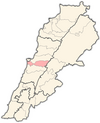
User:Swhatoum/Kfarselwan
Appearance
Kfarselwan | |
|---|---|
City | |
| Coordinates: 33°51′32″N 35°46′58″E / 33.85889°N 35.78278°E | |
| Country | |
| Governorate | Mount Lebanon Governorate |
| District | Baabda District |
| Elevation | 1,409 m (4,623 ft) |
| Time zone | UTC+2 (EET) |
| • Summer (DST) | UTC+3 (EEST) |
| Dialing code | +961 |
Kfarselwan (كفر سلوان), also spelled Kfar Selwan or Kfar Selouane, is a town in Lebanon, about 49 km (30.4486 miles)[1] from Beirut and is part of Greater Beirut. Kfarselwan sits at an altitude of 1409m (approximately 4622.7ft) above sea-level. It is in the Mount Lebanon Governorate in the district (or caza) of Baabda.
The prominent religious communities in Kfarselwan consist of Maronites and Druze.
Etymology
[edit]Kfarselwan, Kfar Selwan, or Kfar Selouane translates as "the village of Selwan." Kfar, or kefar, in Hebrew, means "village." [2] Many villages and cities in the Middle East use this prefix.
References
[edit]
External links
[edit]- [http://]


