User:Jarda2020/2024 Pacific hurricane season
| 2024 Pacific hurricane season | |
|---|---|
 Season summary map | |
| Seasonal boundaries | |
| First system formed | May 21, 2024 |
| Last system dissipated | Season ongoing |
| Strongest storm | |
| Name | Miriam |
| • Maximum winds | 160 mph (260 km/h) (1-minute sustained) |
| • Lowest pressure | 925 mbar (hPa; 27.32 inHg) |
| Seasonal statistics | |
| Total depressions | 17 |
| Total storms | 16 |
| Hurricanes | 12 |
| Major hurricanes (Cat. 3+) | 6 |
| Total fatalities | 18 total |
| Total damage | > $1.196 billion (2024 USD) |
| Related articles | |
The 2024 Pacific hurricane season is the current Pacific hurricane season in the Northern Hemisphere. It officially began on May 15 in the eastern Pacific (east of 140°W), and on June 1 in the central Pacific (from 140°W to the International Date Line); both will end on November 30. These dates, adopted by convention, historically describe the period in each year when most tropical cyclogenesis occurs in these regions of the Pacific.
The season started with the formation of Tropical Storm Aletta on May 21. A month later, on June 20, Hurricane Bud developed, which caused heavy rainfall and flash flooding across Southern Mexico. Following that, Hurricane Carlotta, and Hurricane Daniel formed in mid-July, Carlotta traversed parallel to the coast of Mexico, whilst Daniel traversed the open Pacific ocean, reaching the Big Island, Hawaii and causing flash flooding and heavy damage there, also killing 1 person.
Seasonal forecasts
[edit]| Record | Named
storms |
Hurricanes | Major
hurricanes |
Ref | |
|---|---|---|---|---|---|
| Average (1991–2020): | 15 | 8 | 4 | [1] | |
| Record high activity: | 1992: 27 | 2015: 16 | 2015: 11 | [2] | |
| Record low activity: | 2010: 8 | 2010: 3 | 2003: 0 | [2] | |
| Date | Source | Named
storms |
Hurricanes | Major
hurricanes |
Ref |
| May 2, 2024 | SMN | 14–20 | 5–9 | 1–3 | [3] |
| May 23, 2024 | NOAA | 16–22 | 7–11 | 4–8 | [4] |
| Area | Named
storms |
Hurricanes | Major
hurricanes |
Ref | |
| Actual activity: | EPAC | 15 | 12 | 6 | |
| Actual activity: | CPAC | 1 | 0 | 0 | |
| Actual combined activity: | 16 | 12 | 6 | ||
In advance of each Pacific hurricane season, forecasts of hurricane activity are issued by the United States National Oceanic and Atmospheric Administration (NOAA)'s Climate Prediction Center and Mexico's the Servicio Meteorológico Nacional (SMN). They include weekly and monthly changes in significant factors that help determine the number of tropical storms, hurricanes, and major hurricanes within a particular year. According to NOAA, the average eastern Pacific hurricane season between 1991 and 2020 contained roughly 15 tropical storms, 8 hurricanes, 4 major hurricanes, with a near-normal accumulated cyclone energy (ACE) index between 80 and 115. Broadly speaking, ACE is a measure of the power of a tropical or subtropical storm multiplied by the length of time it existed. It is only calculated for full advisories on specific tropical and subtropical systems reaching or exceeding wind speeds of 39 mph (63 km/h). NOAA typically categorizes a season as above-average, average, or below-average based on the cumulative ACE index, but the number of tropical storms, hurricanes, and major hurricanes within a hurricane season is sometimes also considered.
On May 2, 2024, SMN issued its forecast for the season, forecasting a total of 14–20 named storms developing, with 5–9 hurricanes, and 1–3 major hurricanes. Factors they expected to increase activity were above-average sea surface temperatures across the eastern Pacific and the El Niño–Southern Oscillation (ENSO) remaining in the neutral phase, with the possibility of a strong El Niño developing. On May 23, 2024, NOAA issued their outlook, calling for an above-normal season with 16–22 named storms overall, 7–11 hurricanes, 4–8 major hurricanes, and an ACE index of 90% to 120% of the median.
Seasonal summary
[edit]
Systems
[edit]Tropical Storm Aletta
[edit]| Tropical storm (SSHWS) | |
| Duration | May 21 – May 24 |
|---|---|
| Peak intensity | 40 mph (65 km/h) (1-min); 1002 mbar (hPa) |
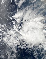
A tropical wave was first observed over the southeastern Caribbean Sea on May 10. The wave entered the East Pacific a few days later, where atmospheric conditions allowed for gradual development. Curved bands of convection developed around a defined center early on May 21, leading to the formation of a tropical depression around 06:00 UTC that day. Twelve hours later, the depression intensified into Tropical Storm Aletta. Influenced by a subtropical ridge over central Mexico, Aletta steadily strengthened and reached peak winds of 40 mph (65 km/h) early on May 22. Thereafter, increasing wind shear and the introduction of mid-level dry air caused the cyclone to begin a quick weakening trend. The low-level circulation became increasingly elongated and opened up into a trough at 23:00 UTC on May 23. Six hours later, Aletta dissipated while located about 775 mi (1,247 km) southwest of Manzanillo, Mexico.
Hurricane Bud
[edit]| Category 1 hurricane (SSHWS) | |
| Duration | June 20 – June 27 |
|---|---|
| Peak intensity | 90 mph (150 km/h) (1-min); 978 mbar (hPa) |
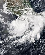
In mid-June, a Kelvin wave interacted with a few tropical waves to the south of Mexico. The system gradually organized and was designated as a tropical depression on June 20, while situated about 290 mi (470 km) south-southeast of Puerto Escondido, Oaxaca. Drifting slowly northwestward, the depression was upgraded further to tropical storm intensity. Although persistent wind shear and dry air hampered intensification early on, Bud strengthened into a hurricane on June 23 after moving into more favorable conditions. However, the return of dry air and upwelling caused the storm to deteriorate into a tropical storm. Paralleling the Mexican coast, Bud regained hurricane intensity on June 25 and peaked with sustained winds of 90 mph (145 km/h) and a pressure of 978 mbar (978 hPa; 28.9 inHg) the next day. Wind shear and dry air afterwards caused Bud to rapidly weaken, falling to tropical storm intensity on June 27 and degenerating into a remnant low-pressure area hours later.
Bud's formation prompted coastal authorities to enact precautionary measures along states deemed at risk. In Guerrero, 507 shelters were opened. The NHC also issued several tropical cyclone warnings and watches between June 21 and June 27 from Jalisco to Guerrero. Rough seas along the shore generated by the hurricane caused widespread damage. Twelve ships, including a yacht worth 11 million pesos (US$717,000), sunk in Playa Manzanillo harbor. The waves, along with heavy rain, inflicted at least 5 million pesos (US$326,000) of damage on Michoacán's coastal installations. Strong winds produced by the passing storm also downed trees, power poles, and billboards, especially in Acapulco. There, 16 homes were swept away by the waves.
Hurricane Carlotta
[edit]| Category 2 hurricane (SSHWS) | |
| Duration | July 11 – July 16 |
|---|---|
| Peak intensity | 105 mph (165 km/h) (1-min); 968 mbar (hPa) |
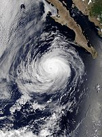
A tropical wave emerged off Africa on June 28 and split over the Caribbean several days later, with the southern portion of the wave continuing into the eastern Pacific. A small low developed in association with this wave, eventually organizing into a tropical depression by 18:00 UTC on July 11. Twelve hours later, the depression intensified into Tropical Storm Carlotta while paralleling the coastline of Mexico. Owing to favorable environmental conditions, Elida intensified steadily on July 12 and then rapidly the following day, attaining hurricane strength around 18:00 UTC on July 13. An eye developed within the storm's compact and symmetrical central dense overcast, and Elida reached peak winds of 105 mph (165 km/h) by 12:00 UTC the next morning. Ultimately, the influence of dry air and cooler waters caused the storm to swiftly weaken, and it degenerated to a remnant area of low pressure by 12:00 UTC on July 16 while positioned west of Baja California Sur. The low turned north before opening up into a trough a little over 24 hours later.[5]
Hurricane Daniel
[edit]| Category 4 hurricane (SSHWS) | |
| Duration | July 15 – July 26 |
|---|---|
| Peak intensity | 130 mph (215 km/h) (1-min); 950 mbar (hPa) |
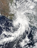
A tropical wave emerged from Africa on July 1, eventually organizing into a tropical depression over the eastern Pacific around 12:00 UTC on July 15; six hours later, it strengthened into Tropical Storm Daniel. A mid-level ridge over Mexico directed the system west-northwest, while improving upper-level winds allowed Daniel to begin rapid intensification. Daniel reached hurricane intensity around 00:00 UTC on July 17 and major hurricane strength by 12:00 UTC the next day. As the hurricane moved parallel to the 26 °C isotherm, its cloud pattern evolved to resemble an annular hurricane, with a large eye and lack of convective bands. It intensified into a Category 4 hurricane early on July 19 and attained peak winds of 130 mph (210 km/h) around 18:00 UTC that day. Increased wind shear prompted a weakening trend as the system entered the central Pacific, and it weakened to a tropical storm by 06:00 UTC on July 23 before making landfall just east of Pahala, Hawaii, with winds of 60 mph (95 km/h) six hours later. The high terrain of Hawaii contributed to the disruption of Daniel's cloud pattern, and it degenerated to a remnant low by 06:00 UTC on July 26 before dissipating west of the island late the next day.[6]
Hurricane Emilia
[edit]| Category 1 hurricane (SSHWS) | |
| Duration | July 22 – July 27 |
|---|---|
| Peak intensity | 85 mph (140 km/h) (1-min); 985 mbar (hPa) |
A large tropical wave departed Africa on July 9 and entered the East Pacific by July 21. The disturbance quickly organized upon emerging over water, and it became Tropical Storm Emilia at 06:00 UTC on July 22 while moving northwest. Emilia became a hurricane on July 24 while passing very close to the coastline of Jalisco and made landfall near Chatmela-Cuixmala with winds of 75 mph (120 km/h) six hours later. Emilia weakened as it emerged back offshore, but it became a hurricane a second time and reached peak winds of 85 mph (135 km/h) late on July 25 as an eye appeared on satellite. The storm struck Baja California Sur near La Ventana at a slightly reduced strength at 03:00 UTC on July 26. Emilia weakened thereafter as it curved north, degenerating to a remnant low as it reached the coastline of mainland Mexico around 12:00 UTC on July 27 and dissipating six hours later.[7]
Tropical Depression Six-E
[edit]| Tropical depression (SSHWS) | |
| Duration | July 26 – August 1 |
|---|---|
| Peak intensity | 35 mph (55 km/h) (1-min); 1007 mbar (hPa) |
A low-pressure trough began producing disorganized convection over the waters of the Pacific Ocean, well to the south of Baja California Peninsula, on July 23.[8] Despite only marginally conducive environmental conditions, the disturbance began to show signs of organization two days later,[9] and it attained tropical depression status by 06:00 UTC on July 26.[10] Strong west-northwesterly wind shear confined the storm's intermittent bursts of convection well to the southwest of its low-level circulation, and the depression consequently failed to produce winds above 35 mph (55 km/h).[11] The system's center later degenerated into a low-pressure trough within the Intertropical Convergence Zone, prompting the NHC to discontinue advisories at 21:00 UTC on August 1.[12]
Tropical Storm Fabio
[edit]| Tropical storm (SSHWS) | |
| Duration | July 30 – August 2 |
|---|---|
| Peak intensity | 45 mph (75 km/h) (1-min); 1001 mbar (hPa) |
A tropical wave emerged off the western coast of Africa on July 17 and entered the East Pacific about a week later, where steady organization led to the formation of a tropical depression around 12:00 UTC on July 30. Embedded within southwesterly flow around a large upper-level trough across northern Mexico, the depression moved steadily northeast in a favorable environment, and it intensified into Tropical Storm Fabio by 06:00 UTC on July 31. After attaining peak winds of 45 mph (70 km/h), the system made landfall around 00:00 UTC on August 2 about 25 miles (40 km) west of Puerto Ángel before the mountainous terrain of Mexico quickly made Fabio dissipate inland twelve hours later.[13]
In the state of Oaxaca, flights out of Bahías de Huatulco International Airport were cancelled and schools were closed until August 3. Dozens of roads were impassable due to mudslides and flooding; numerous locales received over 4 in (102 mm) of rain, with rainfall at a maximum of 19.07 in (484.4 mm) in Huatulco.[13] Numerous landslides caused significant disruption across the state; the storm blocked large areas of Federal Highway 200 in Oaxaca. A landslide in San Marcial Ozolotepec killed two girls and buried several houses, while another in San Carlos Yautepec killed a woman.[14] As of August 4, a total of six people have been killed—five in Oaxaca and two in Tehuantepec.[15] Damage in Oaxaca reached MXN$3.2 billion (US$172 million).[16]
Hurricane Gilma
[edit]| Category 3 hurricane (SSHWS) | |
| Duration | August 1 – August 9 |
|---|---|
| Peak intensity | 125 mph (205 km/h) (1-min); 955 mbar (hPa) |
An area of low pressure formed off the coast of Southern Mexico on July 27.[17] The disturbance became better organized over the course of several days, and developed a well-defined center on the afternoon of August 1, becoming Tropical Depression Eight-E.[18] By early the next day, the depression had begun developing a central dense overcast, and exhibiting banding features, and so was upgraded with the 09:00 UTC advisory, becoming Tropical Storm Gilma.[19] Gilma moved westward out to sea within a favorable environment with low wind shear and warm sea surface temperatures, and was upgraded to a Category 1 hurricane at 15:00 UTC on August 3.[20] It then rapidly intensified and became the season's second major hurricane at 15:00 UTC on August 4. It had a well-defined 17-mile-wide (28 km) eye at the time, with a pronounced ring of deep convection surrounding it.[21] A weakening trend began later that day, and by early on August 6, the system had fallen to tropical storm strength.[22] Still moving generally westward, the storm crossed the 140th meridian at around 15:00 UTC on August 7, thus entering the central Pacific basin; its sustained winds at the time were near 50 mph (85 km/h).[23] Then, early on August 9, Gilma passed just south of the Island of Hawaiʻi.[24] Weakened by the close encounter with land, the storm began losing its tropical characteristics. Gilma became post-tropical by 21:00 UTC on August 9.[25]
All state parks on the Big Island, as well as most of Hawaiʻi Volcanoes National Park, were shut beginning the afternoon of August 8, while public schools were closed for the whole of August 9.[26] Eight emergency shelters were opened across the county on August 8.[27] Gilma caused no significant damage; only minor flooding occurred in flood-prone areas of the Big Island.[28] Rainfall reached up to 7.24 in (184 mm) at Honolii Stream, while peak gusts of 72 mph (116 km/h) and 70 mph (113 km/h) were recorded on the summits of Haleakalā and Mauna Kea, respectively.[29]
Hurricane Hector
[edit]| Category 4 hurricane (SSHWS) | |
| Duration | August 5 – August 17 |
|---|---|
| Peak intensity | 150 mph (240 km/h) (1-min); 937 mbar (hPa) |
A tropical wave left the western coast of Africa on July 22 and tracked westward across the tropics with little convection. The wave moved over Central America and entered the Pacific Ocean on July 30. Convection subsequently increased and became better organized over the next couple of days. An area of low-pressure developed and convection gradually became more organized. A tropical depression spawned around 12:00 UTC on August 5, at approximately 490 mi (790 km) west-southwest of Manzanillo, Mexico. The depression strengthened into Tropical Storm Hector about six hours later.[30]
The cyclone began traveling towards the west-northwest shortly after, moving along the southern edge of a subtropical ridge that extended over the Eastern Pacific Ocean. Located within a favorable environment of moist air, low wind shear, and 84–86 °F (29–30 °C) sea surface temperatures, Hector began a two-day period of rapid intensification around 18:00 UTC on August 5. The storm strengthened into a hurricane one day later. It reached its peak intensity on August 7 at 18:00 UTC as a Category 4 hurricane with winds of 150 miles per hour (240 km/h) and a pressure of 937 mbar (27.67 inHg), while 520 mi (835 km) southwest of the southern tip of the Baja California peninsula. During this time, the hurricane turned westward and later towards the west-southwest as the ridge consolidated and extended further west. Increasing northeasterly wind shear caused Hector to gradually weaken over the next couple of days. The storm fell to Category 2 status by 06:00 UTC on August 9 and maintained that intensity for around a day. Hector then began tracking west-northwestward while the wind shear relaxed, allowing for another period of rapid strengthening. Hector reached its secondary peak at 18:00 UTC on August 10 as a Category 4 hurricane with winds of 140 miles per hour (230 km/h).[30]
Soon after, the hurricane began to weaken once more as it traveled through a region of cooler sea surface temperatures. Hector crossed into the Central Pacific after 00:00 UTC on August 12 as a high-end Category 1 hurricane. The weakening trend continued as Hector tracked westward under the influence of a subtropical ridge that was located to the north and northeast; the cyclone's eye filled in with clouds. The hurricane began a third period of rapid intensification as it moved across warmer sea surface temperatures and an area of low wind shear. Hector reached its tertiary peak intensity on August 13 at 18:00 UTC as a 120 miles per hour (190 km/h) Category 3 hurricane; at that time, it possessed a well-defined eye. On the next day, declining sea surface temperatures and moderate wind shear caused Hector to weaken as it turned northwest. By 18:00 UTC on August 16, Hector had weakened into a tropical storm, while over several hundred miles northeast of the Hawaiian Islands. Wind shear further increased as the system turned northward, exposing the low-level center and prompting more weakening. Hector was downgraded to a post-tropical cyclone around 12:00 UTC on August 17. The remnants turned northeastward and dissipated on August 18 by 12:00 UTC, around 805 mi (1,296 km) north-northeast of the Hawaiian Islands.[30]
Hurricane Ileana
[edit]| Category 1 hurricane (SSHWS) | |
| Duration | August 13 – August 20 |
|---|---|
| Peak intensity | 75 mph (120 km/h) (1-min); 980 mbar (hPa) |
A tropical wave departed Africa on July 28, crossing Central America to become a tropical depression around 12:00 UTC on August 13. With a circulation about 920 mi (1,480 km) across, the unusually large system only slowly organized, becoming Tropical Storm Ileana around 18:00 UTC on August 14. Strong upper-level winds that had been plaguing the system weakened as it moved west then northwest, and its large circulation contracted, allowing Ileana to attain hurricane strength with peak winds of 75 mph (120 km/h) by 12:00 UTC on August 17 as a large eye became evident. Low wind shear allowed Ileana to only slowly decrease in intensity over the coming days despite cooling ocean temperatures. It became a tropical depression early on August 20 and degenerated to a remnant low around 12:00 UTC that morning. The post-tropical cyclone turned west and remained distinct until late on August 24, when it dissipated into an open trough well northeast of Hawaii.[31]
Tropical Storm John
[edit]| Tropical storm (SSHWS) | |
| Duration | August 18 – August 23 |
|---|---|
| Peak intensity | 50 mph (85 km/h) (1-min); 1000 mbar (hPa) |
On August 15, a broad area of low pressure associated with a tropical wave formed well to the east-southeast of the Hawaiian Islands.[32] A few days later, shower and thunderstorm activity within the disturbance became better organized, and it developed a well-defined circulation. Consequently, Tropical Depression Eleven‑E formed at 03:00 UTC on August 18.[33] The depression strengthened into Tropical Storm John six hours later. At the time, the storm was moving westward at 13 mph (20 km/h), and was about to enter the Central Pacific basin.[34] The storm strengthened some on August 19, as an inner core developed and deep convection increased near its center, a result of diminished wind shear and continued warm water temperatures.[35] The wind shear, though relatively light, proved disruptive nonetheless, displacing John's convection to the north of the center and causing it to pulsate.[36] This ultimately led to the system becoming increasingly disorganized late the following day.[37] Later, while south of the Island of Hawaiʻi on August 22, it weakened to a tropical depression, just few hours later, at 06:00 UTC on August 23, it degenerated to a post-tropical cyclone.[38]
Hurricane Kristy
[edit]| Category 3 hurricane (SSHWS) | |
| Duration | August 21 – September 1 |
|---|---|
| Peak intensity | 120 mph (195 km/h) (1-min); 960 mbar (hPa) |
On August 6, a tropical wave moved off the coast of Africa, ultimately organizing into a tropical depression well southwest of Baja California by 00:00 UTC on August 21. After intensifying into a tropical storm six hours later, Kristy tracked west-northwest. Light northeasterly wind shear allowed the cyclone to reach hurricane strength around 06:00 UTC on August 23 and further organize to its peak as a Category 3 with winds of 120 mph (195 km/h) two days later, despite cool ocean temperatures. Shortly after entering the central Pacific, Kristy began to weaken as a result of cold water upwelling. Although the cyclone fell to a tropical storm early on August 29, an upper-level environment still favorable for strengthening allowed Kristy to briefly regain hurricane strength the next day. Kristy fell below hurricane strength once again early on August 31 as southwesterly wind shear increased, weakened to a tropical depression early on September 1, and degenerated to a remnant low around 18:00 UTC that day. The low dissipated over the far northern Pacific on September 4.[39]
Hurricane Lane
[edit]| Category 2 hurricane (SSHWS) | |
| Duration | August 28 – September 3 |
|---|---|
| Peak intensity | 110 mph (175 km/h) (1-min); 967 mbar (hPa) |
On August 22, a tropical wave that had traversed the Atlantic basin moved into the Eastern Pacific.[40] Passing south of the Gulf of Tehuantepec, the disturbance gradually organized, and by August 27, satellite images showed that a surface circulation has formed, however, thunderstorm activity was too disorganized to be classified as a tropical cyclone. It is estimated that Tropical Depression Thirteen-E formed at 00:00 UTC on August 28 about 700 miles (1,100 km) south-southwest of the southern tip of Baja California, after curved banding features developed near the center.[40] The center became embedded in a central dense overcast, and six hours later, it was upgraded to Tropical Storm Lane.
Moving north-northwest around a ridge of high pressure, Lane entered an area of warm sea surface temperatures and low wind shear, prompting a period of rapid intensification as a well-defined eye became visible at the center, and Lane became a hurricane at 06:00 UTC August 29.[40] The hurricane eventually reached its peak intensity as a high-end Category 2 hurricane with winds of 110 mph (180 km/h) at 18:00 UTC that day. The storm then moved into an area of cooler waters, which caused Lane to weaken back to a tropical storm as it slowed down due to a trough approaching it and eventually replaced with a ridge. It began to turn west, and re-strengthened to a hurricane again before eventually succumbing to increasing wind shear and weakening again commenced. Lane deteriorated into a remnant low by September 3, which persisted for another 12 hours before dissipating.[40] Trailing deep tropical moisture from the remnants of Lane passing north of the island chain produced moderate to heavy rainfall and minor flooding along the windward slopes of Haleakalā on September 9.[41]
Hurricane Miriam
[edit]| Category 5 hurricane (SSHWS) | |
| Duration | September 2 – September 7 |
|---|---|
| Peak intensity | 160 mph (260 km/h) (1-min); 925 mbar (hPa) |
A tropical wave departed from the western coast of Africa on August 15 and moved across the tropical Atlantic with minimal convection. The wave arrived at Central America on August 29 and entered the Pacific Ocean on the next day. Convection formed around the wave on August 31; a low-pressure system developed in association with the wave early on September 1. Thunderstorm activity continued to coalesce, and a tropical depression formed by 00:00 UTC on September 2, approximately 265 mi (425 km) south of Manzanillo, Mexico. The system tracked west-northwest and northwest as it continued to organize. An increase in convection and the formation of a central dense overcast resulted in the depression being upgraded to Tropical Storm Miriam by 12:00 UTC on the same day, about 290 mi (465 km) south-southwest of Manzanillo. A favorable environment along with Miriam's smaller size allowed the cyclone to rapidly intensify for nearly two days. Miriam reached hurricane intensity by 06:00 UTC on September 3 and became a major hurricane around 18:00 UTC. Miriam peaked as a Category 5 hurricane on September 4 at 06:00 UTC with winds of 160 miles per hour (260 km/h) and a pressure of 925 mbar (27.32 inHg), while located 195 mi (315 km) south-southwest of Cabo Corrientes, Mexico.[42]
After peaking, a combination of cooling sea surface temperatures and an eyewall replacement cycle caused Miriam to steadily weaken. The hurricane's eye increased sixfold in size between Miriam's peak intensity and the start of September 5. After the replacement cycle ended later that day, the now-Category 3 hurricane tracked northeastward. Around 01:20 UTC on September 7, Willa made landfall near Palmito del Verde, Sinaloa with 115 miles per hour (185 km/h). Strong southwesterly shear along with the mountainous terrain of Mexico caused Miriam to rapidly decline in intensity; the cyclone was a mid-grade tropical storm around 06:00 UTC, while located only 10 mi (15 km) southeast of Durango, Mexico. The storm dissipated six hours later and sent remnant moisture into southern Texas and Louisiana.[42]
Hurricane Miriam necessitated the issuance of tropical cyclone watches and warnings along the southwestern coast of Mexico.[42] As a precautionary measure, over 200,000 people were evacuated from coastal regions in advance of the storm.[43] Miriam brought winds up to 115 miles per hour (185 km/h) to the region where it made landfall and torrential rainfall to multiple states; rainfall peaked at 15.39 in (391 mm) in San Andrés Milpillas, Nayarit.[42] Miriam wrought catastrophic damage throughout the region where it made landfall, with damage totaling US$825 million (MX$17.2 billion).[44][45][46][47] The town of Los Sandovales in Acaponeta Municipality, Nayarit, was completely destroyed by Miriam.[48][49] The cyclone left a total of 9 people dead throughout four Mexican states.[50][51][52][53] The storm isolated multiple communities in Sinaloa and Nayarit; the San Pedro and Acaponeta rivers flooded, leaving 180,000 people without food and outside communication for at least one week after the storm.[54][55] Multiple cities in the states of Sinaloa and Nayarit were left without any potable water,[56][55] and in some cases, this remained the case for several months after the storm.[57] Around 100,000 people were left homeless in Nayarit.[58]
Tropical Storm Hone
[edit]| Tropical storm (SSHWS) | |
| Duration | September 4 – September 9 |
|---|---|
| Peak intensity | 65 mph (100 km/h) (1-min); 995 mbar (hPa) |
On September 4, the NHC began issuing advisories on Tropical Depression Fifteen-E near the Central Pacific Hurricane Center's area of responsibility. Later that day, it moved into the Central Pacific as a tropical depression, quickly strengthening into Tropical Storm Hone, the first Central Pacific storm since Ema (2019). It also started to develop an eye feature, based on satellite imagery. But, southerly shear, introduced by a large upper-level trough, caused Hone to become slightly disorganized on September 5. Despite this, Hone reached its peak intensity of 65 mph (105 km/h) early on September 6, and slowly weakened to become a very disorganized, yet still fairly strong tropical storm, maintaining maximum winds of 50 mph (80 km/h) for the next couple of days. However, Hone weakened to a tropical depression late on September 8, while continuing to quickly become disorganized. Hone degenerated to a remnant low on 06:00 UTC of September 9, roughly 580 miles (930 km) southwest of Honolulu, and 410 miles (660 km) east of Johnston Island, with the CPHC issuing their last advisory at the same time. Hone's remnants lingered for six hours before dissipating by 06:00 UTC.[59]
Hurricane Norman
[edit]| Category 1 hurricane (SSHWS) | |
| Duration | September 7 – September 15 |
|---|---|
| Peak intensity | 80 mph (130 km/h) (1-min); 987 mbar (hPa) |
A tropical wave moved off Africa on August 26 and crossed into the East Pacific eight days later. The disturbance coalesced while positioned south of Mexico, organizing into a tropical depression by 12:00 UTC on September 7. It slowly intensified while moving rapidly west-northwest, becoming Tropical Storm Norman early on September 8 and a hurricane later the next day. After attaining peak winds of 80 mph (130 km/h), the storm weakened amid increasing westerly wind shear. These unfavorable upper-level winds abated on September 11, causing Norman to fluctuate in intensity for the next day. By September 13, however, the storm embarked on a gradual weakening trend. It degenerated to a remnant low to the north of Hawaii at 00:00 UTC on September 15. The low turned north-northwest and dissipated the next morning.[60]
Hurricane Olivia
[edit]| Category 4 hurricane (SSHWS) | |
| Duration | September 11 – September 18 |
|---|---|
| Peak intensity | 130 mph (215 km/h) (1-min); 950 mbar (hPa) |
On September 6, the NHC noted that an area of low pressure could form well south-southwest of the southern tip of Baja California over subsequent days.[61] An area of disturbed weather developed a few hours later,[62] slowly organizing into a tropical depression by 21:00 UTC on September 11.[63] With an impressive spiral band and improved inner core, the depression was upgraded to Tropical Storm Olivia six hours later.[64] Steered northwestward into the central Pacific, the cyclone initially struggled with moderate wind shear; however, an eye feature developed within the storm's central dense overcast by 09:00 UTC on September 14, prompting an upgrade to hurricane intensity.[65] Olivia began a period of rapid intensification thereafter, and with a cloud-filled eye surrounded by a ring of deep convection, was upgraded to a Category 3 hurricane by 21:00 UTC before ultimately peaking as a 130 mph (210 km/h) Category 4 hurricane early the next day.[66][67]
An upper-level trough responsible for the cyclone's northwest trajectory moved north of the Hawaiian Islands on September 15, causing a subtropical ridge to the north of the cyclone to build southward. As a result, Olivia turned west and then southwest.[67] Under increasing wind shear, Olivia's cloud pattern became less rounded and the storm's eye became obscured, signaling its fall below major hurricane intensity.[68] The continued effect of strong westerly shear weakened Olivia to a tropical storm by 00:00 UTC on September 17,[69] to a tropical depression six hours later,[70] and further to a remnant low by 21:00 UTC on September 18 west-southwest of Hawaii. The remnant low ultimately dissipated southwest of Kauai the next day.
Olivia brought minor damage and flooding to the Big island of Hawaii.[71] Across the island, the storm was accountable for 5 to 11 in (125 to 280 mm) of rain spread out over a long period which mitigated serious flooding impacts. A few low-lying, flood-prone roads in Hilo were briefly inundated but no significant damage was reported.[72]
Storm names
[edit]The following names were used for named storms that formed in the northeastern Pacific Ocean during 2024. This is the same list used in the 2018 season. If no names would be retired, this list will be used again in the 2030 season.[73]
|
|
|
For storms that form in the Central Pacific Hurricane Center's area of responsibility, encompassing the area between 140 degrees west and the International Date Line, all names are used in a series of four rotating lists.[74] The next four names that were slated for use in 2024 are shown below. However, none of them were used.
|
|
|
|
Season effects
[edit]This is a table of all the storms that formed in the 2024 Pacific hurricane season. It includes their duration, names, areas affected, damages, and death totals. Deaths in parentheses are additional and indirect (an example of an indirect death would be a traffic accident), but were still related to that storm. Damage and deaths include totals while the storm was extratropical, a tropical wave, or a low, and all the damage figures are in 2024 USD.
| Saffir–Simpson scale | ||||||
| TD | TS | C1 | C2 | C3 | C4 | C5 |
| Storm name |
Dates active | Storm category at peak intensity |
Max 1-min wind mph (km/h) |
Min. press. (mbar) |
Areas affected | Damage (USD) |
Deaths | Ref(s) | ||
|---|---|---|---|---|---|---|---|---|---|---|
| Aletta | May 21–24 | Tropical storm | 40 (65) | 1002 | None | None | None | |||
| Bud | June 20–27 | Category 1 hurricane | 90 (150) | 978 | Southwestern Mexico, Western Mexico | $1.04 million | None | |||
| Carlotta | July 11–16 | Category 2 hurricane | 105 (165) | 968 | Southwestern Mexico, Socorro Island | None | None | |||
| Daniel | July 15–26 | Category 4 hurricane | 130 (215) | 950 | Hawaii | >$148 million | 1 | |||
| Emilia | July 22–27 | Category 1 hurricane | 85 (140) | 985 | Sonora, Sinaloa, Jalisco, Colima, Michoacán, Baja California Peninsula | >$50 million | 1 | |||
| Six-E | July 26 – August 1 | Tropical depression | 35 (55) | 1007 | None | None | None | |||
| Fabio | July 30 – August 2 | Tropical storm | 45 (75) | 1001 | Southwestern Mexico | $172 million | 7 | |||
| Gilma | August 1–9 | Category 3 hurricane | 125 (205) | 955 | Hawaii | Minimal | None | |||
| Hector | August 5–17 | Category 4 hurricane | 150 (240) | 937 | Hawaii | None | None | |||
| Ileana | August 13–20 | Category 1 hurricane | 75 (120) | 980 | None | None | None | |||
| John | August 18–23 | Tropical storm | 50 (85) | 1000 | None | None | None | |||
| Kristy | August 21 – September 1 | Category 3 hurricane | 120 (195) | 960 | Hawaii | None | None | |||
| Lane | August 28 – September 3 | Category 2 hurricane | 110 (175) | 967 | None | None | None | |||
| Miriam | September 2–7 | Category 5 hurricane | 160 (260) | 925 | Central America, Mexico, Texas | $825 million | 9 | |||
| Hone | September 4–9 | Tropical storm | 65 (100) | 995 | None | None | None | |||
| Norman | September 7–15 | Category 1 hurricane | 80 (130) | 987 | Hawaii | None | None | |||
| Olivia | September 11–18 | Category 4 hurricane | 130 (210) | 950 | Clipperton Island, Hawaii | None | None | |||
| Season aggregates | ||||||||||
| 17 systems | May 21 – Season ongoing | 160 (260) | 925 | >$1.196 billion | 18 | |||||
See also
[edit]- Tropical cyclones in 2024
- Weather of 2024
- 2024 Atlantic hurricane season
- 2024 Pacific typhoon season
- 2024 North Indian Ocean cyclone season
- South-West Indian Ocean cyclone seasons: 2023–24, 2024–25
- Australian region cyclone seasons: 2023–24, 2024–25
- South Pacific cyclone seasons: 2023–24, 2024–25
References
[edit]- ^ "Background Information: Eastern Pacific Hurricane Season". College Park, Maryland: NOAA Climate Prediction Center. May 14, 2022. Retrieved June 1, 2023.
- ^ a b "Northeast Pacific Ocean Historical Tropical Cyclone Statistics". Fort Collins, Colorado: Colorado State University. Retrieved August 8, 2023.
- ^ "Temporada de Ciclones Tropicales 2023" [Tropical Cyclone Season 2023] (in Spanish). Servicio Meteorológico Nacional. May 4, 2023. Retrieved June 1, 2023.
- ^ "NOAA 2023 Eastern Pacific Hurricane Season Outlook". Climate Prediction Center. May 25, 2023. Archived from the original on May 28, 2020. Retrieved May 26, 2023.
- ^ John P. Cangialosi (October 24, 2020). Tropical Cyclone Report: Hurricane Elida (PDF) (Report). Miami, Florida: National Hurricane Center. Retrieved October 8, 2021.
- ^ Tobb B. Kimberlain; Michael J. Brennan (June 12, 2018). Tropical Cyclone Report: Hurricane Iselle (PDF) (Report). Miami, Florida: National Hurricane Center. Retrieved June 28, 2018.
- ^ Lixion A. Avila (October 30, 2019). Tropical Cyclone Report: Hurricane Lorena (PDF) (Report). National Hurricane Center. Retrieved April 6, 2020.
- ^ Eric S. Blake (July 14, 2017). "Graphical Tropical Weather Outlook". Miami, Florida: National Hurricane Center. Retrieved July 21, 2017.
- ^ Eric S. Blake (July 16, 2017). "Graphical Tropical Weather Outlook". Miami, Florida: National Hurricane Center. Retrieved July 21, 2017.
- ^ Daniel P. Brown (July 18, 2017). Tropical Depression Eight-E Public Advisory Number 1 (Report). Miami, Florida: National Hurricane Center. Retrieved July 21, 2017.
- ^ Robbie J. Berg (July 18, 2017). Tropical Depression Eight-E Discussion Number 3 (Report). Miami, Florida: National Hurricane Center. Retrieved July 21, 2017.
- ^ John L. Beven II (July 20, 2017). Post-Tropical Cyclone Eight-E Discussion Number 10 (Report). Miami, Florida: National Hurricane Center. Retrieved July 21, 2017.
- ^ a b Daniel P. Brown (July 13, 2017). Tropical Cyclone Report: Tropical Storm Beatriz (PDF) (Report). Miami, Florida: National Hurricane Center. pp. 2, 5. Retrieved July 21, 2017.
- ^ "UPDATE 1-Tropical Storm Beatriz nears Mexico's Pacific coast, kills 3". Thomson Reuters. June 2, 2017. Archived from the original on September 3, 2017. Retrieved June 2, 2017.
- ^ "Suman 7 muertos tras paso de tormenta tropical "Beatriz" en Oaxaca". Intolerancia. June 4, 2017. Retrieved June 11, 2017.
- ^ Sánchez, Virgilio (11 July 2017). "Dejó Beatriz daños por 3 mil 200 mdp en Oaxaca; falta costo de Calvin" (in Spanish). Noticias Voz e Imagen. Archived from the original on 15 July 2017. Retrieved 30 January 2018.
- ^ Brown, Daniel (July 7, 2023). Seven-Day Graphical Tropical Weather Outlook (Report). Miami, Florida: National Hurricane Center. Retrieved July 10, 2023.
- ^ Kelly, Larry; Cangialosi, John (July 11, 2023). Tropical Depression Three-E Discussion Number 1 (Report). Miami, Florida: National Hurricane Center. Retrieved July 11, 2023.
- ^ Brown, Daniel (July 12, 2023). Tropical Storm Calvin Discussion Number 3 (Report). Miami, Florida: National Hurricane Center. Retrieved July 12, 2023.
- ^ Kelly, Larry; Berg, Robbie (July 13, 2023). Hurricane Calvin Discussion Number 8 (Report). Miami, Florida: National Hurricane Center. Retrieved July 13, 2023.
- ^ Reinhart, Brad (July 14, 2023). Hurricane Calvin Discussion Number 12 (Report). Miami, Florida: National Hurricane Center. Retrieved July 14, 2023.
- ^ Gabriel, Angeli; Barker, Aaron; Wulfeck, Andrew; Donegan, Brian (July 16, 2023). "Calvin weakens to tropical storm in Eastern Pacific before impacting Hawaii this week". FOX Weather. Retrieved July 16, 2023.
- ^ Houston, Sam (July 17, 2023). Tropical Storm Calvin Discussion Number 24 (Report). Honolulu, Hawaii: Central Pacific Hurricane Center. Retrieved July 17, 2023.
- ^ Powell, Jeff (July 19, 2023). Tropical Storm Calvin Discussion Number 31 (Report). Honolulu, Hawaii: Central Pacific Hurricane Center. Retrieved July 19, 2023.
- ^ Birchard, Tom (July 19, 2023). Post-Tropical Cyclone Calvin Advisory Number 33 (Report). Honolulu, Hawaii: Central Pacific Hurricane Center. Retrieved July 19, 2023.
- ^ "Big Island schools, parks, more to close as Calvin threatens". Honolulu Star-Advertiser. July 18, 2023. Retrieved July 19, 2023.
- ^ "LIST: Schools, parks closed as Hurricane Calvin takes aim at Hawaii Island". Hawaii News Now. July 19, 2023. Retrieved July 19, 2023.
- ^ "Calvin now a post-tropical cyclone as it passes far south of Hawaii". Honolulu Star-Advertiser. July 19, 2023. Retrieved July 19, 2023.
- ^ McAvoy, Audrey; Thiessen, Mark (July 20, 2023). "Tropical Storm Calvin passes over Hawaii and leaves minor flooding in its wake". ABC News. Associated Press. Retrieved July 21, 2023.
- ^ a b c Brown, Daniel; Powell, Jeff (8 August 2019). Tropical Cyclone Report: Hurricane Norman (PDF) (Report). National Hurricane Center and Central Pacific Hurricane Center. Archived (PDF) from the original on 5 July 2020. Retrieved 5 July 2020.
- ^ Eric S. Blake (January 20, 2015). Tropical Cyclone Report: Hurricane Lowell (PDF) (Report). Miami, Florida: National Hurricane Center. Retrieved July 12, 2018.
- ^ Cangialosi, John (August 11, 2023). "Tropical Weather Outlook". Miami, Florida: National Hurricane Center. Retrieved August 13, 2023.
- ^ Cangialosi, John (August 13, 2023). Tropical Depression Eight-E Discussion Number 1 (Report). Miami, Florida: National Hurricane Center. Retrieved August 13, 2023.
- ^ Brown, Daniel (August 13, 2023). Tropical Storm Greg Advisory Number 2 (Report). Miami, Florida: National Hurricane Center. Retrieved August 14, 2023.
- ^ Gibbs, Alex; Jelsema, Jon (August 15, 2023). Tropical Storm Greg Discussion Number 7 (Report). Honolulu, Hawaii: Central Pacific Hurricane Center. Retrieved August 16, 2023.
- ^ Ballard, Maureen (August 16, 2023). Tropical Storm Greg Discussion Number 11 (Report). Honolulu, Hawaii: Central Pacific Hurricane Center. Retrieved August 17, 2023.
- ^ Ballard, Maureen (August 17, 2023). Tropical Storm Greg Discussion Number 15 (Report). Honolulu, Hawaii: Central Pacific Hurricane Center. Retrieved August 17, 2023.
- ^ Birchard, Tom (August 17, 2023). Tropical Depression Greg Advisory Number 16 (Report). Honolulu, Hawaii: Central Pacific Hurricane Center. Retrieved August 17, 2023.
- ^ Stacy R. Stewart; Christopher Jacobson (February 11, 2016). Tropical Cyclone Report: Hurricane Julio (PDF) (Report). Miami, Florida: National Hurricane Center. Retrieved June 28, 2018.
- ^ a b c d "Hurricane Orlene" (PDF). National Hurricane Center. 27 January 2017. Retrieved 3 February 2017.
- ^ "September 2016 Precipitation Summary". Archived from the original on 2017-04-24. Retrieved 2017-04-23.
- ^ a b c d Brennan, Michael (2 April 2019). Tropical Cyclone Report: Hurricane Willa (PDF) (Report). National Hurricane Center. Archived (PDF) from the original on 10 April 2019. Retrieved 24 July 2020.
- ^ "Nayarit en alerta roja por huracán 'Willa'". Diario de México (in Spanish). 23 October 2018. Archived from the original on 1 August 2019. Retrieved 1 August 2019.
- ^ Espinosa, Gabriela (11 November 2018). "Ascienden a $10 mil millones los daños que causó 'Willa' en Nayarit". La Jornada (in Spanish). Archived from the original on 15 January 2019. Retrieved 14 January 2019.
- ^ "Estiman en 6 mil millones de pesos los daños dejados por huracán Willa en Escuinapa". Noticias Digitales Sinaloa (in Spanish). 6 February 2019. Archived from the original on 30 August 2019. Retrieved 10 February 2019.
- ^ Piña, Ireri (25 October 2018). "Necesarios 35 mdp para solventar daños por "Willa"". Contramuro (in Spanish). Archived from the original on 4 November 2018. Retrieved 26 October 2018.
- ^ "Hay daños evidentes en Lerdo por lluvias". El Siglo de Durango (in Spanish). 3 November 2018. Archived from the original on 4 November 2018. Retrieved 4 November 2018.
- ^ "Nayarit, paralizado por falta de ayuda tras paso de huracán 'Willa'". Televisa News (in Spanish). 8 December 2018. Archived from the original on 10 August 2019. Retrieved 16 August 2019.
- ^ "TRAGEDIA: Poderoso huracán "Willa" destruye un pueblo de México". La Verdad Noticias (in Spanish). 2 November 2018. Archived from the original on 31 July 2019. Retrieved 17 May 2020.
- ^ Cancino, Karina (25 October 2018). "Cuatro muertos y 150 mil damnificados por paso de 'Willa' en Nayarit". El Financiero (in Spanish). Archived from the original on 26 October 2018. Retrieved 26 October 2018.
- ^ Martinez, Abraham Acosta (21 October 2018). "Van a Colima a esparcir cenizas de familiar, mueren por oleaje de 'Willa'" (in Spanish). Excelsior. Archived from the original on 1 August 2019. Retrieved 21 March 2020.
- ^ "Trabajador de CFE muere electrocutado producto de las lluvias por 'Willa'" (in Spanish). Tribuna. 25 October 2018. Archived from the original on 1 August 2019. Retrieved 21 March 2020.
- ^ "'Willa' pega en Sinaloa y deja 2 muertos en Sonora". Milenio (in Spanish). 25 October 2018. Archived from the original on 26 October 2018. Retrieved 26 October 2018.
- ^ "Huracán Willa deja sin luz y agua a varias comunidades de Sinaloa y provoca daños carreteros" [Hurricane Willa leaves several communities in Sinaloa without light and water and causes road damages] (in Spanish). Animal Politico. 24 October 2018. Archived from the original on 25 October 2018. Retrieved 24 October 2018.
- ^ a b "Nayarit no se recupera tras el paso de 'Willa'; 180 mil habitantes siguen incomunicados". Televisa News (in Spanish). 1 November 2018. Archived from the original on 2 August 2019. Retrieved 21 March 2020.
- ^ Suárez, Karina (25 October 2018). "Willa deja 13.000 evacuados y severos daños materiales a su paso por México" [Willa leaves 13,000 evacuated and severe material damage as it passes through Mexico]. El País (in Spanish). Archived from the original on 23 October 2018. Retrieved 24 October 2018.
- ^ Ibarra, Aaron (25 June 2019). "Sin aterrizar aún apoyos por el huracán 'Willa'y el Fonden busca nuevo recuento de daños". Ríodoce (in Spanish). Archived from the original on 31 July 2019. Retrieved 10 October 2019.
- ^ Tello, Antonio; Madrigal, Guadalupe (23 November 2018). "Gobierno de Nayarit se declara en bancarrota para atender emergencia por 'Willa'". Noticieros Televisa (in Spanish). Archived from the original on 14 August 2019. Retrieved 18 March 2020.
- ^ Brennan, Michael J. (February 17, 2010). "Tropical Storm Lana Tropical Cyclone Report" (PDF). Central Pacific Hurricane Center. Retrieved December 9, 2020.
- ^ Richard J. Pasch; David P. Roberts (January 9, 2020). Tropical Cyclone Report: Hurricane Flossie (PDF) (Report). National Hurricane Center. Retrieved April 6, 2020.
- ^ Richard J. Pasch (July 21, 2016). "Tropical Weather Outlook". National Hurricane Center. Retrieved September 5, 2016.
- ^ John P. Cangialosi (July 21, 2016). "Tropical Weather Outlook". National Hurricane Center. Retrieved September 5, 2016.
- ^ Michael J. Brennan (August 26, 2016). Tropical Depression Fourteen-E Public Advisory Number 1 (Report). National Hurricane Center. Retrieved September 5, 2016.
- ^ Eric S. Blake (August 26, 2016). Tropical Storm Madeline Discussion Number 2 (Report). National Hurricane Center. Retrieved September 5, 2016.
- ^ Jeff Powell (August 29, 2016). Hurricane Madeline Discussion Number 11 (Report). Central Pacific Hurricane Center. Retrieved September 5, 2016.
- ^ Tom Birchard (August 29, 2016). Hurricane Madeline Discussion Number 13 (Report). Central Pacific Hurricane Center. Retrieved September 5, 2016.
- ^ a b Jeff Powell (August 30, 2016). Hurricane Madeline Discussion Number 15 (Report). Central Pacific Hurricane Center. Retrieved September 5, 2016.
- ^ Derek Wroe (August 30, 2016). Hurricane Madeline Discussion Number 18 (Report). Central Pacific Hurricane Center. Retrieved September 5, 2016.
- ^ Derek Wroe (August 31, 2016). Tropical Storm Madeline Intermediate Advisory Number 22A (Report). Central Pacific Hurricane Center. Retrieved September 5, 2016.
- ^ Jon Jelsema; Robert Ballard (August 31, 2016). Tropical Depression Madeline Public Advisory Number 28 (Report). Central Pacific Hurricane Center. Retrieved September 5, 2016.
- ^ Kevin Kodama (September 2, 2016). Post-Tropical Cyclone Madeline Public Advisory Number 30 (Report). Central Pacific Hurricane Center. Retrieved September 5, 2016.
- ^ "August 2016 Precipitation Summary". Archived from the original on 2017-04-24. Retrieved 2017-04-23.
- ^ "Tropical Cyclone Names". National Hurricane Center. National Oceanic and Atmospheric Administration. 2013-04-11. Archived from the original on April 30, 2013. Retrieved May 8, 2013.
- ^ "Pacific Tropical Cyclone Names 2016-2021". Central Pacific Hurricane Center. National Oceanic and Atmospheric Administration. May 12, 2016. Archived from the original (PHP) on January 8, 2017.

