[ 3] Name on the Register[ 4]
Image
Date listed[ 5]
Location
City or town
Description
1
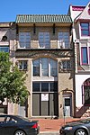
American National Bank American National Bank August 22, 1990 (#90001256 ) 1219 Broadway 39°55′49″N 75°07′12″W / 39.930278°N 75.12°W / 39.930278; -75.12 (American National Bank ) Camden
2
Barnegat (lightship)Barnegat (lightship)November 29, 1979 (#79002317 ) North 7th Street 39°57′21″N 75°06′46″W / 39.955833°N 75.112778°W / 39.955833; -75.112778 (Barnegat (lightship) Camden LV 79 / WAL 506; Was in Philadelphia
3
Volney G. Bennett Lumber Company Volney G. Bennett Lumber Company August 5, 1993 (#93000749 ) 138 Division St. and 845 S. Second St. 39°56′05″N 75°07′43″W / 39.934722°N 75.128611°W / 39.934722; -75.128611 (Volney G. Bennett Lumber Company ) Camden
4
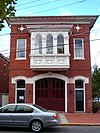
Broadway Trust Company Broadway Trust Company August 24, 1990 (#90001284 ) 938-944 Broadway 39°56′02″N 75°07′11″W / 39.933889°N 75.119722°W / 39.933889; -75.119722 (Broadway Trust Company ) Camden
4
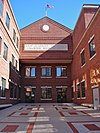
Building 17, RCA Victor Company, Camden Plant Building 17, RCA Victor Company, Camden Plant October 4, 2002 (#02001253 ) 1 Market St. 39°56′51″N 75°07′38″W / 39.9475°N 75.127222°W / 39.9475; -75.127222 (Building 17, RCA Victor Company, Camden Plant ) Camden
5
Building at 525 Cooper Street Building at 525 Cooper Street August 24, 1990 (#90001286 ) 525 Cooper St. 39°56′48″N 75°07′14″W / 39.946667°N 75.120556°W / 39.946667; -75.120556 (Building at 525 Cooper Street ) Camden
6
Camden Fire Insurance Association Camden Fire Insurance Association August 22, 1990 (#90001262 ) 428-432 Federal St. 39°56′38″N 75°07′20″W / 39.943889°N 75.122222°W / 39.943889; -75.122222 (Camden Fire Insurance Association ) Camden Demolished.[ 6]
7
Camden Free Public Library Main Building Camden Free Public Library Main Building October 15, 1992 (#92001385 ) 616 Broadway 39°56′14″N 75°07′06″W / 39.937222°N 75.118333°W / 39.937222; -75.118333 (Camden Free Public Library Main Building ) Camden
8
Camden Safe Deposit & Trust Company Camden Safe Deposit & Trust Company August 22, 1990 (#90001258 ) Market St. and Broadway 39°56′43″N 75°07′09″W / 39.945278°N 75.119167°W / 39.945278; -75.119167 (Camden Safe Deposit & Trust Company ) Camden
9
Central Trust Company Central Trust Company January 5, 2005 (#90001253 ) 401 Federal St. 39°56′39″N 75°07′24″W / 39.944167°N 75.123333°W / 39.944167; -75.123333 (Central Trust Company ) Camden
10
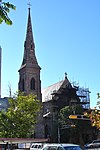
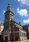
Church of the Immaculate Conception Church of the Immaculate Conception December 10, 2003 (#03001277 ) 642 Market St. 39°56′41″N 75°07′08″W / 39.944722°N 75.118889°W / 39.944722; -75.118889 (Church of the Immaculate Conception ) Camden
11
Cooper Grant Historic District Cooper Grant Historic District January 30, 1989 (#87002229 ) Point, N. Front, Linden, Penn & N. Second Sts. 39°56′58″N 75°07′32″W / 39.949444°N 75.125556°W / 39.949444; -75.125556 (Cooper Grant Historic District ) Camden
12
Cooper Library in Johnson Park Cooper Library in Johnson Park March 11, 1980 (#80002473 ) 2nd and Cooper Sts. 39°56′53″N 75°07′31″W / 39.948056°N 75.125278°W / 39.948056; -75.125278 (Cooper Library in Johnson Park ) Camden
13
Cooper Street Historic District Cooper Street Historic District August 7, 1989 (#89001057 ) Cooper St. from 2nd to 7th Sts. 39°56′49″N 75°07′17″W / 39.946944°N 75.121389°W / 39.946944; -75.121389 (Cooper Street Historic District ) Camden
14
Joseph Cooper House Joseph Cooper House March 14, 1973 (#73001086 ) Head of 7th St. in Pyne Point Park 39°57′16″N 75°06′57″W / 39.954444°N 75.115833°W / 39.954444; -75.115833 (Joseph Cooper House ) Camden
15
James M. Downey Building James M. Downey Building August 22, 1990 (#90001261 ) 521 Cooper St. 39°56′16″N 75°07′14″W / 39.937778°N 75.120556°W / 39.937778; -75.120556 (James M. Downey Building ) Camden
16
East End Trust Company East End Trust Company August 22, 1990 (#90001254 ) 2614-2616 Federal St. 39°56′46″N 75°05′19″W / 39.946111°N 75.088611°W / 39.946111; -75.088611 (East End Trust Company ) Camden
17
Fairview District Fairview District November 19, 1974 (#74001157 ) Roughly bounded by Newton Creek, Crescent Blvd., Mt. Ephraim Ave., Olympia and Hull Rds. 39°54′20″N 75°06′17″W / 39.905556°N 75.104722°W / 39.905556; -75.104722 (Fairview District ) Camden
18
Federal Building and Courthouse Federal Building and Courthouse January 4, 2012 (#11000992 ) 401 Market St. 39°56′46″N 75°07′19″W / 39.946217°N 75.121872°W / 39.946217; -75.121872 (Federal Building and Courthouse ) Camden
19
Finance Building Finance Building August 22, 1990 (#90001260 ) 549-559 Cooper St. 39°56′48″N 75°07′11″W / 39.946667°N 75.119722°W / 39.946667; -75.119722 (Finance Building ) Camden Demolished.[ 7]
20
First Camden National Bank & Trust First Camden National Bank & Trust August 24, 1990 (#90001285 ) Jct. of Broadway and Cooper St. 39°56′42″N 75°07′10″W / 39.945°N 75.119444°W / 39.945; -75.119444 (First Camden National Bank & Trust ) Camden
21
Inter-County Mortgage and Finance Company Inter-County Mortgage and Finance Company August 22, 1990 (#90001263 ) 333 Arch St. 39°56′41″N 75°07′26″W / 39.944722°N 75.123889°W / 39.944722; -75.123889 (Inter-County Mortgage and Finance Company ) Camden
22
Macedonia African Methodist Episcopal Church Macedonia African Methodist Episcopal Church March 12, 2012 (#12000108 ) 261-265 Spruce St. 39°56′06″N 75°07′29″W / 39.93489°N 75.124685°W / 39.93489; -75.124685 (Macedonia African Methodist Episcopal Church ) Camden
23
Marcouse Building Marcouse Building August 24, 1990 (#90001266 ) 231 Market St. 39°56′47″N 75°07′28″W / 39.946389°N 75.124444°W / 39.946389; -75.124444 (Marcouse Building ) Camden
24
National State Bank National State Bank August 24, 1990 (#90001267 ) 123 Market St. 39°56′47″N 75°07′34″W / 39.946389°N 75.126111°W / 39.946389; -75.126111 (National State Bank ) Camden
25
New Jersey Safe Deposit and Trust Company New Jersey Safe Deposit and Trust Company August 24, 1990 (#90001265 ) Market and Third Sts. 39°56′47″N 75°07′40″W / 39.946389°N 75.127778°W / 39.946389; -75.127778 (New Jersey Safe Deposit and Trust Company ) Camden
26
Newton Friends' Meetinghouse Newton Friends' Meetinghouse August 12, 1971 (#71000498 ) 722 Cooper St. 39°56′45″N 75°07′01″W / 39.945833°N 75.116944°W / 39.945833; -75.116944 (Newton Friends' Meetinghouse ) Camden
27
Pomona Hall Pomona Hall August 12, 1971 (#71000499 ) Park Blvd. and Euclid Ave. 39°55′51″N 75°05′40″W / 39.930833°N 75.094444°W / 39.930833; -75.094444 (Pomona Hall ) Camden
28
Sears, Roebuck and Company Retail Department Store-Camden Sears, Roebuck and Company Retail Department Store-Camden July 27, 2000 (#00000795 ) 1300 Admiral Wilson Blvd. 39°56′37″N 75°06′37″W / 39.943611°N 75.110278°W / 39.943611; -75.110278 (Sears, Roebuck and Company Retail Department Store-Camden ) Camden Demolition in progress[ 8]
29
Edward Sharp House Edward Sharp House February 29, 1980 (#80002474 ) 200 Cooper St. 39°56′50″N 75°07′30″W / 39.947222°N 75.125°W / 39.947222; -75.125 (Edward Sharp House ) Camden
30
Smith-Austermuhl Insurance Company Smith-Austermuhl Insurance Company August 24, 1990 (#90001301 ) NW corner of 5th and Market Sts. 39°56′49″N 75°07′17″W / 39.946944°N 75.121389°W / 39.946944; -75.121389 (Smith-Austermuhl Insurance Company ) Camden
31
South Camden Historic District South Camden Historic District September 28, 1990 (#90001453 ) Roughly bounded by Jackson St., S. Fourth St., Chelton Ave. and Railroad Ave. 39°55′18″N 75°07′13″W / 39.921667°N 75.120278°W / 39.921667; -75.120278 (South Camden Historic District ) Camden
32
South Camden Trust Company South Camden Trust Company August 24, 1990 (#90001255 ) Broadway at Ferry St. 39°55′19″N 75°07′12″W / 39.921944°N 75.12°W / 39.921944; -75.12 (South Camden Trust Company ) Camden
33
South Jersey Gas, Electric and Traction Company Office Building South Jersey Gas, Electric and Traction Company Office Building January 5, 2005 (#04001436 ) 418 Federal St. 39°56′51″N 75°07′16″W / 39.9475°N 75.121111°W / 39.9475; -75.121111 (South Jersey Gas, Electric and Traction Company Office Building ) Camden
34
St. Joseph Polish Catholic Church St. Joseph Polish Catholic Church December 18, 2003 (#03001307 ) 1010 Liberty St. 39°55′49″N 75°06′36″W / 39.930278°N 75.11°W / 39.930278; -75.11 (St. Joseph Polish Catholic Church ) Camden
35
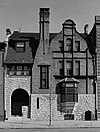
Dr. Henry Genet Taylor House and Office Dr. Henry Genet Taylor House and Office August 12, 1971 (#71000500 ) 305 Cooper St. 39°56′51″N 75°07′23″W / 39.9475°N 75.123056°W / 39.9475; -75.123056 (Dr. Henry Genet Taylor House and Office ) Camden
36
USS New Jersey (BB-62) USS New Jersey (BB-62) September 17, 2004 (#04000980 ) 62 Battleship Place 39°56′31″N 75°07′57″W / 39.941944°N 75.1325°W / 39.941944; -75.1325 (USS New Jersey (BB-62) ) Camden
37
Victory Trust Company Upload image August 24, 1990 (#90001257 ) Broadway and Spruce St. 39°56′06″N 75°07′11″W / 39.935°N 75.119722°W / 39.935; -75.119722 (Victory Trust Company ) Camden
38
George Whitman House George Whitman House October 11, 1990 (#90001482 ) 431 Stevens St. 39°56′31″N 75°07′24″W / 39.941944°N 75.123333°W / 39.941944; -75.123333 (George Whitman House ) Camden Demolished.[ 6]
39
Walt Whitman House Walt Whitman House October 15, 1966 (#66000461 ) 330 Mickle St. 39°56′33″N 75°07′26″W / 39.9425°N 75.123889°W / 39.9425; -75.123889 (Walt Whitman House ) Camden
40
Walt Whitman Neighborhood Walt Whitman Neighborhood January 20, 1978 (#78001752 ) 326-332 Mickle St. 39°56′32″N 75°07′26″W / 39.942222°N 75.123889°W / 39.942222; -75.123889 (Walt Whitman Neighborhood ) Camden
41
Wilson Building Wilson Building August 24, 1990 (#90001259 ) Cooper St. and Broadway 39°56′46″N 75°07′08″W / 39.946111°N 75.118889°W / 39.946111; -75.118889 (Wilson Building ) Camden
42
A. S. Woodruff and Law Buildings A. S. Woodruff and Law Buildings August 24, 1990 (#90001264 ) 328-330 Market St. 39°56′45″N 75°07′23″W / 39.945833°N 75.123056°W / 39.945833; -75.123056 (A. S. Woodruff and Law Buildings ) Camden


