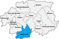
Trebušovce
Appearance
Trebušovce | |
|---|---|
 | |
| Coordinates: 48°07′N 19°12′E / 48.117°N 19.200°E | |
| Country | |
| Region | Banská Bystrica Region |
| District | Veľký Krtíš District |
| Government | |
| • Mayor | Marek Krnáč (Hungarian Alliance) |
| Area | |
• Total | 9.48 km2 (3.66 sq mi) |
| Population (2021)[3] | |
• Total | 169 |
| • Density | 18/km2 (46/sq mi) |
| Time zone | UTC+1 (CET) |
| • Summer (DST) | UTC+2 (CEST) |
| Postal code | 991 27 |
| Area code | +421-47 |
Trebušovce (Hungarian: Terbegec) is a village and municipality in the Veľký Krtíš District of the Banská Bystrica Region of southern Slovakia.
Geography
[edit]It is located around 20 kilometres (12 mi) southwest of Veľký Krtíš.
Demographics
[edit]According to the 2021 census, it had a population of 169 inhabitants.
History
[edit]After the Treaty of Trianon it became part of Czechoslovakia. As a result of the First Vienna Award, it returned to the Kingdom of Hungary until the end of WW II. Afterwards it again became part of Czechoslovakia until the Velvet Divorce. Since then it has been part of Slovakia.
Notable people
[edit]References
[edit]- ^ "Súbory na stiahnutie - Voľby do orgánov samosprávy obcí 2022". volby.statistics.sk. Retrieved 5 September 2024.
- ^ "Registry of Land" (PDF). www.skgeodesy.sk. Retrieved 5 September 2024.
- ^ "SODB2021 - Population - Basic results". www.scitanie.sk. Retrieved 5 September 2024.
- ^ "Ernö Gerö". www.oxfordreference.com. Retrieved 5 September 2024.
External links
[edit]


