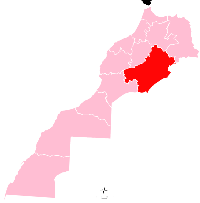
Tinejdad
Appearance
Tinejdad
تنجداد | |
|---|---|
City | |
 | |
| Coordinates: 31°30′N 5°01′W / 31.500°N 5.017°W | |
| Country | |
| Region | Drâa-Tafilalet |
| Province | Errachidia |
| Population (2014) | |
| • Total | 43,999[1] |
| Time zone | UTC+0 (WET) |
| • Summer (DST) | UTC+1 (WEST) |
Tinejdad (Arabic: تنجداد) is a city in Errachidia Province, Drâa-Tafilalet, Morocco. According to the 2014 census it has a population of 43,999.[1]
References
[edit]- ^ a b "عدد سكان تنجداد الكبرى بلغ 43999 حسب إحصاء السكان والسكنى لسنة 2014". tinjdad24.com (in Arabic). March 22, 2015. Archived from the original on July 19, 2017. Retrieved 19 May 2023.
External links
[edit]Wikimedia Commons has media related to Tinejdad.


