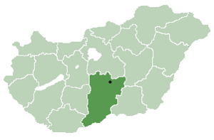
Tataháza
Appearance
Tataháza | |
|---|---|
 | |
| Coordinates: 46°10′27″N 19°18′22″E / 46.1742°N 19.3061°E | |
| Country | |
| County | Bács-Kiskun |
| Government | |
| • Type | Mayor-council government |
| • Mayor | István Vörös[1] (Ind.) |
| Area | |
| • Total | 26.10 km2 (10.08 sq mi) |
| Population (2018) | |
| • Total | 1,151[2] |
| Time zone | UTC+1 (CET) |
| • Summer (DST) | UTC+2 (CEST) |
| Postal code | 6451[3] |
| Area code | 79 |

Tataháza (Croatian: Tataza) is a village in Bács-Kiskun county, in the Southern Great Plain region of southern Hungary.
Geography
[edit]It covers an area of 26.10 km2 (10 sq mi) and has a population of 1,151 people (2018).
Demography
[edit]Magyars and small community of Croats.
A Jewish community lived in the village, until the Holocaust of the Hungarian Jews, some of them were murdered and the community disintegrated.[1]
References
[edit]External links
[edit]- (in Hungarian) Tataháza hivatalos oldala
- (in Croatian) Hrvatski glasnik 33/2006. Ljetna plesna škola u Aljmašu
46°10′N 19°18′E / 46.167°N 19.300°E


