Kiskunmajsa
Appearance
This article includes a list of references, related reading, or external links, but its sources remain unclear because it lacks inline citations. (January 2019) |
Kiskunmajsa | |
|---|---|
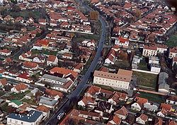
 Aerial photograph of Kiskunmajsa | |
| Coordinates: 46°29′32″N 19°44′13″E / 46.49231°N 19.73683°E | |
| Country | |
| County | Bács-Kiskun |
| District | Kiskunmajsa |
| Area | |
• Total | 221.99 km2 (85.71 sq mi) |
| Population (2009) | |
• Total | 11,707 |
| • Density | 53.5/km2 (139/sq mi) |
| Time zone | UTC+1 (CET) |
| • Summer (DST) | UTC+2 (CEST) |
| Postal code | 6120 |
| Area code | (+36) 77 |
| Website | www |
Kiskunmajsa is a town in the Kiskunmajsa district of Bács-Kiskun county, Hungary.
Twin towns – sister cities
[edit]Kiskunmajsa is twinned with:[1]
 Bačka Topola, Serbia
 Bad Schönborn, Germany
 Baiyin, China
 Gheorgheni, Romania
 Lommatzsch, Germany
 Lubliniec, Poland
 Ukmergė, Lithuania
Gallery
[edit]References
[edit]- ^ "Testvérvárosok". kiskunmajsa.hu (in Hungarian). Kiskunmajsa. Retrieved 2021-03-29.
External links
[edit]Wikimedia Commons has media related to Kiskunmajsa.
- Official website in Hungarian


