
Southshore, New Zealand
Southshore | |
|---|---|
 Southshore and South New Brighton | |
 | |
| Coordinates: 43°33′0″S 172°44′51″E / 43.55000°S 172.74750°E | |
| Country | New Zealand |
| City | Christchurch |
| Local authority | Christchurch City Council |
| Electoral ward | Coastal |
| Community board | Waitai Coastal-Burwood-Linwood |
| Area | |
| • Land | 124 ha (306 acres) |
| Population (2018 Census)[2] | |
• Total | 1,041 |
| South New Brighton | ||
| (Avon Heathcote Estuary) |
|
(Pegasus Bay) |
| Sumner |
Southshore (Māori: Te Kōrero Karoro) is an eastern coastal suburb within Christchurch, New Zealand. It is located on a narrow 2.5 km (1.6 mi) long sandspit that runs along the eastern side of the Avon Heathcote Estuary and west of the Pacific Ocean. The suburb is 8 km (5.0 mi) east of the city centre and 5 km (3.1 mi) south of New Brighton's main retail area.
Before urbanisation, the area was largely swampland bordered by large coastal dunes which had some Māori presence. The area holds strong historical and cultural importance to the local Māori hapū, Ngāi Tūāhuriri, because the land and estuary provided a large amount of resources and seafood. Prehistoric evidence of middens in the area combined with Māori occupation on the sandspit indicates a high potential for the presence of archaeology in the area.
In its early years, the area was known locally to early European settlers as Sandhills Run. They constructed baches (holiday homes) and established a dairy station in the suburb. Southshore initially had very few permanent residents due to the absence of facilities and insufficient transportation; it was later urbanised in the late 1940s. The area was damaged in the 2011 Christchurch earthquake and 198 properties were red-zoned. Southshore is prone to coastal-related hazards such as tsunamis and sea level rise. Nationally, Southshore is part of the Christchurch East parliamentary electorate. It is within the coastal ward for local elections.
Southshore's population predominantly consists of European New Zealanders; its above-average housing costs and coastal setting attracts an older demographic to the area. Notable people with connections to the suburb include the motorcycle speedway rider Ivan Mauger, the former deputy-mayor of Christchurch Peter Skellerup, and the former chairman of the Ngāi Tahu Māori Trust Tipene O'Regan.
Toponymy
[edit]The Māori name for the sandspits are Te Kōrero Karoro,[a][5][6] meaning 'the chattering of the seagulls' or 'the meeting place of the seagulls',[7] and Te Ihutai, literally meaning 'the nose of the tides'.[8]
Prior to the 20th century the area was known locally to early European settlers as Sandhills Run, a name no longer in common usage.[9] The name Southshore was officially adopted in 1955.[10] At the time, the Canterbury Museum advocated for the Māori name Te Kōrero Karoro; however, many locals disliked this proposal because they thought it was "too long" and names of Māori origin were generally unpopular on the South Island.[11] The name "Southend" was suggested by the Christchurch City Council, but many residents preferred Southshore, which had been in use for over a decade and was also the name of an early residential subdivision in the suburb.[12][13]
History
[edit]Māori settlement
[edit]Like the rest of Christchurch, the Māori were the first settlers to the area.[14] Southshore was considered an important food-gathering place by local Māori. The area and the estuary were home to a wide range of birds and plants. There were many wharenui (the Māori term for a type of communal house) around the estuary, which were mainly built from raupō and other native trees.[15][16] Southshore holds historical and cultural importance to local Māori because it has an abundance of pipi and flounder in the estuary. Archaeological evidence of middens in the area combined with the Māori history in the area indicates a high potential for the presence of archaeology in the area.[17][18]
In the eighteenth century, Māori predominantly grew aruhe and kūmara in the sandy soil around the area of the Ōtākoro / Avon River.[19] Early European settlers discovered Māori fishing equipment, eel traps and hāngī pits, which were used by the Māori primarily to cook seafood. In Southshore's early years, a local jogger presumably discovered a wharenui totem in the sand dunes near Tern Street, but others dispute this, as there is no documentation. Later, a skull was discovered which dated to Māori occupation of the area.[15]
Southshore holds cultural significance for Ngāi Tūāhuriri, who are the kaitiaki (caretakers) of the area, and have special food-gathering rights in the estuary and the area.[20][21] There was a walking track from the fortified settlement of Kaiapoi Pā towards South New Brighton, and onwards further to the area now known as Southshore and beyond across the Avon Heathcote Estuary to the Banks Peninsula.[22][23] There was also a sand dune walking track called Pohoareare, between the Ōpāwaho settlement to New Brighton and onwards to Te Kōrero Karoro.
European settlement
[edit]Prior to the 20th century the area was known locally to early European settlers as "Sandhills Run". As more settlers arrived, they constructed baches and established a dairy station in the suburb.[9][24] In 1916, most of the suburb was subdivided into residential sections. There was sparse transportation and lack of facilities in the area in the early twentieth century and Southshore had very few permanent residents.[25][26] The spit was used as a gun range for volunteers to practise during World War I and following.[27] A local resident between 1940 and 1945 noted that the New Zealand Army bulldozed the sandhills and removed the vegetation around Caspian Street to set up a position for defence. This work possibly lowered the land surface here, and the area is prone to extensive flooding by estuary and sea waters. In 1958, another local resident filled a marshy area in use of six sections before building at the Caspian Street and Estuary Road intersection.[28] Development in the suburb was slow because of the absence of facilities, soon receiving a water supply until 1954.[29][30] In 1953, Southshore residents received electricity.[31] Southshore grew rapidly and was heavily urbanised after World War II in the late 1940s. Southshore later received a sewerage system in 1967. Channelling and kerbs were installed to the suburb's main road, Rocking Horse Road, which often flooded.[32][28]
There is a large public reserve at the southern end of the suburb, which is the location of most of the suburb's recreational activities.[33] Southshore has no primary or secondary schools, the nearest primary school is South New Brighton School (established in 1922), 3.2 km (2.0 mi) to the north.[34][35] A few decades ago, the only residential buildings in Southshore were baches. Today, Southshore is home to a range of residences, from large modern homes with all the early homes that have been mostly renovated. Not much land in the suburb is left undeveloped.[36][b] Its housing type is mid-20th century to contemporary homes.[37]
Geography
[edit]
Southshore is sited on a narrow sandspit which is situated between the Pacific Ocean and the Avon Heathcote Estuary. The Avon-Heathcote Estuary was formed between 1000 and 2000 years ago by longshore drift.[38][39] Sand from the mouth of the Waimakariri River was carried southward the east coast of the South Island, and built up along the coastline of what is now Christchurch, progressively forming what is known as the Southshore Spit.[40] The spit is a 2.5 km (1.6 mi) long sandspit with a minimum width of about 300 m (980 ft) at the suburb's boundary with South New Brighton and a maximum width of 500 m (1,600 ft) at its southern end.[41]
To the north of Southshore is South New Brighton's main retail area; to the south of the suburb across the estuary lies the suburb of Sumner and Rapanui Rock,[42] also known as "Shag Rock".[43] The Sumner bar forms a natural barrier between the suburbs. Other suburbs across the estuary include Redcliffs, Mount Pleasant, and Ferrymead.[42]
Prior to European settlement, the area now occupied by Rockinghorse Road from Heron Street to Torea Street was largely swampland, bordered by large coastal sand dunes, that were prone to flooding at high tide.[44][45] In Christchurch's early years, the Brighton spit generally referred to all the land south of Bridge Street. Today, the Southshore's boundary with South New Brighton is considered to be Caspian Street.[46][47][c] The western side of the Southshore spit commands views of the estuary, other eastern suburbs of Christchurch, and parts of the Hillsborough spur.[42]
Christchurch's coastline is characterised by intermediate-type sandy beaches. Historically, coastal dunes provided important resources for local Māori, including weaving materials from made the natural sand binder pīngao. In the 19th century, naitive vegetation were removed or burned by early European settlers. Introduced plants such as marram grass were rebuilt and stabilised when the settlers realised the dunes were a useful coastal protection resource.[48]
As a coastal suburb, Southshore is exposed to complex sea-level rise scenarios, flooding and coastal erosion risks.[49][50] As of 2024[update], the Christchurch City Council has approved NZ$12,500,000 in funding to address issues related to erosion and flooding in Southsore and South New Brighton.[51] The council rejected a request to restore collapsed walls along the red-zoned estuary edge, and have proposed a cobble beach along the eastern edge of the estuary. Challenges to the proposed plan are the local archaeological sites and coastal bird populations.[52][53] Southshore is also prone to other sea-related hazards such as tsunamis and storms.[54][55]
Gallery
[edit]- Gallery of the suburb
-
 Tī kōuka in the sand dunes near Tern Street.
 -
 Aerial view of Southshore (1974)
 -
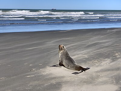 A young seal on the beach


Governance
[edit]The Christchurch City Council administers Southshore. It is part of the Coastal ward for city council elections.[56] As of 2024[update], the elected councillor is Celeste Donovan.[57] Nationally, Southshore is part of the Christchurch East parliamentary electorate. As of 2023[update], the elected member of parliament is Reuben Davidson of the Labour Party.[58] Historically, Christchurch East has supported the Labour Party in general elections and is considered one of Labour's safest seats.[59]
Demographics
[edit]Southshore is part of the South New Brighton SA2 statistical area.[60]
| Year | Pop. | ±% p.a. |
|---|---|---|
| 2006 | 1,395 | — |
| 2013 | 1,137 | −2.88% |
| 2018 | 1,041 | −1.75% |
| Source: [2] | ||
Southshore, comprising the SA1 statistical areas of 7026559–560 and 7026572–575, covers 1.24 km2 (0.48 sq mi).[1] In the 2018 New Zealand census, the population was 1,041, a decrease of 96 people (−8.4%) from the 2013 census and 354 people (−25.4%) from the 2006 census. There were 417 households containing 519 males and 525 females, giving a sex ratio of 0.99 males per female. 198 people (19.0%) were aged under 15 years, 162 (15.6%) were aged 15 to 29, 498 (47.8%) were aged 30 to 64 and 183 (17.6%) were aged 65 or older.
Ethnicities were 94.2% European/Pākehā, 12.1% Māori, 3.2% Pasifika, 2.6% Asian, and 3.2% other ethnicities. People may identify with more than one ethnicity.
Although some people chose not to answer the census's question about religious affiliation, 59.7% had no religion, 28.8% were Christian, 0.3% had Māori religious beliefs, 0.3% were Hindu, 0.6% were Muslim, 0.9% were Buddhist and 2.3% had other religions.
Of those at least 15 years old: 195 (23.1%) people had a bachelor's or higher degree, and 117 (13.9%) people had no formal qualifications; 159 people (18.9%) earned over $70,000 compared to 17.2% nationally; and 408 (48.4%) people were employed full-time, 162 (19.2%) part-time and 30 (3.6%) were unemployed.[2]
Compared to Canterbury region more broadly, Southshore's has higher proportions of European New Zealanders, women and home-owners. Southshore's above-average housing costs, and the coastal setting of the suburb, attracted an older demographic to the area.[61]
Canterbury earthquakes
[edit]

Southshore was hit hard by the 4 September 2010 Canterbury and 22 February 2011 Christchurch earthquakes. Damage was caused to houses and land. Southshore was initially put into the orange zone before the beach side was zoned green on 29 October 2011.[62][63] The estuary side remained in the orange zone awaiting a decision whether it was financially worth repairing and rebuilding on that land due to the extensive damage caused by the two main shakes and aftershocks.[62]
In August 2011, residents were informed that they could expect a land zoning decision within six weeks. Later that month, it was announced that the decision would be released in September. In mid-September, the decision was delayed due to "unexpected complexity". On 12 October, Gerry Brownlee as Earthquake Recovery Minister apologised for the delay and asked for another two weeks of patience.[64] In mid-December, Brownlee stated that a decision would be made "prior to Christmas".[62][65]
One of the last areas to receive a formal red-zoning decision was Southshore.[66] It was publicly released on 18 May 2012, with 198 of the properties zoned red and the remaining 203 properties allowed to be lived in.[67][68] Households which were committed to stay in Southshore, tended to disagree with the red-zoning scheme and frequently sought legal advice or geotechnical explanations for its implementation. For other committed stayers, earthquake damage combined with the lack of amenities in the suburb had less impact on their dedication to the community of Southshore.[69] As of 2024[update] the red-zoned western side of the suburb facing the estuary is an urban green space.[70]
Transport
[edit]
Historically, Southshore was an important travel route for the Māori. They used the sandspit as a through route between Kaiapoi Pā and the wider Banks Peninsula area.[71] In European times, a longstanding aspiration of many people in Christchurch is a bridge across the estuary connecting the area of Southshore to Sumner. However, the project has faced several issues. For example, a local farmer grazed livestock at the southern end of the spit, and some people denied the bridge builders easy access through their land.[72][73] Similarly, there was another proposal in 2014 to install a "chain ferry link" across the estuary, but this idea was never finalised.[74]
Since 1939, the suburb's main and only entrance has been Rocking Horse Road. Road access to Southshore was very uneven and overgrown with gorse and lupin. The name reportedly originates from Peter Skellerup, a former deputy-mayor of the city, who drove the road in its early years, describing it to his son as "travelling on a rocking horse" (before it was metalled and levelled). This name was made official in 1949.[75][76]
A bridge was built in 1926 in South New Brighton.[73] In October 1952, bus services were introduced to the area.[77] A new bridge was later built in 1981. The same year, the bus service extended to the end of Rocking Horse Road.[78]
As of 2024[update], Southshore's public transport is served by the Hillmorton—Southshore (route 60) bus service operated under the Metro brand. It serves neighbouring suburbs; its final destination is the suburb of Wigram (not Hillmorton) on the opposite edge of the city.[79]
Notable people
[edit]Many of the notable people with connections to Southshore are original to the area and have lived there for most of their lives.[80]
- Ivan Mauger, motorcycle speedway rider, once considered to be one of the world's "Greatest Riders"[81][82]
- Peter Skellerup, industrialist, philanthropist and former deputy-mayor of Christchurch from 1974 to 1980[83]
- Richard Petrie, international cricketer who played 12 One Day Internationals[84]
- Tipene O'Regan, academic and former chairman of the Ngāi Tahu Māori Trust. He vacated the suburb when his section was red-zoned.[85][86]
References
[edit]Notes
[edit]- ^ Te Kōrero Karoro refers to the entirety of Southshore and the southern area of South New Brighton.[3][4]
- ^ Excluding the land located in the residential red zone.
- ^ Christchurch has no official definition of the boundaries of suburbs, and as a result there may be inconsistencies between sources about some boundaries. A sign is also located on Caspian Street indicating Southshore's presumed boundaries.
Citations
[edit]- ^ a b "ArcGIS Web Application". statsnz.maps.arcgis.com. Archived from the original on 24 March 2023. Retrieved 7 October 2021.
- ^ a b c "Statistical area 1 dataset for 2018 Census". Statistics New Zealand. March 2020. 7026559–560 and 7026572–575.
- ^ Harris, As it was: early Maori and European settlement, pp. 15–16, cited in Owen 1992, fig. 2.
- ^ Moore Davis 2015, p. 6.
- ^ Gillespie, Noel (2007). Opawa: The Outpost on the Banks of the Heathcote: The Colourful History of One of Christchurch's Oldest Settlements. Christchurch, New Zealand. p. 1–2. ISBN 9780473124045.
{{cite book}}: CS1 maint: location missing publisher (link) - ^ Owen 1992, p. 15.
- ^ Taylor 1952, p. 46; Andersen 1927, p. 99.
- ^ Rowlands, Moore & Osborn 2006, p. 12.
- ^ a b Penney 1982, pp. 191–192.
- ^ "Christchurch Place Names: N-Z : South New Brighton" (PDF). Christchurch City Libraries. February 2016. p. 81. Archived (PDF) from the original on 20 October 2016. Retrieved 20 May 2024.
- ^ Rowlands, Moore & Osborn 2006, pp. 55–56.
- ^ Rowlands, Moore & Osborn 2006, p. 55.
- ^ "South Brighton Sandspit". The Press. 10 August 1955. Archived from the original on 5 June 2024. Retrieved 5 June 2024 – via Papers Past.
- ^ Rice 2008, pp. 9–10.
- ^ a b Rowlands, Moore & Osborn 2006, pp. 11, 13, 19.
- ^ Brailsford, Barry (1981). The Tattooed Land The Southern Frontiers of the Pa Maori. The Eltham Borough Council. p. 182. ISBN 0958350221.
- ^ Moore Davis 2015, pp. 6–7; Walsh 1971, p. 85–86.
- ^ Gates, Charlie (3 August 2013). "Finds rewrite Chch history". The Press. Christchurch, New Zealand. ISSN 0113-9762. ProQuest 1417050068.
- ^ Rowlands, Moore & Osborn 2006, pp. 15, 19.
- ^ Rowlands, Moore & Osborn 2006, pp. 7, 19.
- ^ "South New Brighton Reserves Management Plan" (PDF). Christchurch City Council. 2014. Archived (PDF) from the original on 18 November 2015. Retrieved 3 June 2024.
- ^ Rowlands, Moore & Osborn 2006, pp. 14–19.
- ^ Beattie 1945, p. 100.
- ^ Biggs, Leslie Ronald. The formation, control, and utilisation of the coastal sand dunes between the Waimakariri River and the Sumner estuary (Master of Arts thesis). University of Canterbury. p. 26. Archived from the original on 29 May 2024. Retrieved 28 May 2024.
- ^ Penney 1982, p. 192–197.
- ^ O'Brien, Ray (2008). Memories of Pleasant Point Yacht Club, 1921–1980. Pleasant Point Yacht Club. p. 12.
- ^ Rowlands, Moore & Osborn 2006, p. 44.
- ^ a b Findlay & Kirk 1998, p. 103.
- ^ Hillier 2006, pp. 45–46, cited in Rowlands, Moore & Osborn 2006.
- ^ "Southshore Ratepayers' Association". The Press. No. 27401. 14 July 1954. Archived from the original on 24 September 2024. Retrieved 16 September 2024 – via Papers Past.
- ^ Rowlands, Moore & Osborn 2006, p. 63.
- ^ Rowlands, Moore & Osborn 2006, pp. 50–107.
- ^ Greenaway, R. (2007). Avon-Heathcote Estuary recreation survey 2006–2007. Christchurch, New Zealand: Rob Greenaway and Associates. p. 12.
- ^ "Distance between Southshore and South New Brighton School, Canterbury, (New Zealand)". Distance Calculator via GlobeFeed.com. 2023. Archived from the original on 3 June 2024. Retrieved 3 June 2024.
- ^ Rowlands, Moore & Osborn 2006, p. 47.
- ^ McDonald, Liz (12 June 2004). "Seaside modern". The Press. Christchurch, New Zealand. ISSN 0113-9762. ProQuest 314633588.
- ^ "Suburb snapshot Southshore: [2 Edition]". The Press. Christchurch, New Zealand. 21 January 2006. ProQuest 314776065.
- ^ Macpherson, J. M. (1978). Environmental geology of the Avon-Heathcote Estuary (Doctor of Philosophy thesis). Christchurch, New Zealand: University of Canterbury. p. 11. doi:10.26021/8183. Archived from the original on 24 September 2024. Retrieved 5 June 2024.
- ^ Rowlands, Moore & Osborn 2006, p. 82.
- ^ Harris, A sense of place and time, p.5, cited in Owen 1992, pp. 5, 188.
- ^ Comfort 1995, pp. 36–36.
- ^ a b c "Place name detail: Southshore". New Zealand Gazetteer. New Zealand Geographic Board. Retrieved 16 September 2024.
- ^ O'Callaghan, Jody (12 June 2020). "Shag Rock defacer apologises". The Press. Christchurch, New Zealand. ISSN 0113-9762. ProQuest 2411730297.
- ^ Rowlands, Moore & Osborn 2006, p. 83.
- ^ Findlay & Kirk 1998, p. 104.
- ^ Rowlands, Moore & Osborn 2006, pp. 81–82.
- ^ Comfort 1995, pp. 4.
- ^ Hart, Deirdre E; Knight, Gemma A (2009). "Geographic Information System Assessment of Tsunami Vulnerability on a Dune Coast". Journal of Coastal Research. 25 (1). Allen Press Inc.: 132. doi:10.2112/07-0960.1.
- ^ Comfort 1995, pp. 98, 102–104, 116.
- ^ Rowlands, Moore & Osborn 2006, p. 97.
- ^ Church, Logan (12 November 2020). "$12.5m to fight erosion and flooding in Southshore and South New Brighton". The New Zealand Herald. Archived from the original on 6 June 2024. Retrieved 31 May 2024.
- ^ Law, Tina (26 January 2024). "'Milestone' reached in long-awaited estuary edge development". The Press. Archived from the original on 23 February 2024. Retrieved 31 May 2024.
- ^ "How can Southshore live with the sea?". Radio New Zealand. 7 August 2017. Archived from the original on 30 June 2019. Retrieved 31 May 2024.
- ^ Comfort 1995, p. 9.
- ^ Robson, Seth (8 November 1998). "Danger alert for trendy suburbs". The Press. Christchurch, New Zealand. ISSN 0113-9762. ProQuest 314144453.
- ^ "Coastal Ward Profile" (PDF). Christchurch City Council. Archived (PDF) from the original on 18 May 2024. Retrieved 15 September 2024.
- ^ Barcley, Chris (28 January 2022). "Coastal ties go back to childhood for Celeste Donovan". Otago Daily Times. Archived from the original on 18 May 2024. Retrieved 1 June 2024.
- ^ Morton, Nathan (16 October 2023). "Election 2023 results: The South Island's new elected leaders following blue tidal wave". The New Zealand Herald. Archived from the original on 16 October 2023. Retrieved 16 October 2023.
- ^ Law, Tina (13 March 2023). "Labour stalwart wins selection to contest Christchurch East". Stuff. Archived from the original on 12 January 2024. Retrieved 1 June 2024.
- ^ 2018 Census place summary: South New Brighton
- ^ Dickinson 2019, p. 279.
- ^ a b c Greenhill 2012.
- ^ Utteridge, Phoebe (18 September 2024). "Christchurch's greatest comeback: The revival of the eastern suburbs". Stuff. Retrieved 6 October 2024.
- ^ "Zoning delay". The Press. Christchurch, New Zealand. 1 May 2012. ISSN 0113-9762. ProQuest 1010265580.
- ^ Greenhill, Marc (19 December 2011). "Orange-zone homeowners may get news this week". Christchurch, New Zealand. ISSN 0113-9762. ProQuest 912157000.
- ^ Dickinson 2019, p. 279–280.
- ^ Young, Rachel (18 May 2012). "Southshore decision 'devastating'". The Press. Archived from the original on 21 June 2022. Retrieved 21 June 2022.
- ^ "Land zone announcement Friday 18 May 2012". Canterbury Earthquake Recovery Authority. 18 May 2012. Archived from the original on 16 November 2012. Retrieved 9 June 2024.
- ^ Dickinson 2019, p. 282–284.
- ^ Harvie, Will (7 April 2024), "For lease? Red-zoned driveways could be rented to neighbours", The Press, archived from the original on 10 June 2024, retrieved 10 June 2024
- ^ Moore Davis 2015, p. 6, 16.
- ^ "The Estuary bridge which is still awaited". The Press. No. 34125. 10 April 1976. Archived from the original on 17 September 2024. Retrieved 17 September 2024 – via Papers Past.
- ^ a b Walsh 1971, p. 47.
- ^ Killick, David (26 November 2014). "Coastal pathway will enhance city lifestyle". Stuff. Archived from the original on 6 October 2015. Retrieved 27 May 2024.
- ^ Penney 1982, p. 194; Walsh 1971, p. 120.
- ^ Rowlands, Moore & Osborn 2006, p. 56–57.
- ^ Penney 1982, pp. 199–200.
- ^ Rowlands, Moore & Osborn 2006, pp. 55, 80.
- ^ "Hillmorton / Southshore, Metro". Metro Info. Archived from the original on 8 May 2024. Retrieved 20 May 2024.
- ^ Rowlands, Moore & Osborn 2006, p. 129–141.
- ^ Rowlands, Moore & Osborn 2006, p. 132.
- ^ Lewis, Oliver (28 April 2018). "Life story: Speedway rider Ivan Mauger remembered as the greatest of all time". Stuff. Archived from the original on 27 August 2018. Retrieved 6 June 2024.
- ^ Rowlands, Moore & Osborn 2006, p. 129.
- ^ Rowlands, Moore & Osborn 2006, p. 137.
- ^ McCrone, John (8 February 2014). "Sir Tipene O'Regan: Man of mana". The Press. Archived from the original on 28 December 2021. Retrieved 6 June 2024.
- ^ "O'Regan reunited with tokotoko". The Press. Christchurch, New Zealand. 16 June 2012. ISSN 0113-9762. ProQuest 1020576669.
Works cited
[edit]- Rowlands, Don; Moore, Peter; Osborn, Lee (2006). Sand Dunes to Suburb. Christchurch, New Zealand: Southshore Residents' Association History Group.
- Walsh, Geo. W. (1971). New Brighton : A Regional History 1852–1970. Christchurch, New Zealand: A & C Arts Ltd.
- Penney, Sarah E. W. (1982). The Estuary of Christchurch. Christchurch, New Zealand: Penney Ash Publications.
- Hillier, Lynne (2006). Early European life 1776–1946. Christchurch, New Zealand.
{{cite book}}: CS1 maint: location missing publisher (link) - Comfort, Julie (1995). Lessons From The Past – A History of Coastal Hazards at South Brighton Spit, Christchurch (PDF) (MA (Geography) thesis). University of Canterbury. Archived (PDF) from the original on 19 February 2023. Retrieved 28 May 2024.
- Andersen, J.C (1927). Place-names of Banks Peninsula: a topographical history. Christchurch, New Zealand: New Zealand Government Printer. ISBN 9781877151774. OCLC 3673007.
- Taylor, W.A (1952). Lore and history of the South Island Maori. Christchurch, New Zealand: Bascands. ISBN 9781869643799. OCLC 154645850. Archived from the original on 24 September 2024. Retrieved 8 June 2024 – via Victoria University of Wellington.
- Greenhill, Marc (2 May 2012). "Delays cold and callous, say angry orange-zone residents". The Press. p. 1. Archived from the original on 14 September 2024. Retrieved 14 September 2024 – via University of Canterbury.
- Beattie, J.H. (1945). Māori place-names of Canterbury: including one thousand hitherto unpublished names collected from Māori sources. Dunedin, New Zealand: Otago Daily Times. OCLC 154196301.
- Owen, S.J. (1992). The Estuary Where Our Rivers Meet the Sea Christchurch's Avon-Heathcote Estuary and Brooklands Lagoon. Christchurch, New Zealand: Christchurch City Council. ISBN 9780473015954.
- Moore Davis, Kyle (10 December 2015). "Brief of evidence of Kyle Moore Davis for Te Rūnanga o Ngāi Tahu and Ngā Rūnanga" (PDF). Te Rūnanga o Ngāi Tahu. Archived (PDF) from the original on 7 February 2016. Retrieved 3 June 2024.
- Rice, Geoffrey (2008). Christchurch Changing: An Illustrated History (2nd ed.). Christchurch: Canterbury University Press. ISBN 978-0-908812-53-0.
- Findlay, R. H.; Kirk, R. M. (1 October 1998). "Post‐1847 changes in the Avon‐Heathcote Estuary, Christchurch: A study of the effect of urban development around a tidal estuary". New Zealand Journal of Marine and Freshwater Research. 22. doi:10.1080/00288330.1988.9516283.
{{cite journal}}: CS1 maint: date and year (link) - Dickinson, S. (2019). "Alternative narrations and imaginations of disaster recovery: a case study of relocatees after the Christchurch, New Zealand, earthquakes". Social & Cultural Geography. 22. doi:10.1080/14649365.2019.1574883.
External links
[edit]- How can Southshore live with the sea? on Christchurch Dilemmas via Radio New Zealand