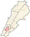
Sir al-Gharbiyah
Sir al-Gharbiyah
سير الغربية | |
|---|---|
Village | |
| Coordinates: 33°19′12″N 35°21′51″E / 33.32000°N 35.36417°E | |
| Grid position | 114/154 L |
| Country | |
| Governorate | Nabatieh Governorate |
| District | Nabatieh District |
| Time zone | UTC+2 (EET) |
| • Summer (DST) | +3 |
| Area code | +961 - (07 - South Lebanon) |
Sir al-Gharbiyah (Arabic: سير الغربية) is a village just north of the Litani River, in the Nabatieh District in southern Lebanon.
History
[edit]In the 1596 tax records, it was named as a village, Sir, in the Ottoman nahiya (subdistrict) of Sagif under the liwa' (district) of Safad, with a population of 10 households, all Muslim. The villagers paid a fixed tax-rate of 25% on agricultural products, such as wheat, barley, olive trees, goats and beehives, in addition to "occasional revenues"; a total of 2,000 akçe.[1][2]
On 23 February 1985, the Israeli Army shot dead seven young men from the village. Six of the dead were aged between fifteen and twenty. They were chosen after a round up of all the village men and machine gunned in the legs, two were bayoneted in the abdomen and one held under water until he drowned.[3][4]
Demographics
[edit]In 2014 Muslims made up 99,63% of registered voters in Sir al-Gharbiyah. 98,76% of the voters were Shiite Muslims.[5]
People
[edit]Hassan Maatouk, the Lebanon national football team all-time goalscorer and most-capped player, is native to Sir al-Gharbiyah.[6]
References
[edit]- ^ Hütteroth and Abdulfattah, 1977, p. 186
- ^ Note that Rhode, 1979, p. 6 writes that the register that Hütteroth and Abdulfattah studied was not from 1595/6, but from 1548/9
- ^ Hirst, David (2010) Beware of Small States. Lebanon, battleground of the Middle East. Faber and Faber. ISBN 978-0-571-23741-8 pp.202-203
- ^ Middle East International No 263, 22 November 1985, Publishers Lord Mayhew, Dennis Walters MP; p.17
- ^ https://lub-anan.com/المحافظات/النبطية/النبطية/صير-الغربية/المذاهب/
- ^ "Hassan Maatouk". Global Sports Archive. Retrieved 13 May 2024.
Bibliography
[edit]- Hütteroth, W.-D.; Abdulfattah, K. (1977). Historical Geography of Palestine, Transjordan and Southern Syria in the Late 16th Century. Erlanger Geographische Arbeiten, Sonderband 5. Erlangen, Germany: Vorstand der Fränkischen Geographischen Gesellschaft. ISBN 3-920405-41-2.
- Rhode, H. (1979). Administration and Population of the Sancak of Safed in the Sixteenth Century (PhD). Columbia University.
External links
[edit]- Sir el Gharbiyeh, Localiban


