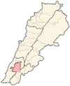
Arnoun
Arnoun
أرنون | |
|---|---|
City | |
| Coordinates: 33°20′0″N 35°32′0″E / 33.33333°N 35.53333°E | |
| Grid position | 130/155 L |
| Country | |
| Governorate | Nabatieh Governorate |
| District | Nabatieh District |
| Elevation | 550 m (1,800 ft) |
| Time zone | UTC+2 (EET) |
| • Summer (DST) | UTC+3 (EEST) |
| Dialing code | +961 |
Arnoun (Arabic: أرنون, Syriac-Aramaic: ܐܪܢܘܢ) is a majority Lebanese Shia village 7 kilometres (4.3 mi) south-east of Nabatiyeh, in Nabatiyeh Governorate, southern Lebanon. The village is located approximately 8 kilometres (5.0 mi) from the Israeli border. The village is approximately 550 metres (1,800 feet) above sea level,[1] and approximately one kilometre (0.62 miles) from the Beaufort Castle.
History
[edit]Arnoun is linked to the nearby Beaufort Castle. The town's name is derived from the Aramaic arnoun, meaning "little top", referring to the highland where the Beaufort Castle stands.[1] The castle itself was referred to as Qal'at Shqif Arnoun (Aramaic: the castle of the high rock on the hill), from which the town took its name.
In 1875 Victor Guérin noted that it contained one hundred "Metualis".[2]
Modern era
[edit]After the establishment of the Israeli Security Zone in southern Lebanon in 1985, Arnoun lay just outside its boundaries, although, from its position at the Beaufort Castle, the Israel Defense Forces (IDF) effectively controlled the village.
On February 17, 1999, after Israel alleged that attacks on IDF forces were launched from Arnoun, the village was formally incorporated into the Security Zone.[3] Most of the village’s 2,000 inhabitants had left in November 1998 when Hizbullah increased the number of operations in the area. In the subsequent months the IDF had demolished twenty-two houses. On February 18 IDF and SLA forces erected fences and laid minefields around the village. The thirty-five remaining villagers were left with a 3km track as their only access. In response, two days later, Hizbullah attacked SLA positions in Jezzine killing one militiaman and blowing up buildings. Then on the night of 22/23 February Hizbullah killed three IDF officers, including a major, in an ambush which led to a three-hour firefight.[4]
On February 28, 1999, two thousand university students, from all over Lebanon, followed by local demonstrators, broke through the fence surrounding Arnoun. The following day government bulldozers restored access to the village.[5] The IDF did not immediately attempt to retake the village but was left with a dilemma since Arnoun overlooked the road which the army used to supply its strategic base in Beaufort Castle.[6]
Two weeks later, 14-15 March, the IDF retook the Arnoun. A force of twenty soldiers backed by tanks and APCs entered the village firing tear gas and shooting over the heads of assembled journalists. One photographer was wounded. After clearing the village and restoring the fencing the IDF installed a SLA checkpoint at the entrance.[7]
The IDF left Arnoun on May 24, 2000, when it withdrew from the Security Zone.
During the recent Israel-Hezbollah conflict, Arnoun has been subject to several attacks. On 16 November 2024, six people were injured in a drone attack.[8]
Demographics
[edit]In 2014 Muslims made up 99,30% of registered voters in Arnoun. 97,93% of the voters were Shiite Muslims.[9]
Notable residents
[edit]- Fouad Ajami (1945–2014), Lebanese-born American university professor and writer on Middle Eastern issues[10]
- Borhane Alaouié, film director
References
[edit]- ^ a b "Regional Promenade Brochures - Al-Nabatieh" (PDF). Archived from the original (PDF) on 2006-07-16. Retrieved 2006-09-07.
- ^ Guérin 1880, p. 521
- ^ "Israeli jets attack, troops seize village in south Lebanon", CNN, April 16, 1999 (accessed September 6, 2006)
- ^ Middle East International No 594, 26 February 1999; Michael Jansen p.12
- ^ Middle East International No 595, 13 March 1999; Michael Jansen pp.7-8
- ^ Middle East International No 596, 26 March 1999; Michael Jansen p.9
- ^ Middle East International No 598, 23 April 1999; Michael Jansen pp.14-16
- ^ "Civilians killed, neighborhoods destroyed in fresh Israeli airstrikes on Beirut, Tyre". Arab News. Retrieved 2024-11-17.
- ^ "التوزيع حسب المذاهب للناخبين/ناخبات في بلدة ارنون، قضاء النبطية محافظة النبطية في لبنان".
- ^ "The Native Informant", Adam Schatz, The Nation, April 28, 2003 Archived September 19, 2016, at the Wayback Machine (accessed August 23, 2016)
Bibliography
[edit]- Guérin, V. (1880). Description Géographique Historique et Archéologique de la Palestine (in French). Vol. 3: Galilee, pt. 2. Paris: L'Imprimerie Nationale.
External links
[edit]- Arnoun, Localiban


