Sesto Campano
Appearance
Sesto Campano | |
|---|---|
| Comune di Sesto Campano | |
 | |
 Sesto Campano within the Province of Isernia | |
| Coordinates: 41°25′N 14°5′E / 41.417°N 14.083°E | |
| Country | Italy |
| Region | Molise |
| Province | Isernia (IS) |
| Frazioni | Roccapipirozzi |
| Government | |
| • Mayor | Luigi Paolone |
| Area | |
| • Total | 36.6 km2 (14.1 sq mi) |
| Population (30 September 2016)[2] | |
| • Total | 2,387 |
| • Density | 65/km2 (170/sq mi) |
| Demonym | Sestolesi |
| Time zone | UTC+1 (CET) |
| • Summer (DST) | UTC+2 (CEST) |
| Postal code | 86078 |
| Dialing code | 0865 |
| Website | Official website |
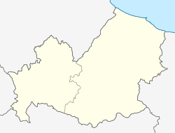
Sesto Campano is a comune (municipality) in the Province of Isernia in the Italian region Molise, located about 50 kilometres (31 mi) southwest of Campobasso and about 25 kilometres (16 mi) southwest of Isernia.
The municipality is located in the south of its province, close to the borders of Molise with Campania and Lazio. It borders with the municipality Venafro and four others belonging to the Province of Caserta: Ciorlano, Mignano Monte Lungo, Pratella and Presenzano.
References
[edit]- ^ "Superficie di Comuni Province e Regioni italiane al 9 ottobre 2011". Italian National Institute of Statistics. Retrieved 16 March 2019.
- ^ All demographics and other statistics: Italian statistical institute Istat.
Wikimedia Commons has media related to Sesto Campano.


