Rocchetta a Volturno
Appearance
Rocchetta a Volturno | |
|---|---|
| Comune di Rocchetta a Volturno | |
 Rocchetta | |
| Coordinates: 41°37′N 14°5′E / 41.617°N 14.083°E | |
| Country | Italy |
| Region | Molise |
| Province | Isernia (IS) |
| Government | |
| • Mayor | Teodoro Santilli |
| Area | |
• Total | 23.34 km2 (9.01 sq mi) |
| Elevation | 540 m (1,770 ft) |
| Population (30 September 2016)[2] | |
• Total | 1,105 |
| • Density | 47/km2 (120/sq mi) |
| Demonym | Rocchettani |
| Time zone | UTC+1 (CET) |
| • Summer (DST) | UTC+2 (CEST) |
| Postal code | 86070 |
| Dialing code | 0865 |
| Website | Official website |

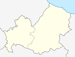
Rocchetta a Volturno is a comune (municipality) in the Province of Isernia in the Italian region Molise, located about 50 kilometres (31 mi) west of Campobasso and about 13 kilometres (8 mi) west of Isernia.
Rocchetta a Volturno borders the following municipalities: Castel San Vincenzo, Cerro al Volturno, Colli a Volturno, Filignano, San Biagio Saracinisco, Scapoli, Vallerotonda.
The village contains two main settlements. The older part, called Rocchetta Alta, lies on the top of a rocky hill that dominates the valley. The old town is deserted since the end of the 20th century. The new town is at the bottom of the hill, in the valley.
References
[edit]- ^ "Superficie di Comuni Province e Regioni italiane al 9 ottobre 2011". Italian National Institute of Statistics. Retrieved 16 March 2019.
- ^ All demographics and other statistics: Italian statistical institute Istat.
External links
[edit]


