Sarab Hammam
Sarab Hammam
Persian: سراب حمام | |
|---|---|
City | |
| Coordinates: 33°06′54″N 47°41′35″E / 33.11500°N 47.69306°E[1] | |
| Country | Iran |
| Province | Lorestan |
| County | Pol-e Dokhtar |
| District | Central |
| Population (2016)[2] | |
• Total | 4,054 |
| Time zone | UTC+3:30 (IRST) |
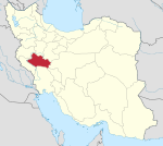
Sarab Hammam (Persian: سراب حمام)[a] is a city in the Central District of Pol-e Dokhtar County, Lorestan province, Iran. As a village, it was the capital of Jayedar Rural District.[4][b] Its capital was transferred to the village of Valieasr,[6] and again in April 2023 to the village of Rahimabad.[5]
Demographics
[edit]Population
[edit]At the time of the 2006 National Census, Sarab Hammam's population was 1,108 in 227 households, when it was a village in Jayedar Rural District.[7] The following census in 2011 counted 3,868 people in 1,009 households,[8] by which time the village had merged with the villages of Sarab-e Ganj Ali and Sarab Mahmudvand.[6] The 2016 census measured the population of the village as 4,054 people in 1,161 households. It was the most populous village in its rural district.[2]
After the census, the village was elevated to the status of a city.[9]
See also
[edit]Notes
[edit]References
[edit]- ^ OpenStreetMap contributors (27 August 2023). "Sarab Hammam, Pol-e Dokhtar County" (Map). OpenStreetMap (in Persian). Retrieved 27 August 2023.
- ^ a b "Census of the Islamic Republic of Iran, 1395 (2016)". AMAR (in Persian). The Statistical Center of Iran. p. 15. Archived from the original (Excel) on 12 October 2020. Retrieved 19 December 2022.
- ^ Sarab Hammam can be found at GEOnet Names Server, at this link, by opening the Advanced Search box, entering "-3082437" in the "Unique Feature Id" form, and clicking on "Search Database".
- ^ Mousavi, Mirhossein. "Creation and formation of 47 rural districts including villages, farms and places in Khorramabad County under Lorestan province". Research Center of the System of Laws of the Islamic Council of Farabi Mobile Library (in Persian). Ministry of Interior, Council of Ministers. Archived from the original on 20 February 2013. Retrieved 28 November 2023.
- ^ a b Mokhbar, Mohammad (26 April 2023). "Letter of approval regarding the country divisions of Lorestan province". Shahr Danesh Research Institute (in Persian). Ministry of Interior, Council of Ministers. Archived from the original on 6 June 2023. Retrieved 12 August 2024.
- ^ a b Jahangiri, Ishaq (13 October 2013). "Letter of approval regarding the conversion of Saidabad village, the center of Saidabad Rural District, Jajrud District, Pardis County, Tehran province, into a city". Shahr Danesh Law Research Institute (in Persian). Ministry of Interior, Council of Ministers. Archived from the original on 24 June 2021. Retrieved 24 November 2023.
- ^ "Census of the Islamic Republic of Iran, 1385 (2006)". AMAR (in Persian). The Statistical Center of Iran. p. 15. Archived from the original (Excel) on 20 September 2011. Retrieved 25 September 2022.
- ^ "Census of the Islamic Republic of Iran, 1390 (2011)". Syracuse University (in Persian). The Statistical Center of Iran. p. 15. Archived from the original (Excel) on 19 January 2023. Retrieved 19 December 2022.
- ^ "By the order of the governor of Lorestan, the first mayor of the newly established city of Sarab Hammam was appointed". Mehr News (in Persian). 18 January 2022. Archived from the original on 27 August 2023. Retrieved 27 August 2023.


