Sandford Hydro
| Sandford Hydro | |
|---|---|
 | |
 | |
| Country | England |
| Location | Kennington, Oxfordshire |
| Coordinates | 51°42′41″N 1°14′10″W / 51.7115°N 1.2361°W |
| Status | Operational |
| Commission date | 2018 |
| Owner | Low Carbon Hub Sandford Hydro Ltd |
| Operator | Low Carbon Hub Sandford Hydro Ltd |
| Power generation | |
| Nameplate capacity | 450 kW |
| External links | |
| Commons | Related media on Commons |
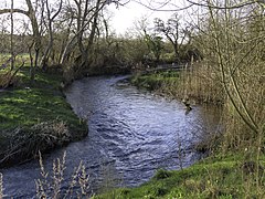
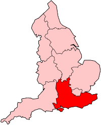
Sandford Hydro is a small hydroelectric scheme located on the River Thames in Oxfordshire, England. It uses the head of water provided by the weir at Sandford Lock in Sandford-on-Thames, but is actually situated on the opposite bank of the river in Kennington. It can generate 450 kilowatts (600 hp) of electricity with its three archimedes screw turbines. Construction began in 2011, and the plant became operational in 2018.[1][2][3][4]
Sandford Hydro is owned by Low Carbon Hub Sandford Hydro Ltd, which is itself a subsidiary Low Carbon Hub IPS Ltd, an industrial and provident society for the benefit of the community that seeks to develop a decentralised, locally-owned renewable energy infrastructure for Oxfordshire.[5]
As part of the development of the hydro scheme, a new fish pass has been constructed. It is designed to help fish adapted to both fast and slow watercourses, and comprises a 120 metres (390 ft) gravel-lined channel with a gradient of 1 in 160, flanked at either end by sections with a gradient of 1 in 20 and brush and baffle components.[6]
Gallery
[edit]-
The turbines and the weir
-
Upstream side of the plant
-
The fish pass
References
[edit]- ^ "Oxford's Sandford Hydro power plant in pictures". Oxford Mail. 27 March 2018.
- ^ "Thames hydro-power set to make a splash". Oxford Mail. 27 April 2013.
- ^ "Sandford Hydro". Low Carbon Hub. Retrieved 16 February 2022.
- ^ Election Maps (Map). Ordnance Survey. Retrieved 16 February 2022.
- ^ "About". Low Carbon Hub. Retrieved 16 February 2022.
- ^ "Sandford Hydro - The Fish Pass" (PDF). Low Carbon Hub. Retrieved 16 February 2022.


