San Juan Chamelco
Appearance
San Juan Chamelco | |
|---|---|
Municipality | |
| Coordinates: 15°25′32.430″N 90°19′34.626″W / 15.42567500°N 90.32628500°W | |
| Country | |
| Department | |
| Municipality | San Juan Chamelco |
| Government | |
| • Type | Municipal |
| Area | |
• Municipality | 228 km2 (88 sq mi) |
| Population (2023)[1] | |
• Municipality | 64,144 |
| • Density | 280/km2 (730/sq mi) |
| • Urban | 13,264 |
| • Rural | 44,192 |
| • Ethnicities | Q'eqchi' Ladino |
| • Religions | Roman Catholicism Evangelicalism Maya |
| Climate | Cfb |
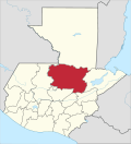
San Juan Chamelco is a town and a municipality in the Guatemalan department of Alta Verapaz. The municipality is situated at 1,350 metres above sea level and covers an area of 228 km2. The annual festival is on June 24. At the 2018 census, the population of the municipality was 57,456 and that of the town of San Juan Chamelco was 13,264.[2]
Alta Verapaz is known for its diverse geography, including mountains, forests, and rivers. San Juan Chamelco, like many other municipalities in the region, is likely characterized by a mix of indigenous and mestizo populations.
Climate
[edit]San Juan Chamelco has temperate climate (Köppen: Cfb).
| Climate data for San Juan Chamelco | |||||||||||||
|---|---|---|---|---|---|---|---|---|---|---|---|---|---|
| Month | Jan | Feb | Mar | Apr | May | Jun | Jul | Aug | Sep | Oct | Nov | Dec | Year |
| Mean daily maximum °C (°F) | 20.8 (69.4) |
22.4 (72.3) |
23.8 (74.8) |
24.4 (75.9) |
24.6 (76.3) |
23.9 (75.0) |
23.1 (73.6) |
23.6 (74.5) |
23.6 (74.5) |
22.7 (72.9) |
21.7 (71.1) |
21.2 (70.2) |
23.0 (73.4) |
| Daily mean °C (°F) | 15.5 (59.9) |
16.6 (61.9) |
17.8 (64.0) |
18.8 (65.8) |
19.6 (67.3) |
19.7 (67.5) |
19.1 (66.4) |
19.2 (66.6) |
19.2 (66.6) |
18.4 (65.1) |
17.2 (63.0) |
16.4 (61.5) |
18.1 (64.6) |
| Mean daily minimum °C (°F) | 10.3 (50.5) |
10.9 (51.6) |
11.9 (53.4) |
13.3 (55.9) |
14.6 (58.3) |
15.5 (59.9) |
15.2 (59.4) |
14.9 (58.8) |
14.9 (58.8) |
14.1 (57.4) |
12.8 (55.0) |
11.6 (52.9) |
13.3 (56.0) |
| Average precipitation mm (inches) | 105 (4.1) |
72 (2.8) |
91 (3.6) |
83 (3.3) |
158 (6.2) |
286 (11.3) |
254 (10.0) |
240 (9.4) |
300 (11.8) |
283 (11.1) |
193 (7.6) |
116 (4.6) |
2,181 (85.8) |
| Source: Climate-Data.org[3] | |||||||||||||
Geographic location
[edit]San Juan Chamelco is surrounded by Alta Verapaz Department municipalities.[4]
Demographics
[edit]| Male | 31,703 |
| Female | 32,441 |
| 0-14 years | 21,756 |
| 15-64 years | 39,315 |
| 65+ years | 3,073 |
| 70+ years | 2,063 |
| 60-69 years | 2,227 |
| 50-59 years | 3,471 |
| 40-49 years | 6,352 |
| 30-39 years | 9,078 |
| 20-29 years | 12,816 |
| 10-19 years | 13,643 |
| 0-9 years | 14,494 |
| Rural | 44,192 |
| Urban | 13,264 |
| Same municipality | 51,260 |
| Other municipality in Guatemala | 5,558 |
| Other country | 49 |
| Maya | 55,755 |
| Garifuna | 56 |
| Xinca | 2 |
| Afro-Guatemalan | 18 |
| Ladino | 1,590 |
| Foreign | 35 |
| Spanish | 7,510 |
| Q'eqchi' | 43,354 |
| K'iche' | 44 |
| Mam | 18 |
| Kaqchikel | 42 |
| Other language | 547 |
| yes | 33,150 |
| no | 13,817 |
Economic
[edit]- Agriculture is a significant activity in this area, with the cultivation of crops
- Coffee
- Corn
- Beans
- Traditional crafts and artisan activities
- Central Square Market
See also
[edit]References
[edit]- ^ Citypopulation.de Population of departments and municipalities in Guatemala
- ^ Citypopulation.de Population of cities & towns in Guatemala
- ^ "Climate: San Juan Chamelco". Climate-Data.org. Retrieved 21 August 2015.
- ^ SEGEPLAN. "Municipios de Alta Verapaz, Guatemala". Secretaría General de Planificación y Programación de la Presidencia de la República (in Spanish). Guatemala. Archived from the original on 30 June 2015. Retrieved 30 June 2015.


