San Jose Airport (Mindoro)
San Jose Airport Paliparan ng San Jose | |||||||||||
|---|---|---|---|---|---|---|---|---|---|---|---|
 | |||||||||||
| Summary | |||||||||||
| Airport type | Public | ||||||||||
| Owner/Operator | Civil Aviation Authority of the Philippines | ||||||||||
| Serves | San Jose | ||||||||||
| Opened | 1951 | ||||||||||
| Elevation AMSL | 4 m / 14 ft | ||||||||||
| Coordinates | 12°21′41″N 121°02′48″E / 12.36139°N 121.04667°E | ||||||||||
| Map | |||||||||||
 | |||||||||||
| Runways | |||||||||||
| |||||||||||
| Statistics (2018) | |||||||||||
| |||||||||||
Source: Statistics from eFOI[1] | |||||||||||
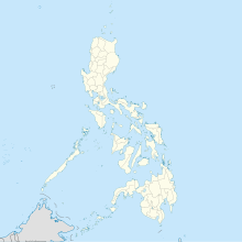
San Jose Airport (IATA: SJI, ICAO: RPUH), formerly known as McGuire Field, is an airport serving the general area of San Jose, Occidental Mindoro in the Philippines. It is one of three airports in Occidental Mindoro, the others being Mamburao Airport and Lubang Airport. The airport is classified as a Principal class 1 domestic airport by the Civil Aviation Authority of the Philippines, an agency of the Department of Transportation that is responsible for the operations of not only this airport but also of all other airports in the Philippines, except the major international airports.
History
[edit]San Jose Airport was originally an American air facility which operated in the latter years of World War II. The airstrip was formerly named after World War II 5th Air Force ace Major Thomas McGuire.[2] Consolidated B-24 Liberators were stationed in the facility.[3]
After the war, the air facility was abandoned by American forces,[4] the national government renovated the air facility and was inaugurated years later in 1951 by then President Elpidio Quirino.[3] The national government later built a concrete road from the town center to the airport as well as converted the wooden bridge over the Pandurucan River into a concrete bridge.[4]
The airport underwent a rehabilitation sometime around 2013.[5]
Facilities
[edit]
The airport resides at an elevation of 14 feet (4 m) above mean sea level. It has one runway designated 10/28 with a concrete surface measuring 1,836 by 30 metres (6,024 ft × 98 ft). It can accommodate aircraft as large as the Airbus A320.[6]
Airlines and destinations
[edit]Passenger
[edit]| Airlines | Destinations |
|---|---|
| Cebgo | Manila |
See also
[edit]References
[edit]- ^ Civil Aviation Authority of the Philippines - Aerodrome Development & Management Service (15 April 2018). "Passenger Statistics Philippines". Republic of the Philippines - Freedom of Information Portal. Retrieved 27 April 2019.
- ^
 This article incorporates public domain material from the Air Force Historical Research Agency
- ^ a b Candelario, Rudy. "History of San Jose". Occ. Mindoro History & Culture. Retrieved 5 May 2016.
- ^ a b "History". Barangay San Roque, San Jose, Occidental Mindoro. Archived from the original on 2019-05-01. Retrieved 5 May 2016.
- ^ "PNoy mulls on disrupting beach or forest cover in building a road link between 2 Mindoro provinces". Island Sentinel. 3 September 2014. Retrieved 5 May 2016.
- ^ Airport information for RPUH[usurped] from DAFIF (effective October 2006)
External links
[edit]- Pacific Wrecks - McGuire Field (San Jose Airport)
- Accident history for SJI at Aviation Safety Network


