Cuyo Airport
Appearance
Cuyo Airport Paliparan ng Cuyo | |||||||||||
|---|---|---|---|---|---|---|---|---|---|---|---|
| Summary | |||||||||||
| Airport type | Public | ||||||||||
| Owner/Operator | Civil Aviation Authority of the Philippines | ||||||||||
| Serves | Cuyo | ||||||||||
| Elevation AMSL | 4 m / 13 ft | ||||||||||
| Coordinates | 10°51′29″N 121°4′10″E / 10.85806°N 121.06944°E | ||||||||||
| Map | |||||||||||
 | |||||||||||
| Runways | |||||||||||
| |||||||||||
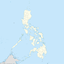
Cuyo Airport (IATA: CYU, ICAO: RPLO) is an airport serving the municipalities of Magsaysay, Cuyo, and Agutaya. It is located within the boundaries of Barangay Lucbuan and Emilod in the town of Magsaysay in the main island of Cuyo Island.[1][2] It is one of several airports in Palawan, the other being Puerto Princesa International Airport, Cesar Lim Rodriguez Airport, El Nido Airport and Francisco Reyes Airport in the municipality of Busuanga. It is classified as a feeder airport by the Civil Aviation Authority of the Philippines, a body of the Department of Transportation that is responsible for the operations of not only this airport but also of all other airports in the Philippines except the major international airports.
Airlines and destinations
[edit]| Airlines | Destinations |
|---|---|
| Air Juan | Caticlan, Puerto Princesa |
See also
[edit]References
[edit]- ^ Accident history for CYU at Aviation Safety Network. Retrieved 2008-10-11.
- ^ Airport information for RPLO at Great Circle Mapper. Retrieved 2008-10-11.
External links
[edit]


