Rural Municipality of La Broquerie
Rural Municipality of La Broquerie
Municipalité rurale de La Broquerie | |
|---|---|
Rural municipality | |
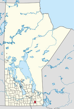
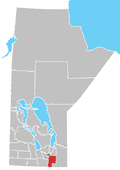
 Location of the RM of La Broquerie in Manitoba | |
| Coordinates: 49°23′58″N 96°30′37″W / 49.39944°N 96.51028°W | |
| Country | Canada |
| Province | Manitoba |
| Region | Eastman |
| Government | |
| • MP (Provencher) | Ted Falk (CPC) |
| • MLA (La Verendrye) | Konrad Narth (PC) |
| • Reeve | Ivan Normandeau |
| Area | |
• Total | 578.97 km2 (223.54 sq mi) |
| • Water | 9.0 km2 (3.5 sq mi) |
| Elevation | 268 m (879 ft) |
| Population | |
• Total | 6,725 |
| Time zone | UTC-6 (CST) |
| • Summer (DST) | UTC-5 (CDT) |
| Website | http://www.labroquerie.com/ |
La Broquerie (French: Municipalité rurale de La Broquerie) is a rural municipality in the province of southern Manitoba, located just southeast of the city of Steinbach.
The municipality includes the local urban district of La Broquerie to the north, and the unincorporated communities of Marchand to the east and Zhoda to the south form the urban centres of the municipality.[2][3] Besides these areas, the municipality mainly consists of agricultural production and rural residential developments in the northern half to hog production facilities and vastly undeveloped areas in the south.
History
[edit]The Rural Municipality of La Broquerie was incorporated on May 25, 1881.[2]
The local urban district of La Broquerie was first named Carleton before Member of Parliament A.A.C. Larivière had it changed to honour Joseph de La Broquerie Taché (1759-1830), who played an important role in the life of his nephew Archbishop Alexandre-Antonin Taché of St. Boniface.[2][4]
Taché designed the municipal seal, including the inscription "All from above."[4]
On November 15, 1883, Taché declared La Broquerie as "St. Joachim’s mission," and a new St-Joachim Catholic Parish was built in 1884.[4][5]
Having a large Francophone population, La Broquerie has been celebrating Saint-Jean-Baptiste Day since 1897.[4]
Geography
[edit]According to Statistics Canada, the rural municipality has an area of 578.20 km² (223.24 sq mi). There are no separately incorporated cities, towns or villages within the municipality. Provincial Highways #12 and #52 run through the southwest and north portions of the municipality respectively. Provincial Roads #301 and #302, both gravel highways, bisect the municipality. The municipality is located in the plant hardiness zone of 3a/3b.[6] The municipality straddles the Aspen parkland, the traditional tallgrass prairie and the Manitoba lowlands regions.[7]
The community sits close to the Sandilands Provincial Forest, which includes the Marchand Provincial Park. The Seine River runs through the community as well.[4]
Communities
[edit]Demographics
[edit]| Year | Pop. | ±% |
|---|---|---|
| 1891 | 330 | — |
| 1896 | 1,532 | +364.2% |
| 1901 | 583 | −61.9% |
| 1911 | 1,191 | +104.3% |
| 1921 | 1,289 | +8.2% |
| 1931 | 1,644 | +27.5% |
| 1941 | 1,888 | +14.8% |
| 1951 | 1,608 | −14.8% |
| 1956 | 1,570 | −2.4% |
| 1961 | 1,454 | −7.4% |
| 1966 | 1,340 | −7.8% |
| 1971 | 1,328 | −0.9% |
| 1976 | 1,523 | +14.7% |
| 1981 | 1,638 | +7.6% |
| 1986 | 1,774 | +8.3% |
| 1991 | 2,038 | +14.9% |
| 1996 | 2,493 | +22.3% |
| 2001 | 2,894 | +16.1% |
| 2006 | 3,659 | +26.4% |
| 2011 | 5,198 | +42.1% |
| 2016 | 6,076 | +16.9% |
| 2021 | 6,725 | +10.7% |
As of the 2021 Census, La Broquerie has a population of 6,725, an increase of 10.7% from its 2016 population of 6,076. This population occupies 2,044 of the community's 2,177 total private dwellings. With a land area of 578.97 km2 (223.54 sq mi), it has a population density of 11.6/km2 (30.1/sq mi).[1]
The fast-growing community consists of a wide range of cultural backgrounds including English, French and Mennonite. The 2021 Census reported a population of 6,725 persons, with a median age of 28.6.[10][11]
| Panethnic group | 2021[12] | 2016[13] | 2011[14] | 2006[15] | 2001[16] | |||||
|---|---|---|---|---|---|---|---|---|---|---|
| Pop. | % | Pop. | % | Pop. | % | Pop. | % | Pop. | % | |
| European[a] | 5,430 | 80.74% | 5,085 | 83.7% | 4,310 | 82.96% | 3,295 | 90.15% | 2,565 | 89.06% |
| Indigenous | 1,185 | 17.62% | 920 | 15.14% | 850 | 16.36% | 355 | 9.71% | 310 | 10.76% |
| Southeast Asian[b] | 65 | 0.97% | 60 | 0.99% | 0 | 0% | 0 | 0% | 0 | 0% |
| South Asian | 20 | 0.3% | 0 | 0% | 0 | 0% | 10 | 0.27% | 0 | 0% |
| Latin American | 15 | 0.22% | 0 | 0% | 40 | 0.77% | 0 | 0% | 0 | 0% |
| African | 10 | 0.15% | 0 | 0% | 0 | 0% | 10 | 0.27% | 0 | 0% |
| East Asian[c] | 0 | 0% | 15 | 0.25% | 0 | 0% | 0 | 0% | 0 | 0% |
| Middle Eastern[d] | 0 | 0% | 0 | 0% | 0 | 0% | 0 | 0% | 0 | 0% |
| Other/multiracial[e] | 0 | 0% | 0 | 0% | 0 | 0% | 0 | 0% | 10 | 0.35% |
| Total responses | 6,725 | 100% | 6,075 | 99.98% | 5,195 | 99.94% | 3,655 | 99.89% | 2,880 | 99.52% |
| Total population | 6,725 | 100% | 6,076 | 100% | 5,198 | 100% | 3,659 | 100% | 2,894 | 100% |
| Note: Totals greater than 100% due to multiple origin responses | ||||||||||
Notable people
[edit]- Konrad Narth, MLA from Zhoda
- Théophile Paré, secretary-treasurer for the RM of La Broquerie
- Mélanie Rocan, painter from La Broquerie
- Gabrielle Roy, writer who taught in Marchand
- Daniel Tetrault, hockey player from La Broquerie
- Albert Vielfaure, politician from La Broquerie
See also
[edit]Notes
[edit]- ^ Statistic includes all persons that did not make up part of a visible minority or an indigenous identity.
- ^ Statistic includes total responses of "Filipino" and "Southeast Asian" under visible minority section on census.
- ^ Statistic includes total responses of "Chinese", "Korean", and "Japanese" under visible minority section on census.
- ^ Statistic includes total responses of "West Asian" and "Arab" under visible minority section on census.
- ^ Statistic includes total responses of "Visible minority, n.i.e." and "Multiple visible minorities" under visible minority section on census.
References
[edit]- ^ a b "Population and dwelling counts: Canada, provinces and territories, and census subdivisions (municipalities), Manitoba". Statistics Canada. February 9, 2022. Retrieved February 20, 2022.
- ^ a b c "Manitoba Communities: La Broquerie (Rural Municipality)". www.mhs.mb.ca. Retrieved April 2, 2024.
- ^ "Zoning Map of the Rural Municipality of La Broquerie." RM of La Broquerie. July 2018.
- ^ a b c d e La Broquerie Tourism Map. 2017. Retrieved 2024-04-01.
- ^ La Paroisse St-Joachim de La Broquerie 1883-1983 (French). Steinbach: Derksen Printers. 1983. ISBN 0-919673-60-0.
- ^ "Manitoba Interactive Plant Hardiness Zone Map".
- ^ "Resource Not Found | Province of Manitoba" (PDF).
- ^ "La Broquerie Census Data 2016". Statistics Canada. Retrieved May 3, 2017.
- ^ "Manitoba Municipalities: La Broquerie (Rural Municipality)". Manitoba Historical Society. Retrieved May 3, 2017.
- ^ "La Broquerie, MB - Demographics". Townfolio. Retrieved April 2, 2024.
- ^ "Focus on Geography Series, 2011 Census - Census subdivision of La Broquerie, RM (Manitoba)". 2.statcan.ca. February 2, 2012. Retrieved February 9, 2012.
- ^ Government of Canada, Statistics Canada (October 26, 2022). "Census Profile, 2021 Census of Population". www12.statcan.gc.ca. Retrieved June 2, 2024.
- ^ Government of Canada, Statistics Canada (October 27, 2021). "Census Profile, 2016 Census". www12.statcan.gc.ca. Retrieved June 2, 2024.
- ^ Government of Canada, Statistics Canada (November 27, 2015). "NHS Profile". www12.statcan.gc.ca. Retrieved June 2, 2024.
- ^ Government of Canada, Statistics Canada (August 20, 2019). "2006 Community Profiles". www12.statcan.gc.ca. Retrieved June 2, 2024.
- ^ Government of Canada, Statistics Canada (July 2, 2019). "2001 Community Profiles". www12.statcan.gc.ca. Retrieved June 2, 2024.
Further reading
[edit]- La Paroisse St-Joachim de La Broquerie 1883-1983 (French). Steinbach: Derksen Printers. 1983. ISBN 0-919673-60-0. — produced to commemorate the St-Joachim Catholic Parish's centennial, celebrated in 1984.

