R343 road (Ireland)
Appearance
| R343 road | |
|---|---|
| Bóthar R343 | |
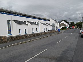
 R343 passing Carraroe Library | |
| Route information | |
| Length | 4.2 km (2.6 mi) |
| Major junctions | |
| From | Carraroe |
| To | |
| Location | |
| Country | Ireland |
| Highway system | |
The R343 road is a 4.2 km long regional road in Ireland, located in Connemara, County Galway.[1][2]
Reference
[edit]- ^ "R343 - Roader's Digest: The SABRE Wiki". www.sabre-roads.org.uk.
- ^ "S.I. No. 54/2012 - Roads Act 1993 (Classification of Regional Roads) Order 2012". irishstatutebook.ie. Retrieved 22 June 2020.
53°15′53″N 9°35′48″W / 53.264816°N 9.596794°W

