R229 road (Ireland)
Appearance
| R229 road | |
|---|---|
| Bóthar R229 | |
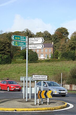
 The Oatfield Roundabout, where the R229 and R940 meet. | |
| Route information | |
| Length | 2.5 km (1.6 mi) |
| Major junctions | |
| From | |
| To | |
| Location | |
| Country | Ireland |
| Highway system | |
The R229 road is a short regional road in Ireland, located in Letterkenny, County Donegal.[1][2]
References
[edit]- ^ "R229 - Roader's Digest: The SABRE Wiki". sabre-roads.org.uk. Retrieved 9 March 2016.
- ^ "S.I. No. 54/2012 - Roads Act 1993 (Classification of Regional Roads) Order 2012". irishstatutebook.ie. Retrieved 9 March 2016.

