Porto de Pedras
Appearance
You can help expand this article with text translated from the corresponding article in Portuguese. Click [show] for important translation instructions.
|
Porto de Pedras | |
|---|---|
 Porto de Pedras with its lighthouse in the background | |
| Etymology: In English "Port of Stones", due to its location between the sea and a rocky slope[1] | |
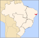
 Location of Porto de Pedras in Alagoas | |
| Coordinates: 9°9′28″S 35°17′42″W / 9.15778°S 35.29500°W | |
| Country | |
| Region | Northeast |
| State | |
| Founded | 9 June 1921[1] |
| Government | |
| • Mayor | Carlos Henrique Vilela de Vasconcelos (MDB) (2021-2024)[3] |
| • Vice Mayor | João Costa Bento (MDB) (2021-2024)[3] |
| Area | |
| • Total | 257.105 km2 (99.269 sq mi) |
| Elevation | 15 m (49 ft) |
| Population (2022) | |
| • Total | 9,295[2] |
| • Density | 36.15/km2 (93.6/sq mi) |
| Demonym | Porto-pedrense (Brazilian Portuguese)[2] |
| Time zone | UTC-03:00 (Brasília Time) |
| Postal code | 57945-000, 57948-000[4] |
| HDI (2010) | 0.541 – low[2] |
| Website | portodepedras.al.gov.br |
Porto de Pedras is a municipality located in the northern coast of the Brazilian state of Alagoas. Its population was 7,701 in 2020.[5] Its area is 266 km².[6]
Geography
[edit]Climate
[edit]| Climate data for Porto de Pedras (1981–2010, extremes 1961–present) | |||||||||||||
|---|---|---|---|---|---|---|---|---|---|---|---|---|---|
| Month | Jan | Feb | Mar | Apr | May | Jun | Jul | Aug | Sep | Oct | Nov | Dec | Year |
| Record high °C (°F) | 32.0 (89.6) |
32.6 (90.7) |
33.4 (92.1) |
32.6 (90.7) |
31.7 (89.1) |
30.5 (86.9) |
37.1 (98.8) |
30.3 (86.5) |
37.3 (99.1) |
30.7 (87.3) |
31.2 (88.2) |
32.5 (90.5) |
37.3 (99.1) |
| Mean daily maximum °C (°F) | 30.2 (86.4) |
30.6 (87.1) |
30.5 (86.9) |
30.0 (86.0) |
29.1 (84.4) |
28.0 (82.4) |
27.4 (81.3) |
27.4 (81.3) |
28.2 (82.8) |
29.3 (84.7) |
29.9 (85.8) |
30.3 (86.5) |
29.2 (84.6) |
| Daily mean °C (°F) | 27.2 (81.0) |
27.5 (81.5) |
27.4 (81.3) |
27.1 (80.8) |
26.2 (79.2) |
25.3 (77.5) |
24.7 (76.5) |
24.6 (76.3) |
25.4 (77.7) |
26.2 (79.2) |
26.8 (80.2) |
27.1 (80.8) |
26.3 (79.3) |
| Mean daily minimum °C (°F) | 24.0 (75.2) |
24.1 (75.4) |
23.9 (75.0) |
23.7 (74.7) |
22.9 (73.2) |
22.3 (72.1) |
21.7 (71.1) |
21.6 (70.9) |
22.5 (72.5) |
23.1 (73.6) |
23.8 (74.8) |
24.0 (75.2) |
23.1 (73.6) |
| Record low °C (°F) | 18.3 (64.9) |
18.3 (64.9) |
19.4 (66.9) |
19.2 (66.6) |
17.7 (63.9) |
17.2 (63.0) |
16.1 (61.0) |
15.8 (60.4) |
17.3 (63.1) |
13.0 (55.4) |
17.2 (63.0) |
19.1 (66.4) |
13.0 (55.4) |
| Average precipitation mm (inches) | 68.2 (2.69) |
90.9 (3.58) |
201.1 (7.92) |
211.6 (8.33) |
227.6 (8.96) |
305.7 (12.04) |
240.4 (9.46) |
166.2 (6.54) |
91.9 (3.62) |
43.2 (1.70) |
32.5 (1.28) |
39.6 (1.56) |
1,718.9 (67.67) |
| Average precipitation days (≥ 1.0 mm) | 7 | 9 | 12 | 15 | 17 | 20 | 20 | 16 | 9 | 6 | 4 | 5 | 140 |
| Mean monthly sunshine hours | 282.8 | 240.3 | 256.4 | 225.2 | 213.9 | 180.2 | 185.3 | 213.9 | 246.1 | 276.0 | 291.8 | 292.7 | 2,904.6 |
| Source 1: Instituto Nacional de Meteorologia[7] | |||||||||||||
| Source 2: Meteo Climat (record highs and lows)[8] | |||||||||||||
Gallery
[edit]-
Tatuamunha Beach
-
Tatuamunha Beach
-
Tatuamunha Beach
-
Lages Beach
-
Lages Beach
-
Tatuamunha Beach
-
Tatuamunha Beach
-
Patacho Beach
-
Tatuamunha River
-
Tatuamunha River
-
Rua da Piedade at the waterfront
-
Waterfront
-
Our Lady of Glory Parish Church
-
Porto de Pedras Beach
-
Porto de Pedras Lighthouse
-
Tourist sign
See also
[edit]References
[edit]- ^ a b "Porto de Pedras, a antiga Águas Belas". História de Alagoas. História de Alagoas. Retrieved 24 September 2024.
- ^ a b c "Porto de Pedras". Instituto Brasileiro de Geografia e Estatística. Instituto Brasileiro de Geografia e Estatística. Retrieved 24 September 2024.
- ^ a b "Prefeito e vereadores de Porto de Pedras tomam posse; veja lista de eleitos". globo.com. globo.com. Retrieved 24 September 2024.
- ^ "Código Postal Porto de Pedras/AL - Brasil". Código Postal. Código Postal. Retrieved 24 September 2024.
- ^ IBGE 2020
- ^ IBGE - [1]
- ^ "Normais Climatológicas Do Brasil 1981–2010" (in Portuguese). Instituto Nacional de Meteorologia. Retrieved 25 October 2018.
- ^ "Station Porto de Pedras" (in French). Meteo Climat. Retrieved 25 October 2018.


