Pariconha
Appearance
You can help expand this article with text translated from the corresponding article in Portuguese. Click [show] for important translation instructions.
|
Pariconha | |
|---|---|
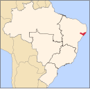
Location of Pariconha in Alagoas, Brazil | |
| Coordinates: 9°15′14″S 38°00′21″W / 9.253889°S 38.005833°W | |
| Founded | 1992 |
| Government | |
| • Mayor (Prefeito) | Antônio Telmo Noia (PP) |
| Area | |
• Total | 260.858 km2 (100.718 sq mi) |
| Elevation | 350 m (1,150 ft) |
| Population (2020) | |
• Total | 10,539 |
| • Density | 39.28/km2 (101.7/sq mi) |
| Demonym | pariconhense |
| Time zone | UTC-03:00 (Brasília Time) |
Pariconha is a municipality located in the western of the Brazilian state of Alagoas. Its population is 10,539 (2020)[1] and its area is 261 km².[2]


