Ponova Vas
Ponova Vas | |
|---|---|
 | |
| Coordinates: 45°56′23.11″N 14°37′53.51″E / 45.9397528°N 14.6315306°E | |
| Country | |
| Traditional region | Lower Carniola |
| Statistical region | Central Slovenia |
| Municipality | Grosuplje |
| Area | |
• Total | 3.37 km2 (1.30 sq mi) |
| Elevation | 333.4 m (1,093.8 ft) |
| Population (2002) | |
• Total | 441 |
| [1] | |
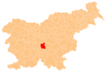
Ponova Vas (pronounced [pɔˈnɔːʋa ˈʋaːs] or [pɔˈnoːʋa ˈʋaːs]; Slovene: Ponova vas, German: Pöndorf[2]) is a village southwest of Grosuplje in central Slovenia. The area is part of the historical region of Lower Carniola. The Municipality of Grosuplje is included in the Central Slovenia Statistical Region.[3] The settlement includes the hamlets of Čemetija, Benat, and Kobiljek.[4]
Name
[edit]Ponova Vas was attested in written sources in 1436 as Penndorff (and as Ponoua vaſs in 1686, Pondorff in 1688, and Panoua vaſs in 1720).[5][6] In the past the German name was Pöndorf.[2] In the local dialect, the name is pronounced Panova vas. The morphology of the name indicates that it is a possessive form of a personal name, perhaps Old High German Pono or Bono, thus meaning 'Pono's village' or 'Bono's village'. Derivations from *(Žu)panova vьsь 'mayor's village' and from the Italian personal name Beno have been rejected for accentual reasons.[5]
Notable people
[edit]Notable people that were born or lived in Ponova Vas include:
- Josip Perme (1874–1940), mayor of Šent Jurij and discoverer of Mayor Cave (Slovene: Županova jama) in Cerovo[4]
References
[edit]- ^ Statistical Office of the Republic of Slovenia
- ^ a b Leksikon občin kraljestev in dežel zastopanih v državnem zboru, vol. 6: Kranjsko. Vienna: C. Kr. Dvorna in Državna Tiskarna. 1906. p. 114.
- ^ Grosuplje municipal site
- ^ a b Savnik, Roman (1971). Krajevni leksikon Slovenije, vol. 2. Ljubljana: Državna založba Slovenije. pp. 145–146.
- ^ a b Snoj, Marko (2009). Etimološki slovar slovenskih zemljepisnih imen. Ljubljana: Modrijan. pp. 322–323.
- ^ "Slovenska historična topografija". Retrieved February 21, 2020.
External links
[edit] Media related to Ponova Vas at Wikimedia Commons
- Ponova Vas on Geopedia


