Pongtiku Airport
Appearance
Pongtiku Airport Bandara Pongtiku | |||||||||||
|---|---|---|---|---|---|---|---|---|---|---|---|
| Summary | |||||||||||
| Airport type | Public, defunct | ||||||||||
| Operator | Government | ||||||||||
| Serves | Makale | ||||||||||
| Location | Tana Toraja Regency, South Sulawesi, Sulawesi Island, Indonesia | ||||||||||
| Time zone | WITA (UTC+08:00) | ||||||||||
| Elevation AMSL | 879 m / 2,883.86 ft | ||||||||||
| Coordinates | 03°02′33.23″S 119°49′15.38″E / 3.0425639°S 119.8209389°E[1] | ||||||||||
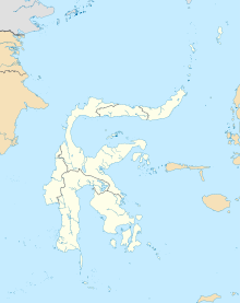
| Map | |||||||||||
 | |||||||||||
| Runways | |||||||||||
| |||||||||||
Pongtiku Airport (IATA: TTR, ICAO: WAFT) is a defunct airport in Rantetayo, Tana Toraja Regency, Province South Sulawesi, Indonesia. It had a 1,300 meter runway and was served by ATR 42 and Fokker 50 aircraft.[3] The airport was closed on 4 September 2020 with the opening of the Buntu Kunik Airport.[4]
Former airlines and destinations
[edit]| Airlines | Destinations |
|---|---|
| Gatari Air Service | Makassar |
| Susi Air | Masamba, Seko |
| Aviastar | Makassar |
| Wings Air | Makassar |
References
[edit]- ^ "TTR - Tana Toraja [Pongtiku], SN, ID - Airport - Great Circle Mapper".
- ^ "Direktorat Jenderal Perhubungan Udara | Data Bandar Udara".
- ^ GHOIDA RAHMAH (February 3, 2017). "Bandara Buntukunik Tana Toraja Segera Diuji Teknis".
- ^ FIRDAUS (January 9, 2020). "Jhon Rende Prediksi Bandara Buntu Kunik Baru Bisa Beroperasi 2022".
3°02′33″S 119°49′16″E / 3.04250°S 119.82111°E

