Sibisa Airport
Appearance
Sibisa Airport Bandar Udara Sibisa | |||||||||||
|---|---|---|---|---|---|---|---|---|---|---|---|
| Summary | |||||||||||
| Airport type | Public | ||||||||||
| Operator | Government of Indonesia | ||||||||||
| Serves | Parapat | ||||||||||
| Location | Ajibata, North Sumatra, Indonesia | ||||||||||
| Elevation AMSL | 3,081 ft / 939 m | ||||||||||
| Coordinates | 02°36′01″N 098°57′52″E / 2.60028°N 98.96444°E | ||||||||||
| Map | |||||||||||
 | |||||||||||
| Runways | |||||||||||
| |||||||||||
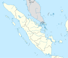
Sibisa Airport (IATA: SIW, ICAO: WIMP) is located in Ajibata, Toba Samosir, North Sumatra, Indonesia.[3] The airport is located 10 kilometers from Parapat city, Lake Toba.
References
[edit]- ^ "Airport information for WIMP". World Aero Data. Archived from the original on 2019-03-05.
{{cite web}}: CS1 maint: unfit URL (link) Data current as of October 2006. Source: DAFIF. - ^ Airport information for SIW at Great Circle Mapper. Source: DAFIF (effective October 2006).
- ^ (in Indonesian) Indonesia's Department of Transportation

