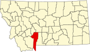
Ponderosa Pines, Montana
Ponderosa Pines, Montana | |
|---|---|
| Coordinates: 46°1′56″N 111°22′2″W / 46.03222°N 111.36722°W | |
| Country | United States |
| State | Montana |
| County | Gallatin |
| Area | |
| • Total | 39.88 sq mi (103.28 km2) |
| • Land | 39.65 sq mi (102.68 km2) |
| • Water | 0.23 sq mi (0.60 km2) |
| Elevation | 4,656 ft (1,419 m) |
| Population (2020) | |
| • Total | 665 |
| • Density | 16.77/sq mi (6.48/km2) |
| Time zone | UTC-7 (Mountain (MST)) |
| • Summer (DST) | UTC-6 (MDT) |
| Area code | 406 |
| FIPS code | 30-58840 |
| GNIS feature ID | 2583834[2] |
Ponderosa Pines is a census-designated place (CDP) in Gallatin County, Montana, United States. The population was 336 at the 2010 census.[3] Formerly a 13,000-acre ranch, the land was subdivided into 10- and 20-acre parcels and sold by a Hawaiian real estate agency starting in 1972. The lots lacked water, sewer, electricity and road access, and some were on such steep terrain that building would be impossible.[4]
Demographics
[edit]| Census | Pop. | Note | %± |
|---|---|---|---|
| 2020 | 665 | — | |
| U.S. Decennial Census[5] | |||
Education
[edit]Most of the CDP is in the Three Forks Elementary School District and the Three Forks High School District. A small portion is in Pass Creek Elementary School District and the Manhattan High School District.[6] The Three Forks elementary and high school districts are both a part of Three Forks Public Schools.[7] The Manhattan high school district is a part of Manhattan Public Schools.[8]
References
[edit]- ^ "ArcGIS REST Services Directory". United States Census Bureau. Retrieved September 5, 2022.
- ^ a b U.S. Geological Survey Geographic Names Information System: Ponderosa Pines, Montana
- ^ "U.S. Census website". United States Census Bureau. Retrieved May 14, 2011.
- ^ Porter, Kenneth F.; Torgrimson, Tina (January 1974). "Ponderosa Pines Ranch: A Subdivision Case Study" (PDF). State of Montana Environmental Quality Council. Retrieved November 7, 2021.
- ^ "Census of Population and Housing". Census.gov. Retrieved June 4, 2016.
- ^ "2020 CENSUS - SCHOOL DISTRICT REFERENCE MAP: Gallatin County, MT" (PDF). U.S. Census Bureau. p. 1 (PDF p. 2/3). Retrieved October 4, 2024. - Text list
- ^ "Directory of Montana Schools". Montana Office of Public Instruction. March 13, 2024. p. 109/317. Retrieved March 13, 2024.
- ^ "Directory of Montana Schools". Montana Office of Public Instruction. March 13, 2024. p. 105/317. Retrieved March 13, 2024.


