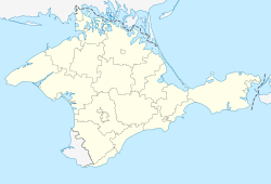
Piatykhatka
Piatykhatka
П'ятихатка | |
|---|---|
 | |
| Coordinates: 46°02′59″N 33°45′18″E / 46.04972°N 33.75500°E | |
| Country | |
| Republic | |
| Raion | |
| Area | |
• Total | 0.42 km2 (0.16 sq mi) |
| Elevation | 7 m (23 ft) |
| Population (2001) | |
• Total | 635 |
| • Density | 1,500/km2 (3,900/sq mi) |
| Time zone | UTC+2 (EET) |
| • Summer (DST) | UTC+3 (EEST) |
| Postal code | 96021 |
| Area code | +380 6565 |
| Vehicle registration | AK/KK/01 |
Piatykhatka (Ukrainian: П'ятихатка; Russian: Пятихатка; Crimean Tatar: Pâtihatka), is a village in the Krasnoperekopsk Raion, Autonomous Republic of Crimea, Ukraine. The settlement came under Russian occupation in 2014, and was unilaterally annexed by the Russian Federation, after conducting what was vastly considered to be a sham referendum.[1] According to the 2001 Ukrainian Census, the settlement counted a population of 635 inhabitants.[2]
Geography
[edit]Piatykhatka is located in the central portion of the Isthmus of Perekop on the northern edge of the Crimean peninsula and the Krasnoperekopsk raion. The district capital of Krasnoperekopsk is located 11 km (6.8 mi) to the south, while Armiansk is located 8 km (5 mi) to the northwest. The settlement has access to the M-17 Highway, which is connecting Kherson and Kerch.[citation needed]
History
[edit]The settlement was founded in 1887 by Ukrainian settlers. In the following years, the population of the village experienced rapid growth, and increased to 92 people in 1926.[3]
Demographics
[edit]As of the 2001 Ukrainian census, the settlement had a population of 635 inhabitants, a slight increase from 598 in 1989. The exact native language composition was as follows:[2][4]
Historical population data
[edit]As of the 1926 Soviet census, the settlement consisted of 19 farmsteads and counted a population of 92 residents. 87 residents were ethnic Ukrainians, while 5 were Russians.[5]
References
[edit]- ^ Birrell, Ian (17 March 2014). "Crimea's referendum was a sham display of democracy". The Guardian.
- ^ a b "Рідні мови в об'єднаних територіальних громадах України". socialdata.org.ua.
- ^ "Кількість наявного та постійного населення по кожному сільському населеному пункту, Автономна Республіка Крим (осіб) - Регіон, Рік, Категорія населення , Стать (1989(12.01))". db.ukrcensus.gov.ua (in Ukrainian).
- ^ "Кількість наявного та постійного населення по кожному сільському населеному пункту, Автономна Республіка Крим (осіб) - Регіон, Рік, Категорія населення , Стать (1989(12.01))". db.ukrcensus.gov.ua (in Ukrainian).
- ^ "Файл:Список населенных пунктов Крымской АССР.pdf — Википедия" (PDF). commons.wikimedia.org.


